Hi,
i live in italy and i would like to know, which coordinate system uses the instrument WGS 84?
Because, i have registred the difference point altitude beetwen reachapp and google earth…
help me…thanks
Hi,
i live in italy and i would like to know, which coordinate system uses the instrument WGS 84?
Because, i have registred the difference point altitude beetwen reachapp and google earth…
help me…thanks
Talking to surveyors in the US, they assured me Google Maps isn’t perfect. Unless you are using I think they called, “scientific maps” there can be error on Google Maps. They quoted something like 30m off, so I assume altitude can have error too.
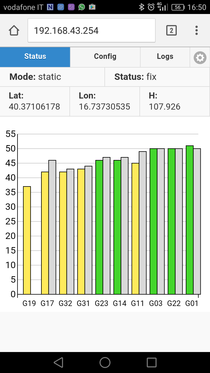
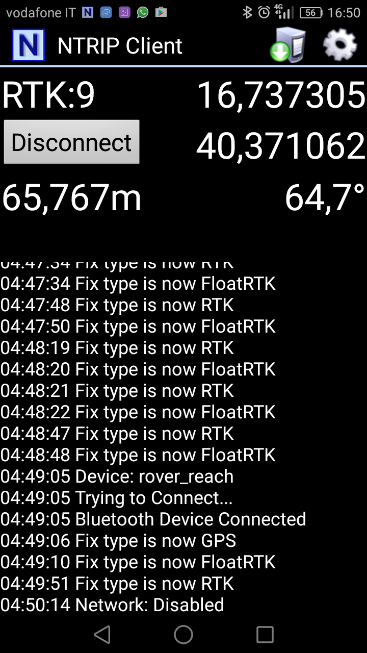
i have a solution…
the first-reach app rec a geoide quote, the ntrip client a ellisoide quote above the sea level.
Reach shows ellipsoide (unless you have changed it in advanced setting), Lefebure i suspect is showing MSL/geoid as it shows the same values in mobile topographer which is ellipsoide and msl/geoid.
I don’t understand Your answer
This one will probably explain it better
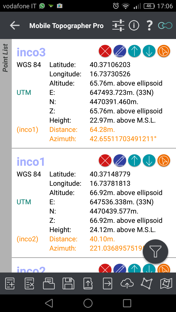
there are the same coordinate rec with mobile topographer.
the z value is the same to ntrip client…
therefore the ntrip client rec to ellipsoide, and reachappviev rec to geoide i hope.
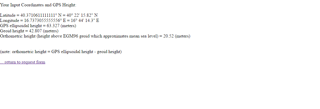
i have calculated the difference of earth ondulation with this site
all is ok!!
understand? thanks
Just as @TB_RTK correctly pointed out, by default Reach uses ellipsoid height.
The web app by Unavco does its job well, but requires the coordinates to be in DMS format before entering. Here’s a converter, just in case. The converter had me trim one digit from the original coordinates, by the way.
Here are the results from the app the with correct input:
ok, thanks!!!