


Hello! I want to find out information about importing Points manually for staking them out. Can anyone give me information how I can do it? Does it need special format?
Thank you for your attention!
Here
Points import
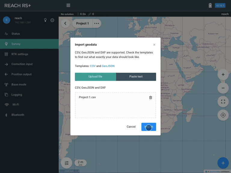
Hit ••• button on the right side of the project name and choose Import in the drop-down list.
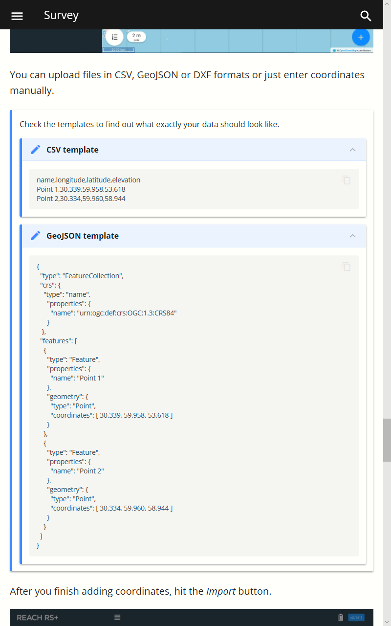
You can upload files in CSV, GeoJSON or DXF formats or just enter coordinates manually.
Check the templates to find out what exactly your data should look like.
CSV template
name,longitude,latitude,elevation

Point 1,30.339,59.958,53.618

Point 2,30.334,59.960,58.944
GeoJSON template
{ “type”: “FeatureCollection”, “crs”: { “type”: “name”, “properties”: { “name”: “urn:ogc:def:crs:OGC:1.3:CRS84” } }, “features”: [ { “type”: “Feature”, “properties”: { “name”: “Point 1” }, “geometry”: { “type”: “Point”, “coordinates”: [ 30.339, 59.958, 53.618 ] } }, { “type”: “Feature”, “properties”: { “name”: “Point 2” }, “geometry”: { “type”: “Point”, “coordinates”: [ 30.334, 59.960, 58.944 ] } } ] }
After you finish adding coordinates, hit the Import button.
3 Likes
That are csv and geoJSON but how it is made manually don’t you know?
You can make the csv manually in Notepad, Textedit or another basic text-editor. It is not hard at all, just follow this pattern for each coordinate:
1 Like
But I work with phone and the system doesn’t let me to drop files despite I have it csv file in my phone. What can I do?
iOS or Android?
Android. Huawei mate 20 lite
Hi Giorgi,
You can use a text editor app for Android to make a CSV file. For example, a Simple Spreadsheet.
As David already mentioned you can follow the template:
name,longitude,latitude,elevation
Point 1,30.339,59.958,53.618
Point 2,30.334,59.960,58.944
May I ask you to connect to Reach using its IP address (you can find it in ReachView) using the browser? There you can also find the Survey tab and upload a CSV file.
2 Likes
Same issue here.
Android 9 on LG V30
Hi, I had the same problem but I requested it by uploading my csv file to the following website and copied the coordinates and pasted them into the app
1 Like
Thank you very much. It has helped me a lot! My device opened this points
1 Like
You can connect to Reach using its IP address (you can find it in ReachView) in the browser. There you can also find the Survey tab and upload a CSV file.
1 Like
Excellent, thanks Anastasiia. I overlooked the details of your previous post and missed that I should try it in a browser.
2 Likes
This topic was automatically closed 100 days after the last reply. New replies are no longer allowed.