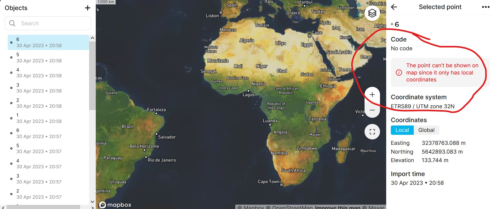
Typically, Emlid Flow 360 converts local coordinates into geographical ones to show them on the map. The conversion is accomplished according to the coordinate system selected for the project. If it didn’t happen, probably points were out of the bounds of that coordinate system.
Please send me your file via PM or to support@emlid.com, so I can examine what might go wrong.
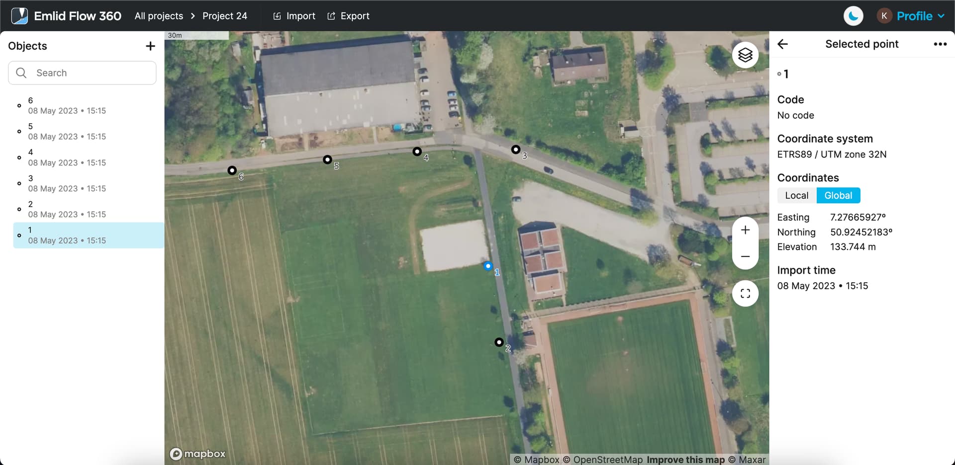
I’ve edited your CSV file and managed to import it into Emlid Flow 360. I removed “32” from the Easting coordinate as it’s redundant (means zone number) and rewrote the header. Points were imported and received global coordinates.