We want to make an RGB ortophotoplan that has improved accuracy trough GCP’s, we1 have an issue with the import of 4 GCP coordinates taken with Emlid Reach RS+. The issue is that when importing the GCP’s they appear in Africa and not Romania, even if the WGS 84 coordinate system inside Pix4D Mapper is set to 34N (România) and the Reach RS+ only captures coordinates in WGS 84 system.
We have checked the X, Y coordinates inside Google Maps and there they appear fine, in the right location.
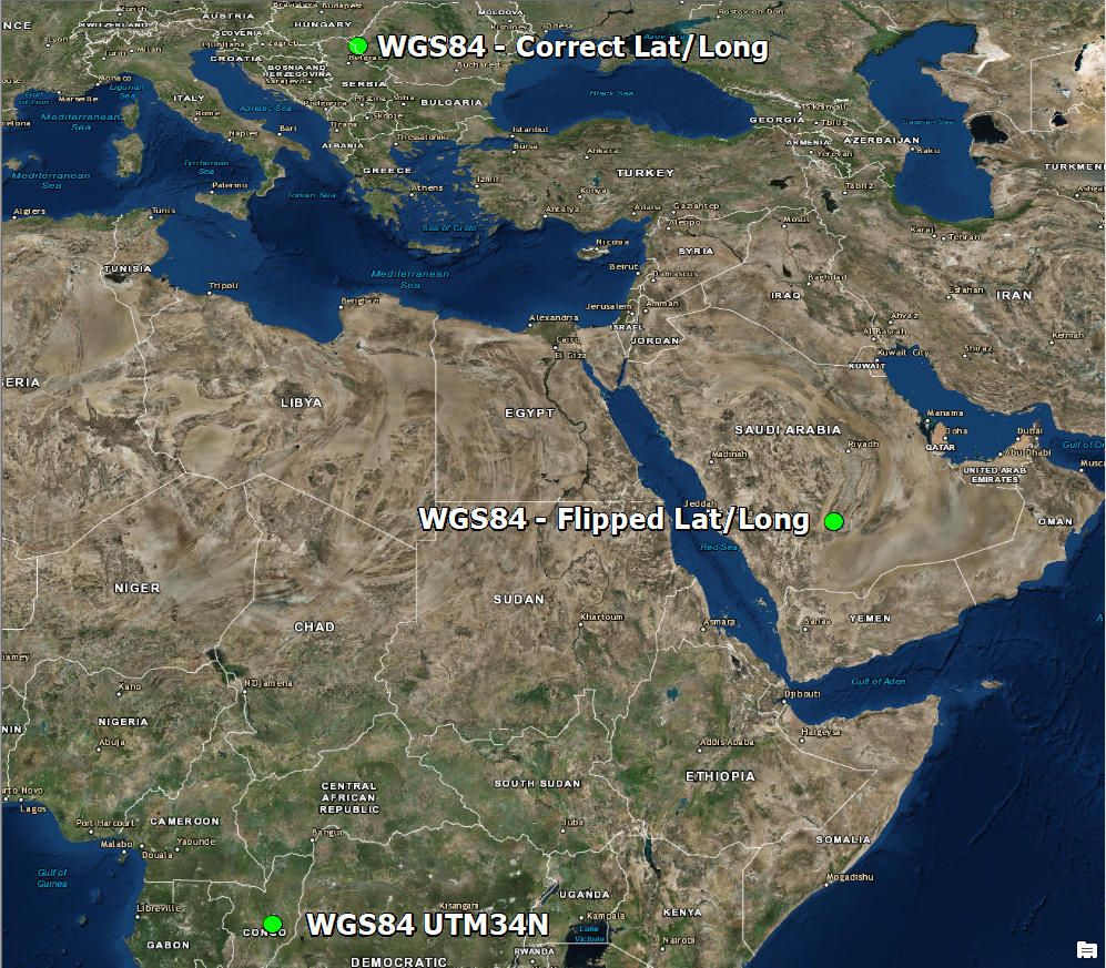
I’ve attached the exported coordinates so you can have a look at them, they’re somewhere near Beregsău Mare, România.
What could be the issue?
Thank you. Hello,
We want to make an RGB ortophotoplan that has improved accuracy trough GCP’s, we1 have an issue with the import of 4 GCP coordinates taken with Emlid Reach RS+. The issue is that when importing the GCP’s they appear in Africa and not Romania, even if the WGS 84 coordinate system inside Pix4D Mapper is set to 34N (România) and the Reach RS+ only captures coordinates in WGS 84 system.
We have checked the X, Y coordinates inside Google Maps and there they appear fine, in the right location.
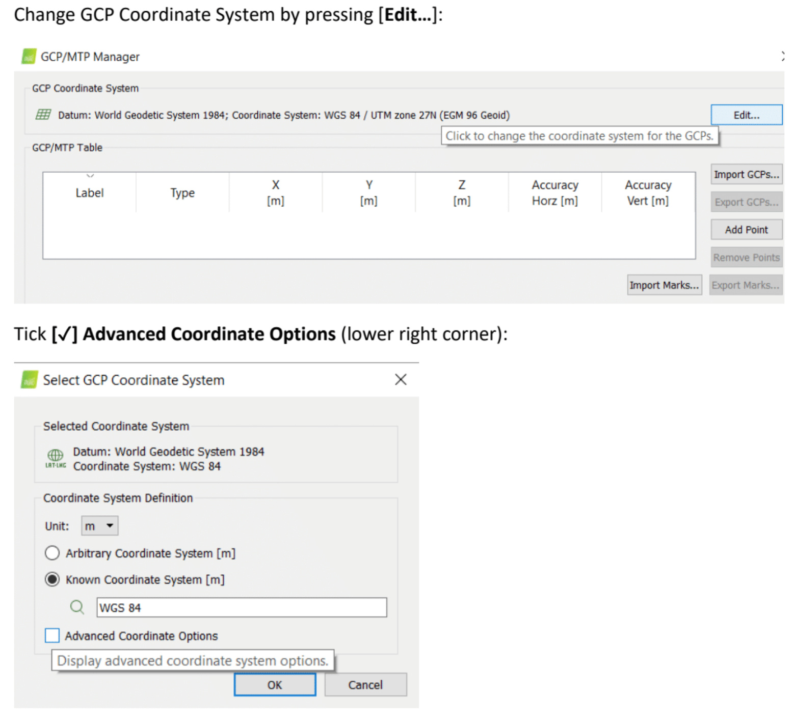
Make sure the GCP coordinate system is set to WGS84 (not UTM). Pix4DMapper will reproject to UTM and should automatically select the correct UTM zone.
Best regards,
Lars
In Pix4D the GCPs must be the same as your output coordinate system. If you want UTM 34N you must convert WGS84 (Emlid) coordinates into UTM first.
That seems not to be true. You can indeed supply Pix4DMapper with GCPs in WGS84 lat long and get resulting products in UTM - but you need to specify the correct coordinate system for the GCPs.
You are correct, I slightly misspoke from personal experience. GCPs don’t have to be in same coordinate system as output but in general should be to reduce possible error (transform on user end). If they are different they need to be “close” or could throw Pix4D off.
Thank you for clarifying, I think we both agree @alex.ucoz.ro had defined his GCPs the same as the output coordinate system (UTM) rather than WGS84 and put the GCPs somewhere in the Congo.
Our GCP’s must be absolutely relative to the local grid. Even with that we see shifts occasionally with scale factors and have to adjust in Carlson after a direct transformation which does not take the scale factor into account.