i’am new for the emlid reach GNSS. i did static measurenment with emlid several time. but now i have problem. After i process my data in rinex format, the result of the process define rover coordinate is exactly same with the base coordinate.
maybe some one can solve this problem?
Rover data https://drive.google.com/file/d/1k7Yfn6ke0JeJw4mRBNoKEsRWMPBbvEcH/view?usp=sharing
Can you save your RTKPOST options so I can load them up? Also, did you use the base or the rover NAV file?
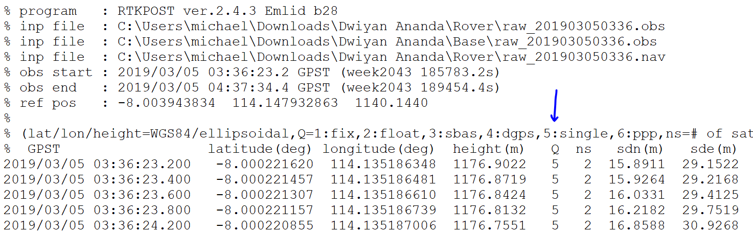
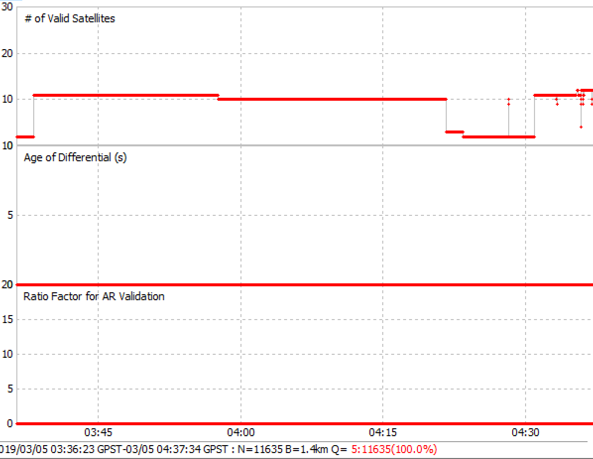
I ran assuming GPS,Galileo and QZSS as that is what I saw in the NAV file, but the status turned out Q=5 the whole time and had at most 10 sats. I am not an expert at RTKLIB, but can process my own data just fine and would like to learn how to troubleshoot things like this. I am sure someone more experienced will chime in.
Are base and rover meshed during download or something?
Both contain the same data. Could it be you have overwitten the one and then saved it separately?