


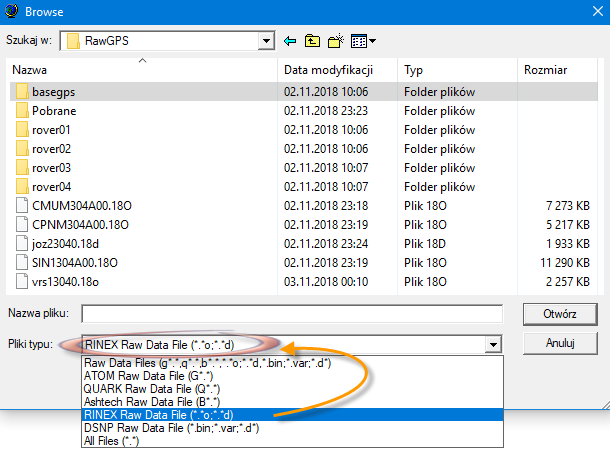
Only these two RINEX formats are acceptable. That’s why you sometimes need to convert to these formats. Hence ‘Load from disk’
If RINEX is created from raw data, always in the header will be approximate coordinates that the receiver registered at the beginning of the session. Hence these differences of position after postprocessing. If there would not be differences, there is a risk of zero-vector calculations, which may suspend the program.
In active geodetic networks, the principle is to provide exact coordinates in the header. They are related to a specific spatial reference system…
I intend to post process and collect raw data as much as possible.
@timmyd , I will watch all the video and obviously I have a lot to learn. Too bad that my area doesn’t have any CORS station to access, the only way maybe setting up VRS or find known point. I have to pay for the known point data, sometime the known point was underneath the building isn’t there anymore and cannot be use.
@michaelL, I have Reach RS for base and 4 Reach module for rover.
@r.pazus, What is the software do you recommend and do you have any instruction to process these data?
This topic was automatically closed 100 days after the last reply. New replies are no longer allowed.