


I’m new to the gnss realm. I’ve been a robotic total station user for 20 years but need to be able to survey my RTK drone GCPs (mostly remote sites w/ no NTRIP or cell service) so recently acquired a pair or RS3s and am low on the learning curve. In the Static Processing section of the Elmid Studio tutorials is says “In this case, you need to log the raw data on your base and get logs from the nearest continuously operating reference station (CORS) for further post-processing.” Where do I find a good explanation of how to get the CORS logs and pair those up with the time periods of my base logs?
What State and County are you in?
I’m in Colorado, in Adams County, but my projects are all over the mountainous parts of the State as well as neighboring States.
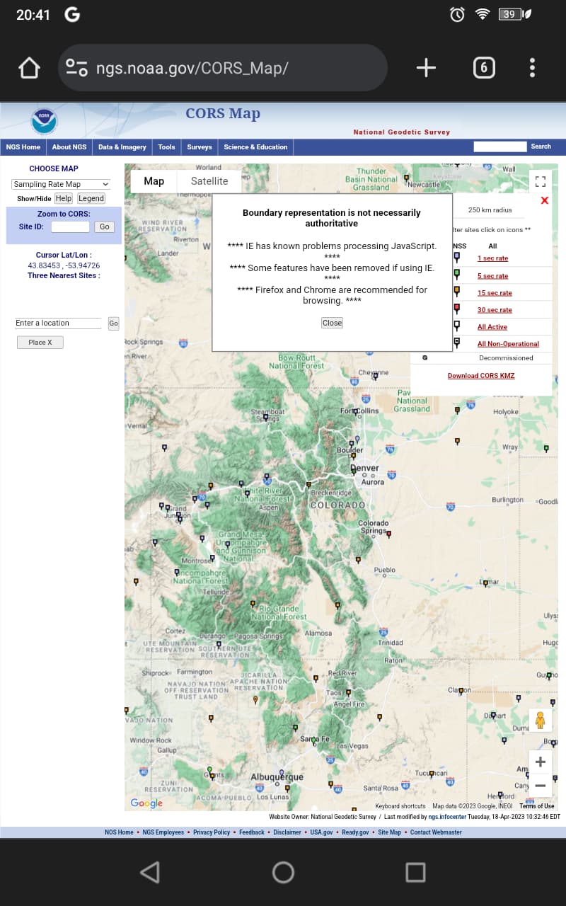
I didn’t see anything on a quick search of Adams County so I would start here. Looks like there’s not a whole lot of infrastructure east of Denver in that County so there may not be a lot of options but you will be able to recognize the City names better than me. Another effort would be asking County/State GIS departments if they have download portals or a resource they could point you to. Example being that I can download from here but I find it easier to just go to our State DOT site and download the exact hour(s) I want by folder system which I know by heart now.
1 Like
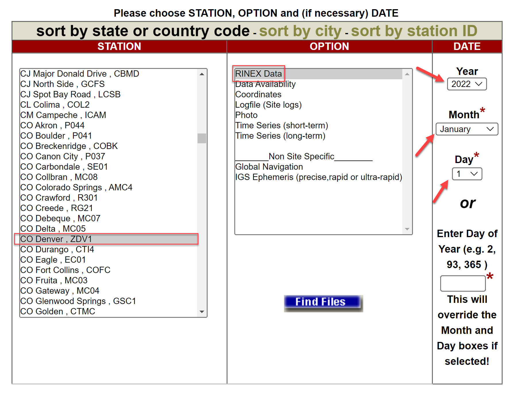
https://geodesy.noaa.gov/UFCORS/
I use this most all the time, however I also use my states RTN log files.
Consider also your baseline lengths when PP. Longer baselines require longer observation times.
3 Likes