Hello Emlid community,
We are doing the project where we are using ppk enabled drone for aerial data capturing. In Base we have added ellipsoidal height through which we processed the data & we got the aerial data output in ellipsoidal height. In this project we are completely using ppk enable drone with only having single check point for accuracy. But the problem is client wanted the orthomosaic in orthographic & all our data is in the ellipsoidal. And the event file generated from rover file giving the ellipsodial height for each photo.we got accuracy of 30cm but we want accuracy in between 3 to 5cm. Is it possible?
Is there any solution for this problem?
Ortho’s are 2D. Are they wanting contours, points, surface? What photogrammetry software are you using? Most of them have the capability of applying a Geoid. You can do a single point elevation shift or even average a few points but you are going to lose accuracy anywhere the Geoid deviates.
Thank you for your reply. Client requirement is orthomosaic & contours. I am using Agisoft metashape. Currently we have been capturing data using ppk enable drone & using emlid studio for finding out fix or float result. And the matter is that in base we have to apply Ellipsoidal height so the drone will be giving the captured image altitude in ellipsoidal height? And we are just using one check point for verifying accuracy.Because if gcp were marked then we can convert that value from ellipsoidal to orthographic using geoid height calculator. But in rover event file that we get after processing in emlid studio how can we convert each image altitude because the result provided is in notepad format.so what can be the solution?
I haven’t used any pp imagery in Metashape yet. All my flight missions to date have been using RTK method via our states RTN. The data available from the state is based on ITRF2014. The imagery imported into Metashape already has +/- 2cm accuracy in vertical (ellipsoid) and horizontal (ITRF 2014) components.
So all collected imagery is based on ITRF2014. It’s a simple matter of providing a geoid model for your area in Metashape and selecting the coordinate projection system when exporting either a dem model or orthometric model of the imagery.
You can read more about the workflow and process here
If you need to provide the gcp coordinates in orthometric heights, you can simply convert the gcp coordinates with your selected coordinate projection in Emlids Flow
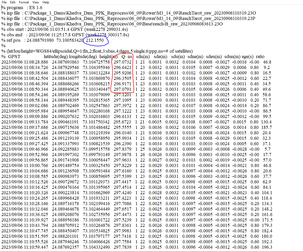
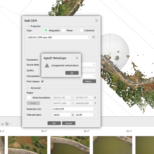
Data processed & the rover event file which i got that screenshot has been attached where Blue mark is the ellipsoidal height & red mark is photo taken coordinates which is providing ellipsoidal or orthographic height of particular image captured. So now how can I achieve orthographic height of each image taken using ppk enable drone? Is there anyway? The provided height using drone is ellipsoidal or orthographic?
If you could help me out I did not understand how do i get geoid model for our study region which is having coordinate system EPSG:32643 WGS 84 UTM ZONE 43N. So how will know about choosing geoid height? And we want the output in orthographic height.
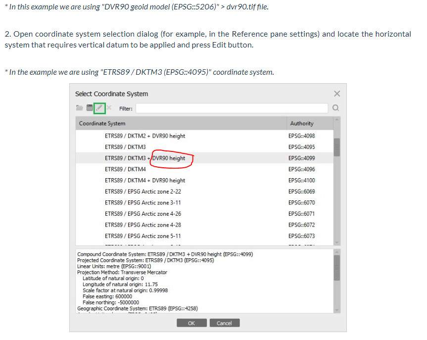
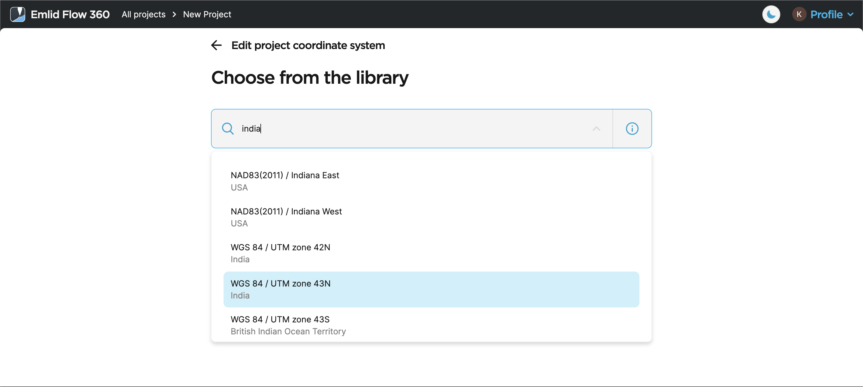
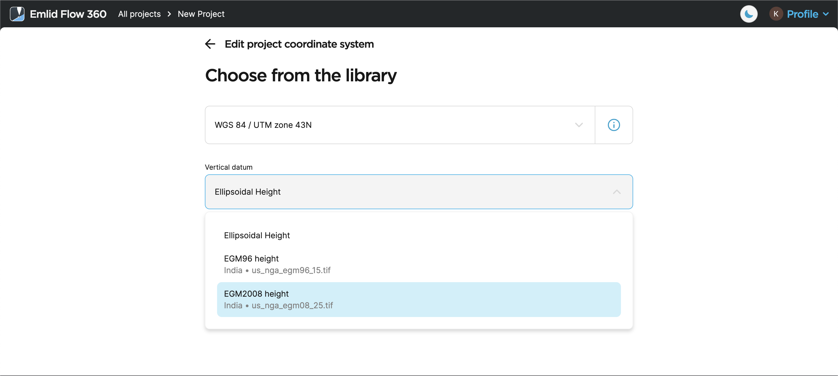
You can check it out in Emlid Flow or Emlid Flow 360, for example. Just type in your country, select the required coordinate system, and Emlid Flow will suggest appropriate vertical datums for your coordinate system:
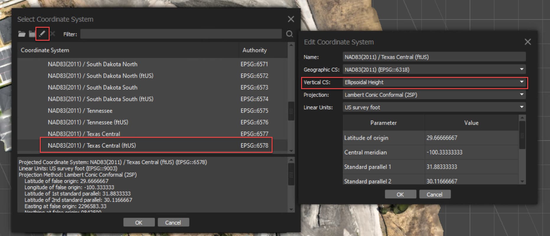
If you look in your Program Files>Agisoft>Metashape>Geoids folder do you see a TIF for the EGM2008 Geoid? If not you need to download and save it there. If it is there then you need to create the instance in Metashape.
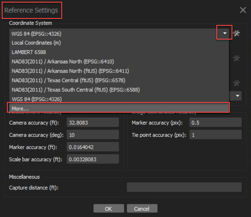
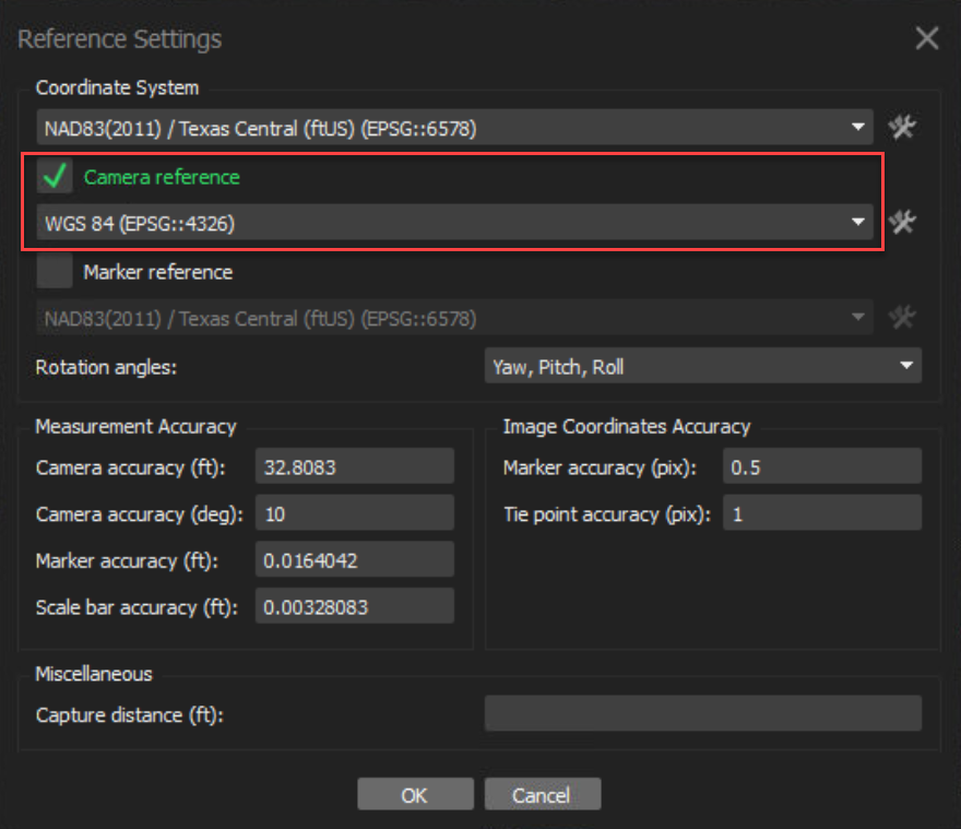
Go into Reference Settings to change your CS to your choice of Grid.