There does not appear to be an option to save/export corrected data from Emlid Studio V1.5 to an industry standard format.
How is this done, and if it’s currently been overlooked from RTKPOS when is this going to be implemented?
Thanks
There does not appear to be an option to save/export corrected data from Emlid Studio V1.5 to an industry standard format.
How is this done, and if it’s currently been overlooked from RTKPOS when is this going to be implemented?
Thanks
For now I’m afraid you will have to go through a third-party tool, such as QGis to make the conversion in GPX or SHP.
In QGis, you create a new layer by importing the pos file issued by Emid Studio in txt format, then export it in the desired format.
OK thanks, when will this be implemented in Emlid Studio?
No clue about that. Maybe someone from the dev team will tell here.
Hi Wombo,
Welcome to our community!
It’s a valuable suggestion. I’ll note it and pass it on to the team to consider further implementation. As @Florian recommended, currently, you need third-party software to convert the POS file to GPX or SHP.
Alternatively, I would suggest Stop & Go processing, which allows you to generate a CSV. You can use it right away in many software.
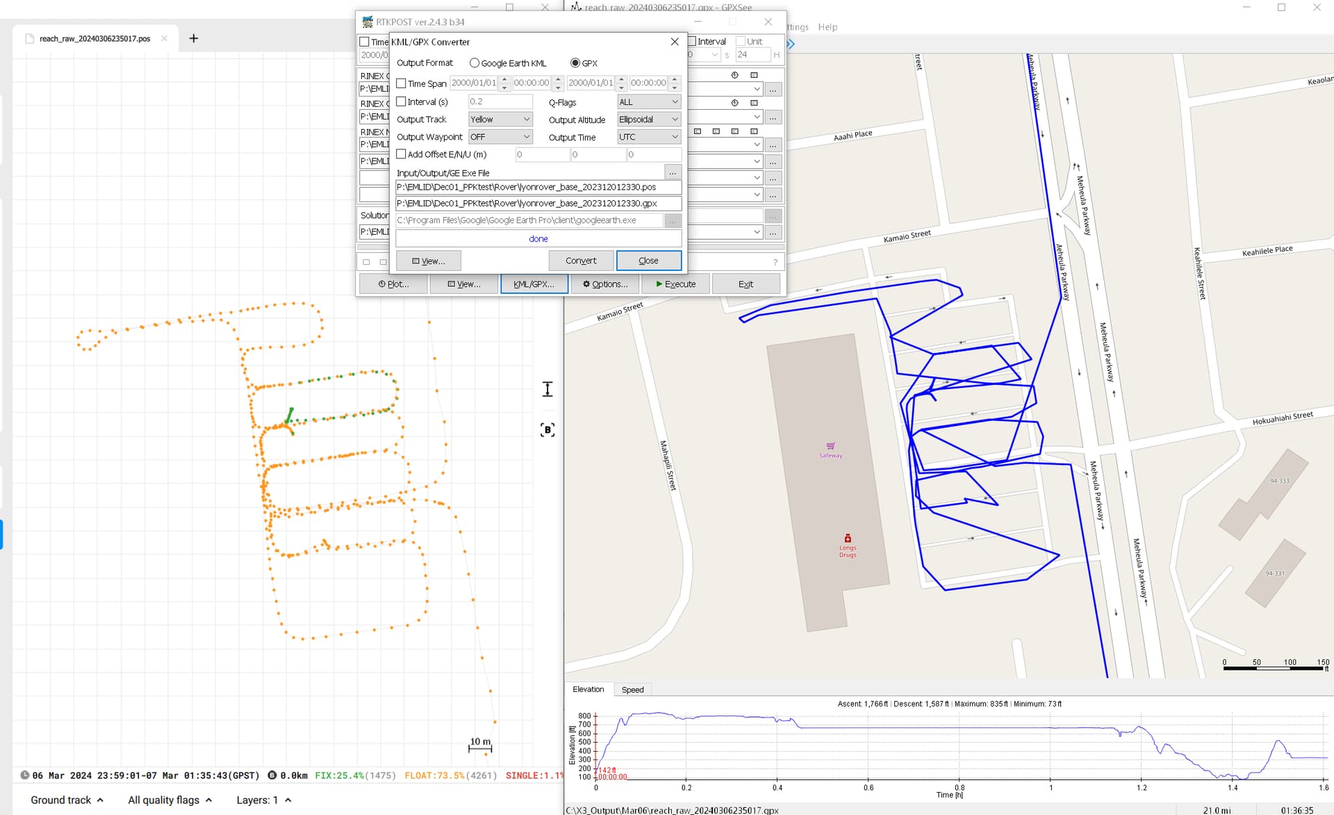
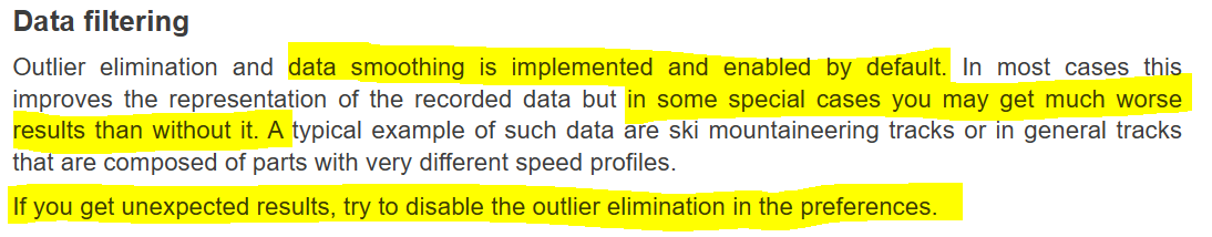
I’ve encountered a problem with RTKPost, it sometimes generates a horrible GPX with many points missing
Looks more like self-inflicted in your GPX viewer, it even admits it messes up your data by default:
Wow, it never occurred to me the program wouldn’t just show the GPX data as it is, especially when it’s discreet points with coordinates! Thanks for pointing this out