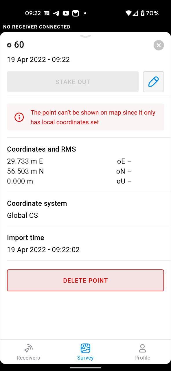
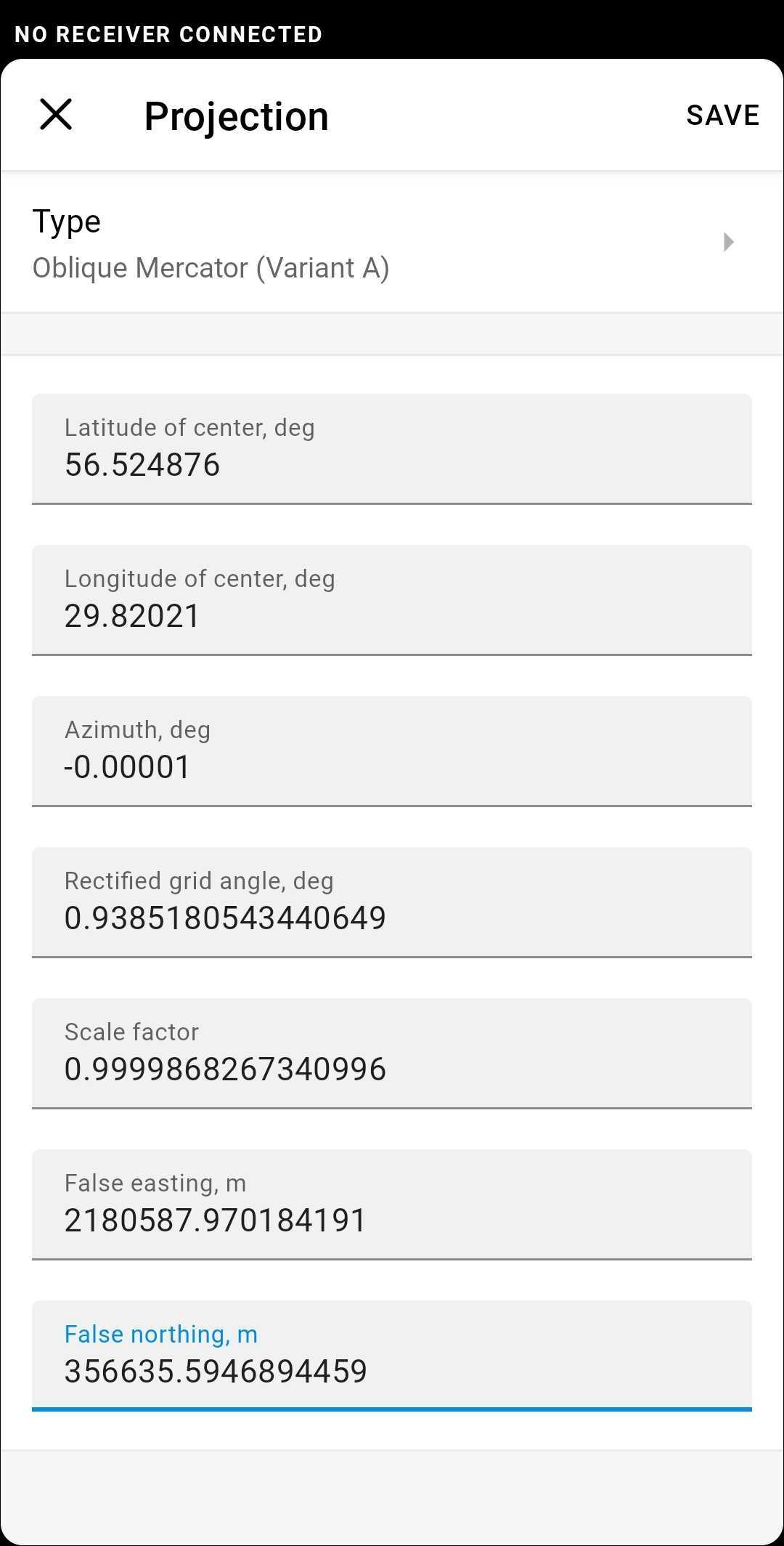
I imported coordinates in WGS84 format into project, but it shows this message.
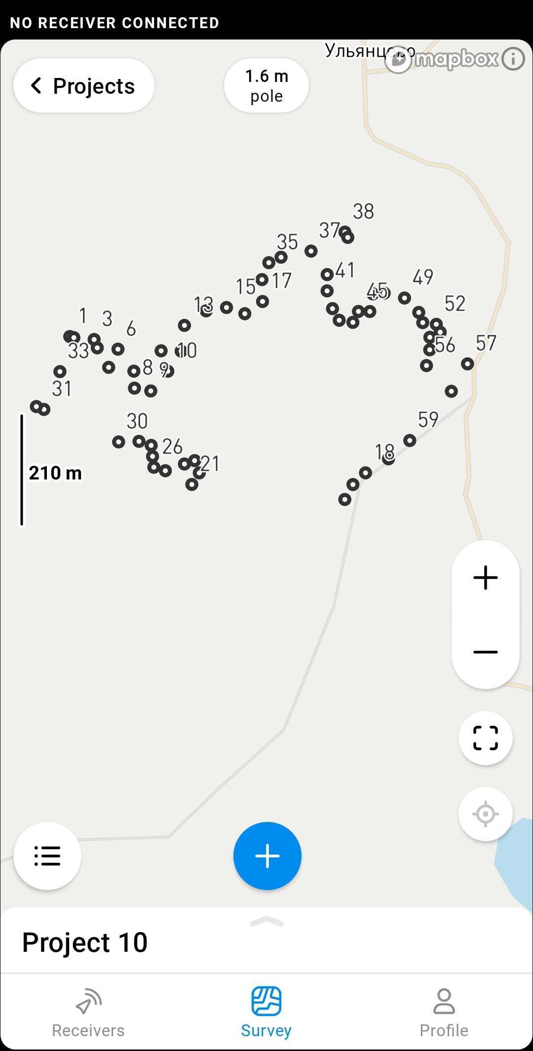
Name,Northing,Easting,Elevation
1,56.505272964051,29.7232638352869,0
2,56.505253400913,29.7233934303051,0
3,56.505221256325,29.7240337691687,0
4,56.505076457048,29.7241332811426,0
5,56.504735826992,29.7244953916845,0
6,56.505052357109,29.7247883007795,0
7,56.504669807835,29.7252904607235,0
8,56.504372781543,29.7253095847392,0
9,56.504324043528,29.7258252129367,0
10,56.504667334604,29.7263649651064,0
11,56.505024351581,29.7261527507144,0
12,56.505018179768,29.7267868896587,0
13,56.505466679768,29.7268905836859,0
14,56.505722479903,29.7275767525714,0
15,56.505779809891,29.7282207248777,0
16,56.505671412402,29.7287998388324,0
17,56.505884024588,29.7293602257358,0
18,56.502895583825,29.7326166503812,0
19,56.502692050417,29.7322210122015,0
20,56.502431745109,29.7319628066140,0
21,56.502693524352,29.7271229545345,0
22,56.502894989180,29.7273609274051,0
23,56.503109187191,29.7272121073879,0
24,56.503050515246,29.7268896451666,0
25,56.502933135857,29.7262871151096,0
26,56.502993416774,29.7259223445166,0
27,56.503183517284,29.7258808346935,0
28,56.503373705973,29.7258391592053,0
29,56.503445811914,29.7254530520179,0
30,56.503435529543,29.7248087480841,0
31,56.504001601056,29.7224465156360,0
32,56.504051963080,29.7222066239582,0
33,56.504662458551,29.7229535985376,0
34,56.506267103657,29.7293416260401,0
35,56.506560695128,29.7295588164641,0
36,56.506657810732,29.7299463538419,0
37,56.506763746956,29.7308961105133,0
38,56.507094233251,29.7319662070464,0
39,56.507001791474,29.7320563865667,0
40,56.506354470706,29.7314047701456,0
41,56.506069181110,29.7314025188147,0
42,56.505760153082,29.7315722242711,0
43,56.505557627371,29.7317854649772,0
44,56.505519821143,29.7322184010393,0
45,56.505711138190,29.7323932335348,0
46,56.505709806128,29.7327535384934,0
47,56.506017645452,29.7328483136769,0
48,56.506029320784,29.7332070693552,0
49,56.505944616437,29.7338510371291,0
50,56.505693998499,29.7343001819156,0
51,56.505515695247,29.7344280115031,0
52,56.505486105840,29.7348571089283,0
53,56.505349347136,29.7349806875958,0
54,56.505259371842,29.7346513964464,0
55,56.505042226320,29.7346461364829,0
56,56.504766676961,29.7345465841141,0
57,56.504796654065,29.7358440354499,0
58,56.504317873017,29.7353325518455,0
59,56.503459752532,29.7340167005373,0
60,56.503140423716,29.7333426271828,0