You can create a geotiff file in QGIS that you can then use in Mapbox Studio to use in Emlid Flow.
It is quite simple.
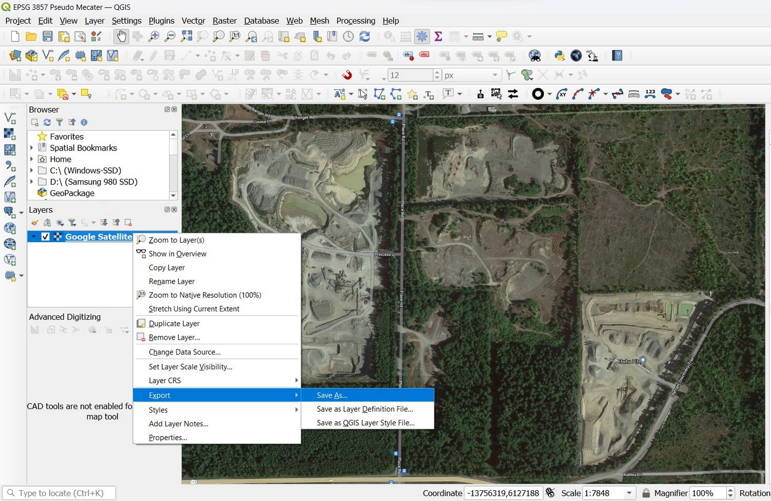
- Open QGIS
- Set the project coordinate system to WGS 84 / Pseudo-Mercator (EPSG:3857)
- Load whatever layer you have available. In my example, I use a Google Satellite Hybrid layer.
- Then right-click on the layer and select EXPORT > SAVE AS and, in the dialog, select the FORMAT > GeoTiff.
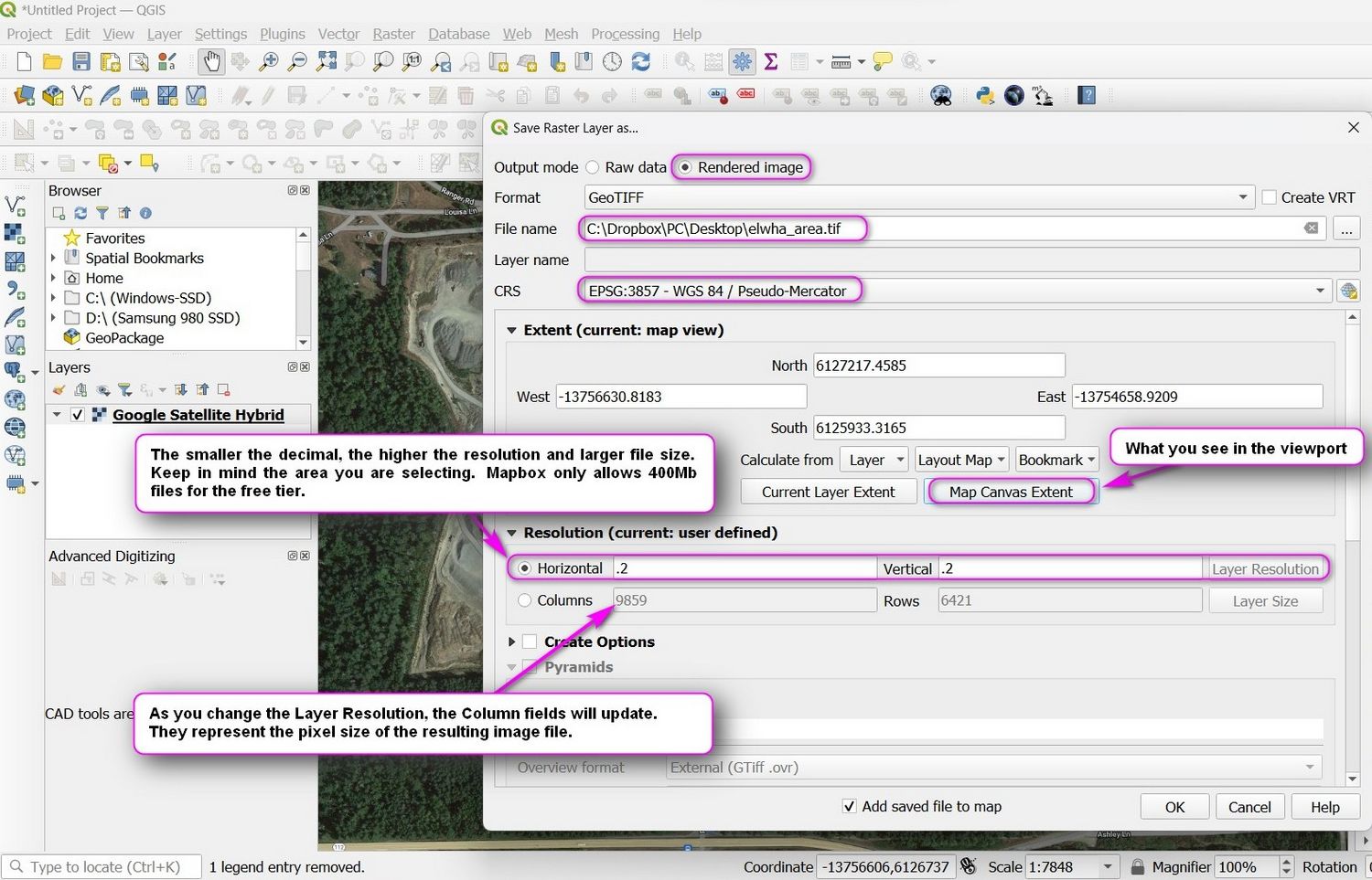
Look at the screenshots to see which settings to apply. When done, click on OK and your geotiff file will be rendered. If you plan to use this file in the Mapbox workflow, you need to keep the resulting file under 400Mb. If your file comes out too large, simply redo the process and either select a smaller area, a smaller resolution, or both.