Hello everyone, I am very new to the use of M+. and in generally at measuring with GPS equipments.
I wish you could help me with this first question:
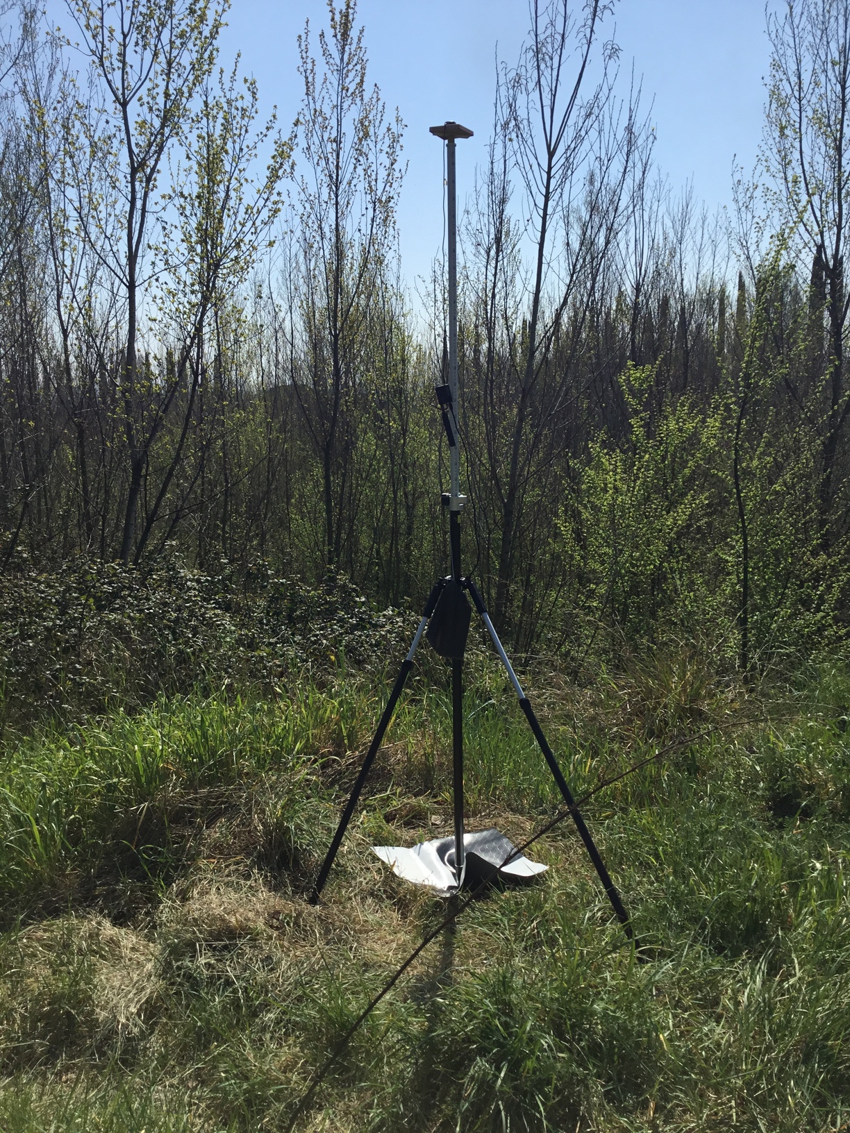
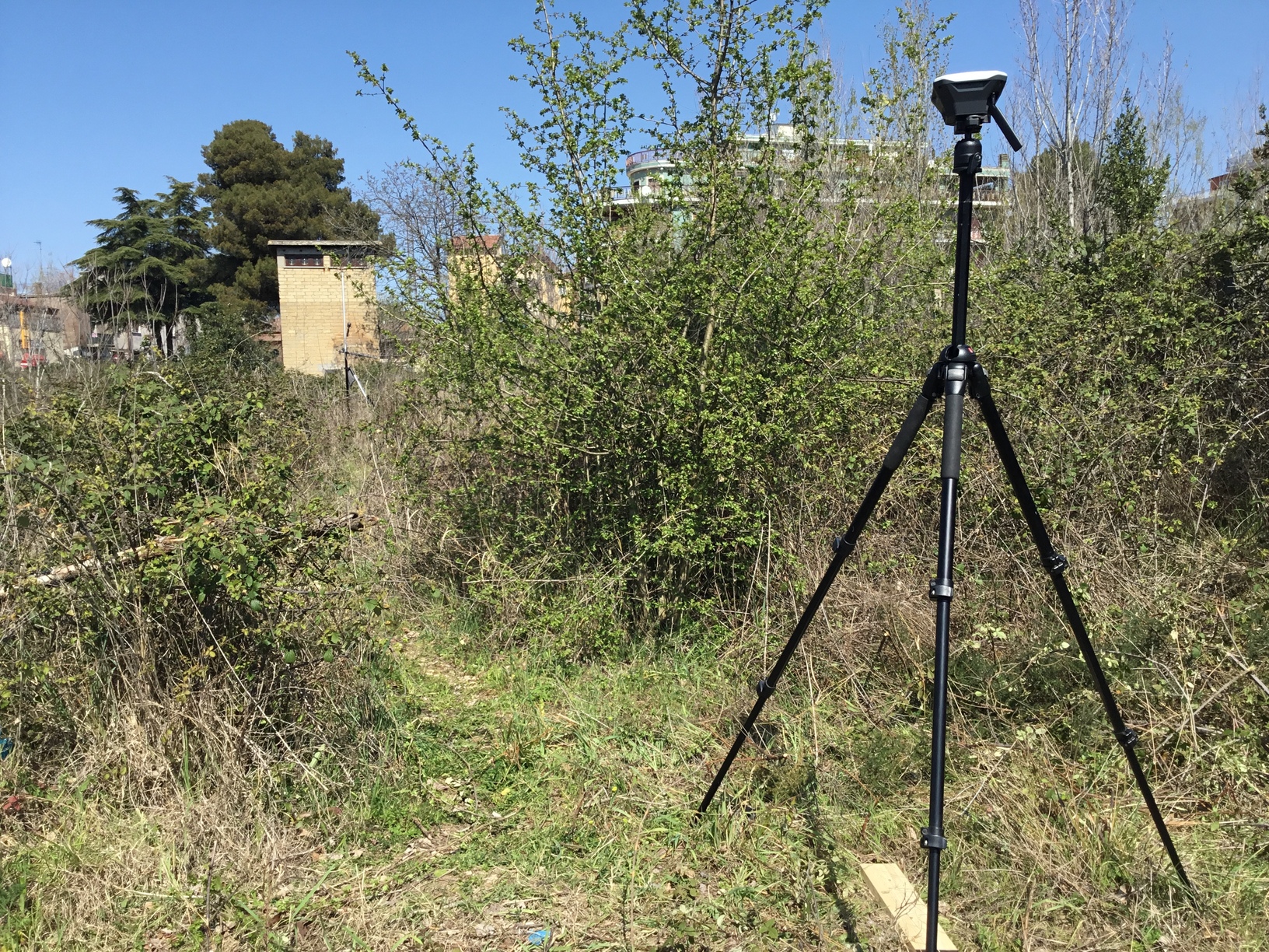
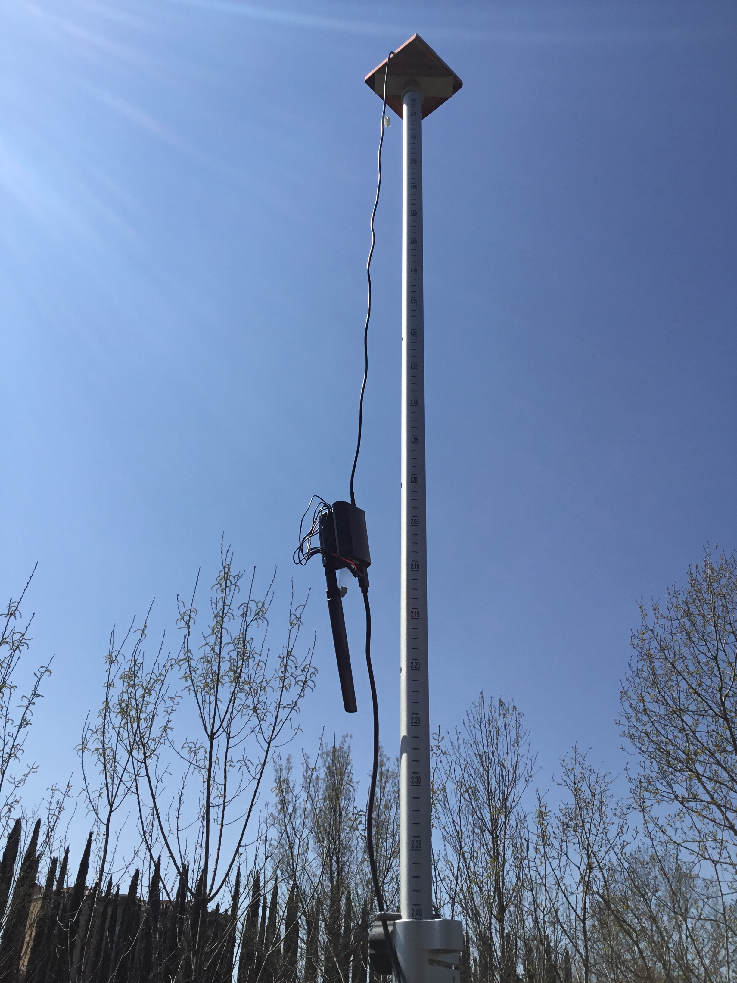
I am using a M+ as Rover placed on a bipot Pole of about 2.0 mts.
And with the Tallysman antenna placed just onto of the Pole, sitting on a ground plate of Copper
At the high top 2,40.
Now what value for the hight should I put into my ReachView Survey page for the M+ ?
Is the exact hight where the box of the M+ along the pole is ? Or is the Antenna that I should consider at the final hight on the pole?
Hope you can help with this small but very important point.
Thank you to you all
Hi Christian,
thank you for your reply.
Could you help me a bit more?
If I use my Tallysman with M+ for PPK setup on my drone I would put the antenna hight at 13/20 cms as suggested also from the provider of the PPk kit for my drone, and that is ok.
However if I use it as described above “I mean on a Bepod Pole” and as its suggested, if possible to keep the antenna as distante as possible from the M+ such as with an extension cable found also on the Emlid shop.
My question is :
what value for the hight should I put into my ReachView Survey page for the M+ when working as a Rover on a Survey Pole?
Would it be the exact hight where the box of the M+ along the pole is ?
And in this case I should not at all worry where ever the Tallysman Antenna will be?
You can measure from the top of the pole to the Phase Center of the antenna. The height will be individual, so there is really no substitute for getting the measuring band in action.
Wherever you want, but the shorter the antenna-cable , the better.
The antenna is where you need to measure from/to. Where you place the box is almost irrelevant, in a ground-use scenario.
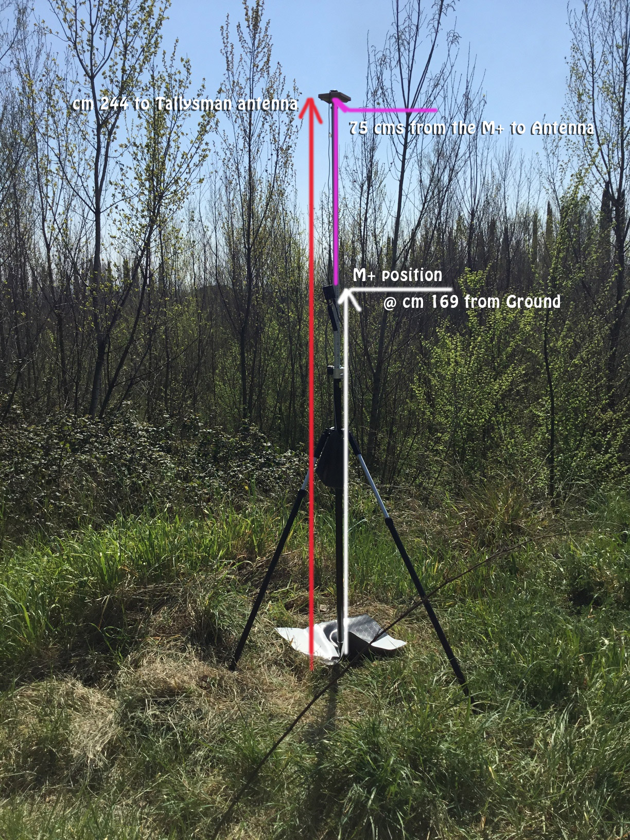
Here it is and I measured the antenna from the copper base down to ground that is 2.44 cams.
Hope I got it right.
Now this place is full of vegetation and that is a big problem but I wonder why from the status on the rover I see my base at 4500 Km away while is just 50 meters more or less.
Both in single unfortunately
You need to enter the distance from the ground to the antenna in the Survey tool. In this case, the distance will be subtracted from the calculated height, and you will get points’ coordinates on the ground in the CSV file.
I wonder why from the status on the rover I see my base at 4500 Km away while is just 50 meters more or less. Both in single unfortunately
If the rover is in Single, it means it doesn’t receive base corrections and base coordinates. That’s why it can’t calculate the proper baseline. On the latest Beta firmware update, the baseline should be shown only if the rover gets base corrections.
Could you please clarify whether your base transmits corrections when the rover’s solution status stays Single?
So in this case I did the right thing, I guess, or I hope
As I show here in the attached image, I measured “see the red line drawned on the attached image” the distance from the ground up to top of the Antenna. And the measure was 244 cms
Can you double confirm it?
About the second point here below:
I wonder why from the status on the rover I see my base at 4500 Km away while is just 50 meters more or less. Both in single unfortunately
I solved it simply by correcting other settings on the “Base mode” of my Base the Reach RS and after that I managed to get the correct distance from my Base to my Rover.
Yes, you will need to enter the length of the red line in the Survey tool on a rover.
I solved it simply by correcting other settings on the “Base mode” of my Base the Reach RS and after that I managed to get the correct distance from my Base to my Rover.
Thanks for keeping me posted! Glad to hear it works now.