


We continue our series of tips dedicated to the GNSS & RTK basics. Last time, we covered that every GNSS satellite sends a signal containing the exact transmission time and a navigation message. Now, let’s take a closer look at what happens after the receiver picks up that signal and how it uses that data to calculate its position.
Processing GNSS signals on receivers
While this is a simplified overview, the general process is as follows. When the receiver picks up the signal from GNSS satellite, it compares the transmission time with the time of reception to calculate how long the signal took to arrive. Because GNSS signals travel at the speed of light (~299,792 km/s), the receiver can then compute the distance to the satellite using the following formula:
Distance = Speed of Light × Time Delay
For example, if the signal takes 0.07 seconds to arrive, the satellite is about 20,985 km away. Even a 1-microsecond timing error (one millionth of a second) can introduce a 300-meter positioning error—highlighting why precise timing is critical to GNSS accuracy.
One GNSS signal is not enough
To calculate a 3D position (latitude, longitude, and altitude), any receiver needs signals from at least four satellites. This method is called trilateration. Imagine you’re standing somewhere, and you know how far you are from three different landmarks. If you draw a circle around each landmark with the distance as the radius, your location is where all three circles intersect. That’s what a GNSS receiver does—except instead of landmarks, it uses satellites in space, and instead of circles, it draws spheres. Where those spheres overlap is your position.
So, each satellite sends a signal with its exact position and time, and your receiver calculates the following:
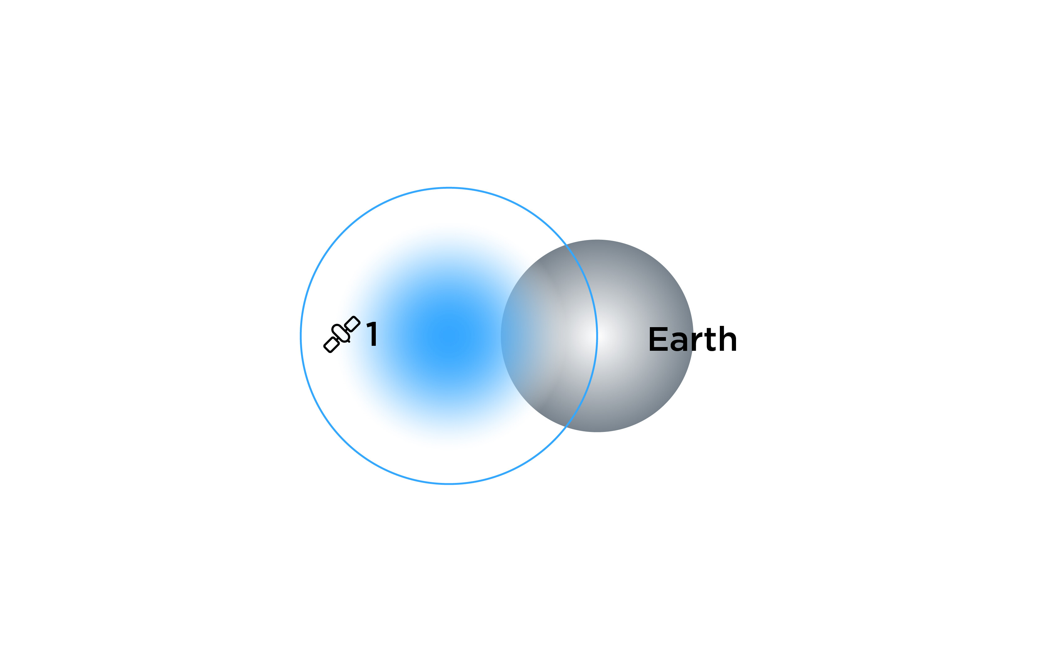
- With the distance to one satellite, you know you’re somewhere on a sphere around it.
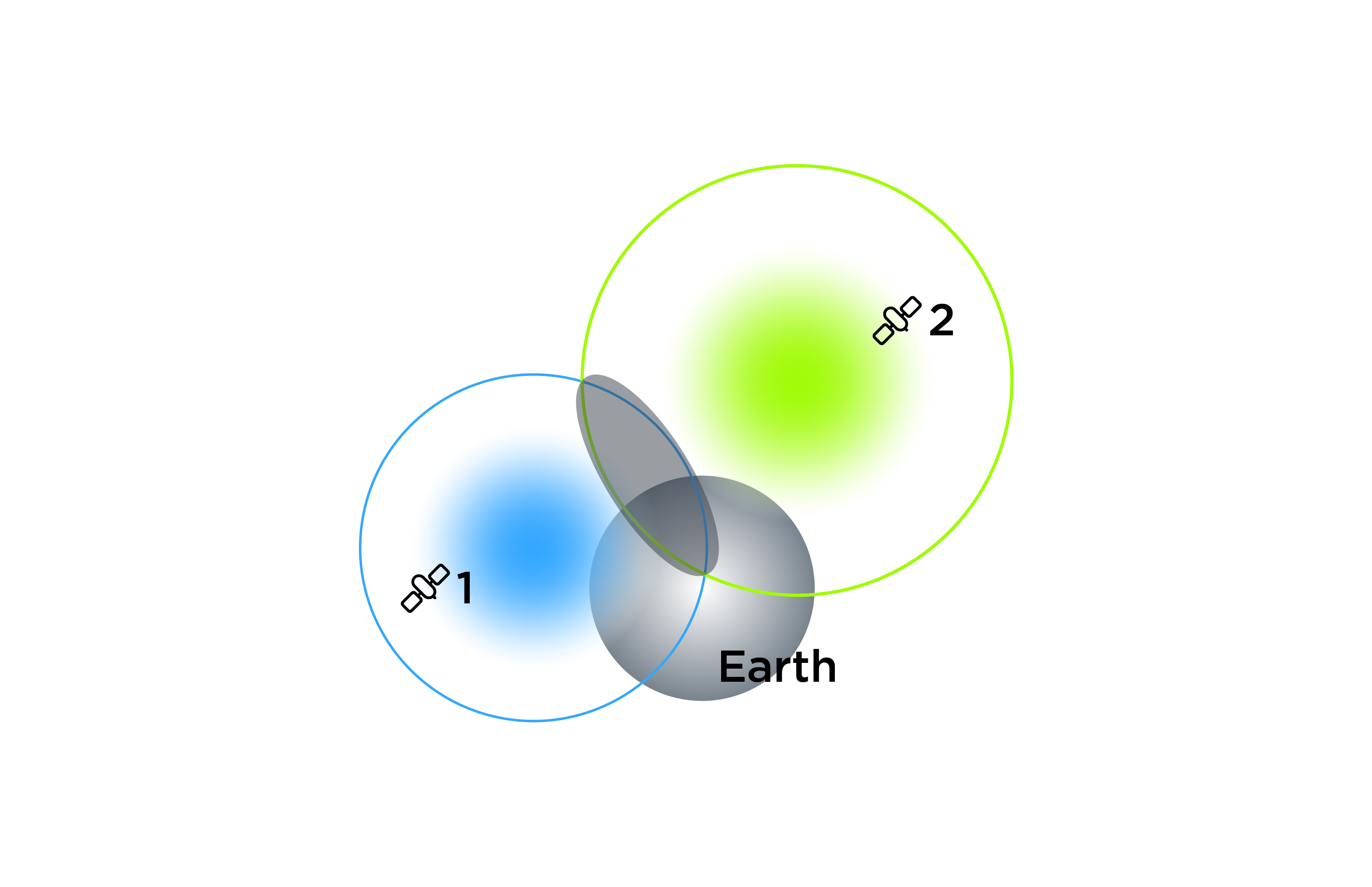
- With two satellites, you’re somewhere on the circle where two spheres intersect.
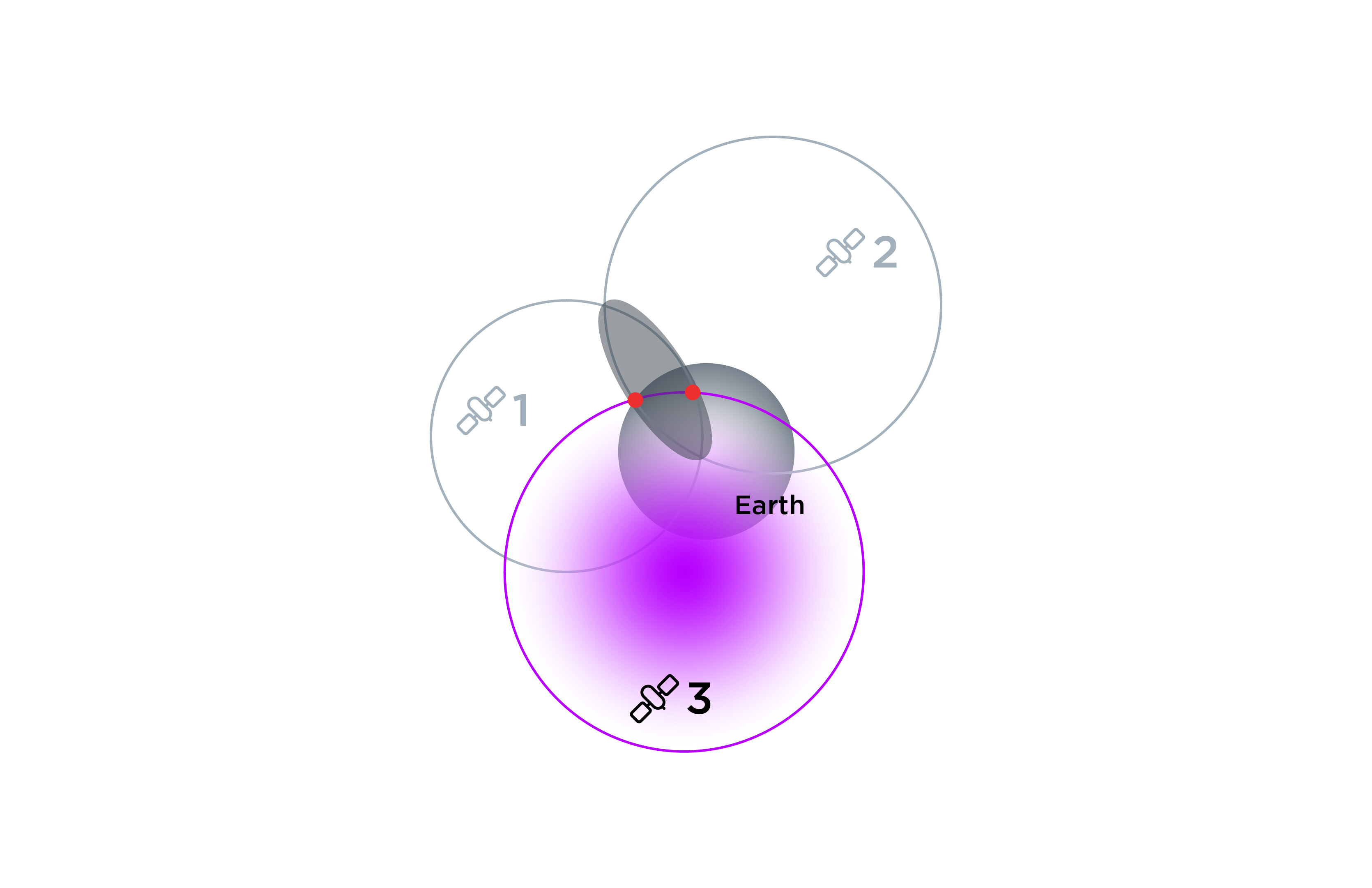
- Three satellites narrow it down to two possible points.
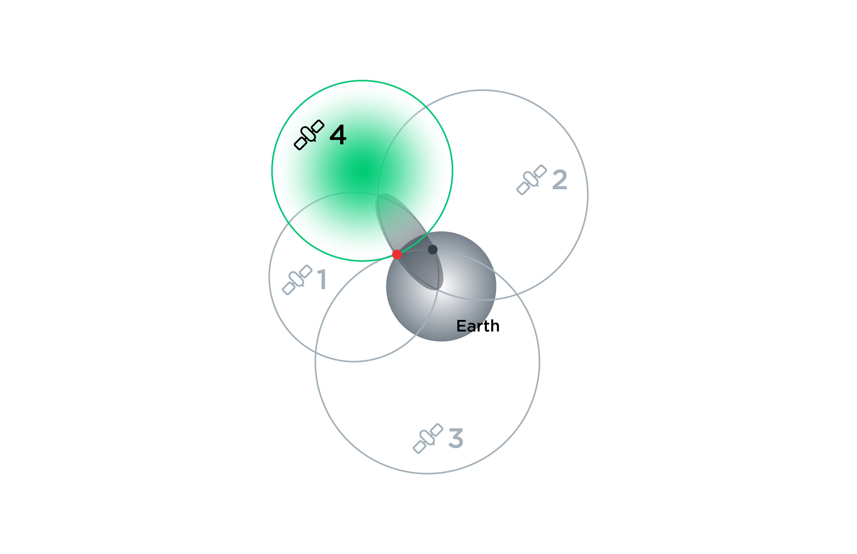
- The fourth satellite helps resolve which point is correct and fixes the receiver’s clock error.
In general, any receiver calculates distances from multiple satellites and finds the intersection point, determining its exact position. The more satellites involved, the easier it is for the receiver to spot and correct bad data. However, even using this method the regular receivers like GPS in our smartphones have the accuracy of only several meters.
GNSS signals characteristics impact
When GNSS signals travel from satellites to receivers on Earth, they pass through the ionosphere and troposphere—two layers of the atmosphere that can bend, delay, or weaken the signal. This is the main reason typical consumer devices, such as smartphones, remain limited to meter-level accuracy. In contrast, high-precision GNSS receivers like Reach use advanced technologies and specialized algorithms to correct for these distortions and achieve centimeter-level accuracy. This also includes accounting for the following key characteristics of GNSS signals:
Signal frequency and multi-frequency advantage
GNSS satellites transmit signals on multiple frequencies, such as L1, L2, and L5 (GPS) or E1, E5a, and E5b (Galileo). Using multiple signals on different carriers significantly enhances a receiver’s positioning accuracy.
Signal modulation and data content
GNSS signals use different modulation techniques to encode navigation messages and carriers. Higher bandwidth signals, such as GPS L5 and Galileo E5, improve error correction and tracking in challenging environments.
Signal power
When they reach Earth, GNSS signals are weak, making them vulnerable to obstructions and interference. To catch such signals, multi-constellation receivers with high-sensitivity antennas are required.
Satellite geometry and GDOP (Geometric Dilution of Precision)
The positioning accuracy depends on how well satellites are distributed in the sky relative to the receiver. A well-spread satellite configuration reduces GDOP, improving accuracy. Poor satellite geometry increases positioning uncertainty, leading to larger errors. For this reason, GNSS receivers continuously evaluate satellite geometry to ensure reliable and accurate positioning.
As discussed above, the characteristics of incoming GNSS signals have a direct impact on positioning accuracy. In the next support tip, we’ll take a closer look at the next key component in the positioning process—GNSS receivers.