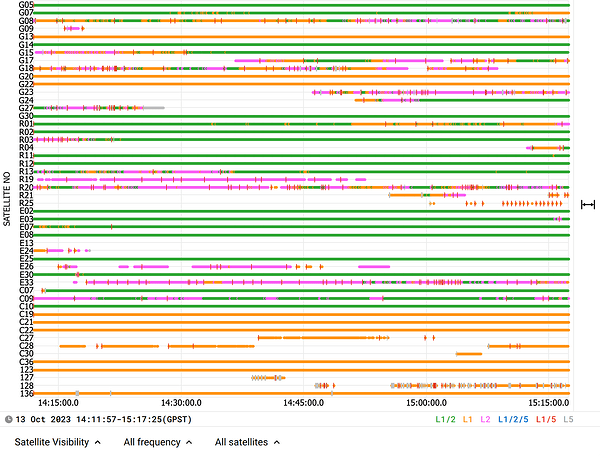
This question was asked here: Standalone surveying with rs2+, but the answers largely diverted into asking why you would want it, instead of whether it was used. And now that it is >100 days old, I cannot add to that topic.
I have been running a variety of tests with my Reach RS2+ unit, and although SBAS satellites are reported in the app, I have never seen the GGA NMEA string report a quality of 2 (DGPS/SBAS/etc). The tests in question were run with the Reach set up to output NMEA over serial to a separate logger, with all constellations enabled and both the GGA and GSA strings enabled. The system was left running for approximately 1 hour.
I can see 3 options -
- The RS2+ tracks the SBAS satellites, but doesn’t use them
- The RS2+ tracks the SBAS satellites and uses them as part of the solution, but doesn’t report it in the GGA string.
- The RS2+ tracks the SBAS satellites but only uses them if it improves the solution, and in my test perhaps it never made an improvement.
Can anyone clarify which of these options (or perhaps some other option I haven’t considered) is true?
Again, I’m not interested in whether I should or should not be using SBAS in a given survey design, just wanting to understand what the RS2+ is doing.


