I have started a new topic, in the previous one I had no positive response.
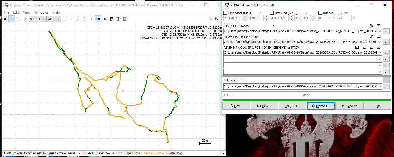
I have not achieved 100% positive results in post-processing.
In concrete terms, I need to obtain the coordinates of the field points. The work is for cadastral purposes and EMLID REACH RS has not been able to give positive results.
In the field I do not have a fixed solution in most points, that’s why I went to post-processing.
I need suggestions or alternatives to obtain accuracy with REACH RS and not die trying.
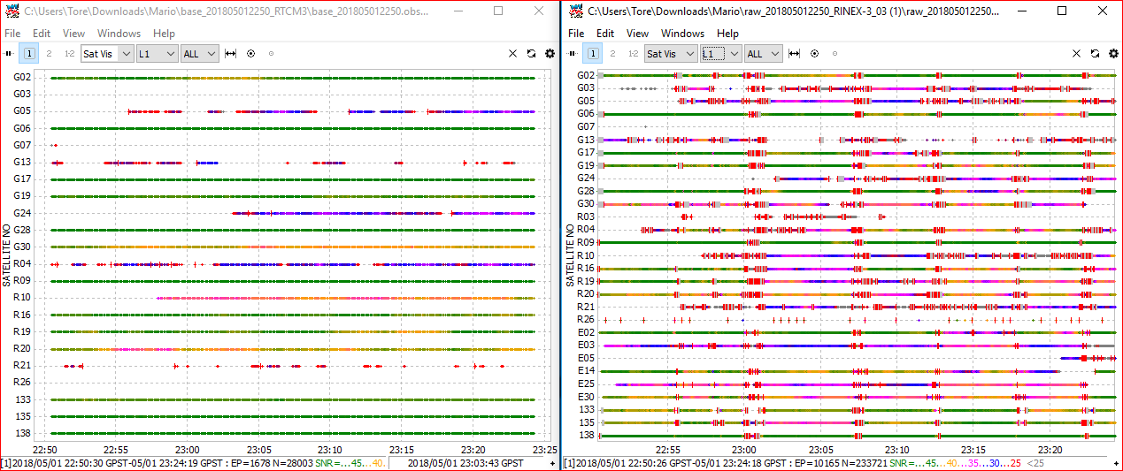
If you open log for rover and base. Compare them and you`ll see there is much more noice on the rover.
Like the picture below, rover to the right. The red flags is bad news.
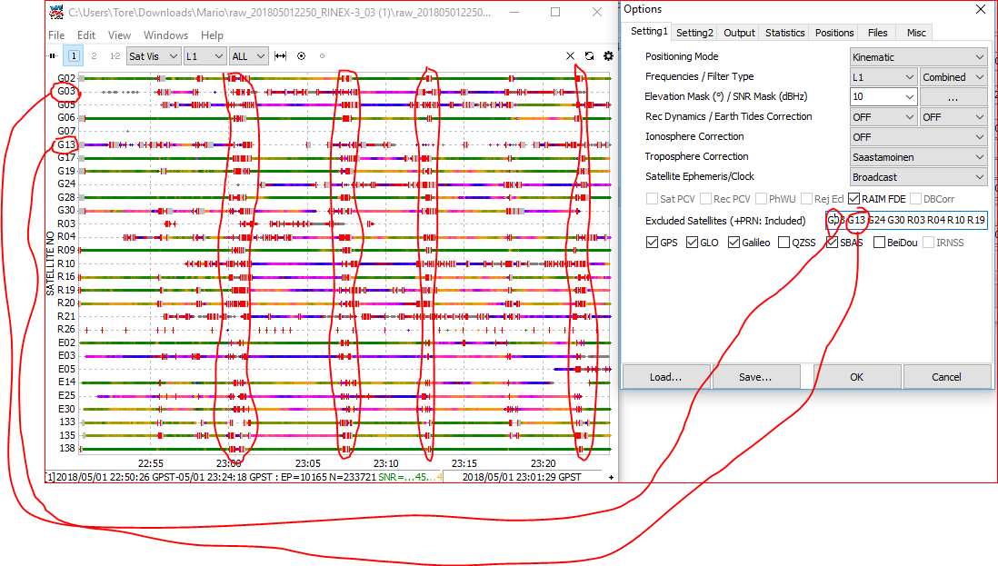
If you look at the picture, i have set red ring around satellite nr to exclude them from the process. This can help getting better result. You want to avoid using areas with red flags (like the areas i have set red ring around)
Also pay attention to the color of each satellite. Green is good, and the lesser green it get, the worse SNR level it has.
Hope this help