Hi,
I recently received this from Mapit support regarding a difference in coordinates I had observed.
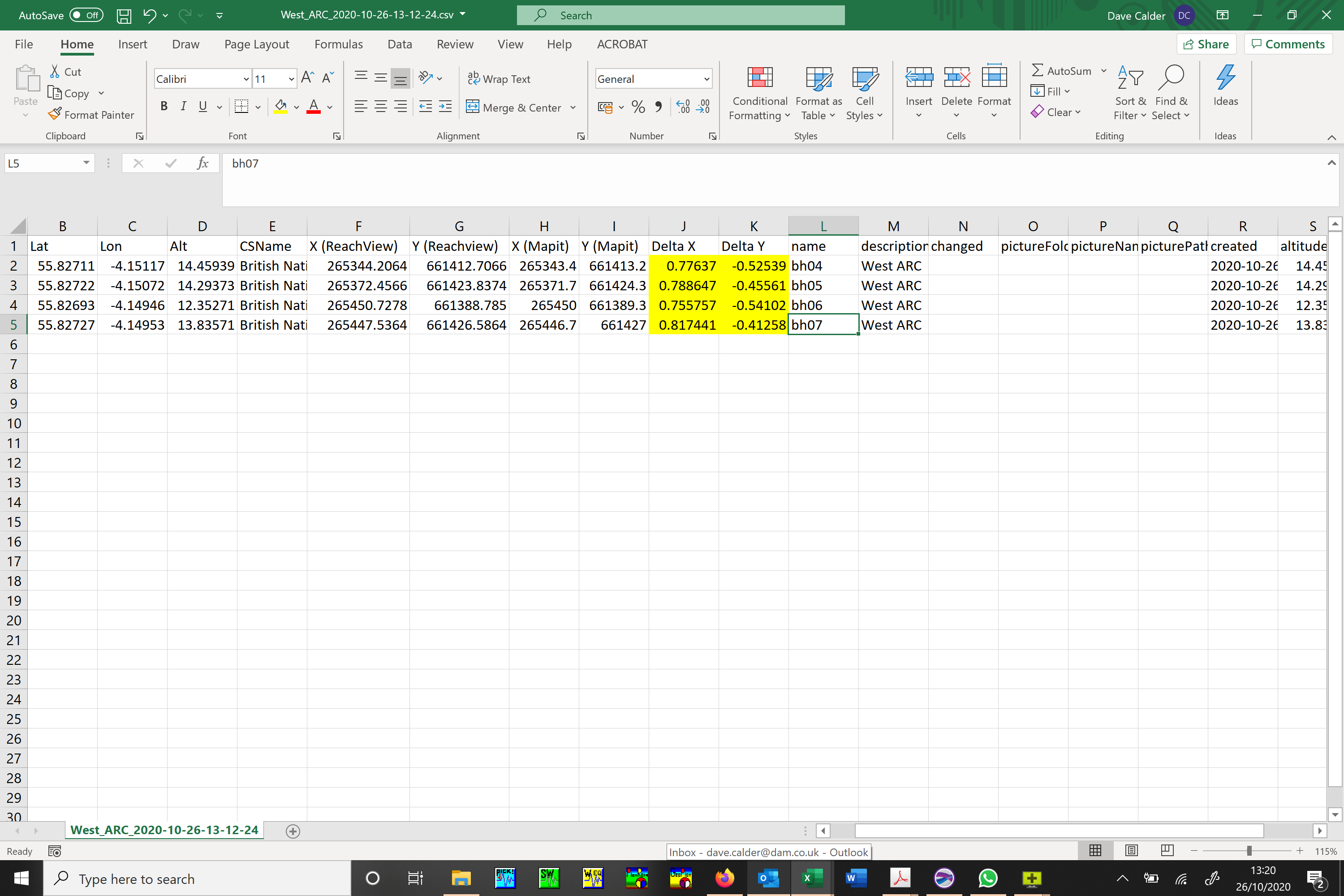
The employee was out using Mapit and forgot to use orthometric height to OSGM15 geoid and so I converted the lat/lon manually after and noticed a shift between the conversion using Ordnance Survey software and the Mapit British National Grid output coordinates. Here is the response from Mapit:
“Hi Dave, this is related to the fact that Mapit is not using the grid to convert coordinates.
It uses standard 7 parameters Helmert Transformation between WGS84 and OSGB36.
For maximum accuracy, I would suggest logging all the data in WGS84 in form of lat, lon and get the data converted to 27700 using professional software which is utilising OSGM15 grid.
The support for OSGM15 conversion of the coordinates possibly will be supported directly in Mapit in the future, however now all transformations are being done using PRJ4 library and not grid conversions, which is always a less accurate method.”
My question is: Does Reachview3 have the same issue when converting to BNG and OSGM15?
Thanks