Hi, I´m doing a PPK process with a know position from a base station
I have a cuestion about the kind of heigth that I should use in rtkpost?
Can I use ellipsoidal heigth? or I need a transformation?
I hope someone can help me thanks
Hi, I´m doing a PPK process with a know position from a base station
I have a cuestion about the kind of heigth that I should use in rtkpost?
Can I use ellipsoidal heigth? or I need a transformation?
I hope someone can help me thanks
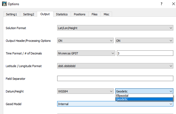
Always ellipsoidal, even if outputting to a local geoid.
I think this may depend on what you are using it for? If you are post-processing individual survey observations then you will want all the datum to be on the same page as they are indepentdently relative to the base, but in my case when I am post-processing drone surveys the GNSS track is relative to itself and I fake in the local known elevation (converted to meters) to then make the track relative to the site that I am mapping.
Hi Javier,
RTKLIB uses ellipsoidal height. In case you need orthometric it is possible to use 3-rd party software like QGIS to convert it after RTKLIB post-processing.
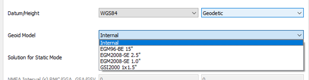
Dear @mikhail.goryachev RTKLIB it can generate ortometric heights you have to select it in Datum / height and you have 5 options 4 of global models and one to load a cut file from your region, for this last option you have to go Files -> Geoid data file, at the moment I don’t know well what type of file RTKLIB reads, we would have to experiment a little more.
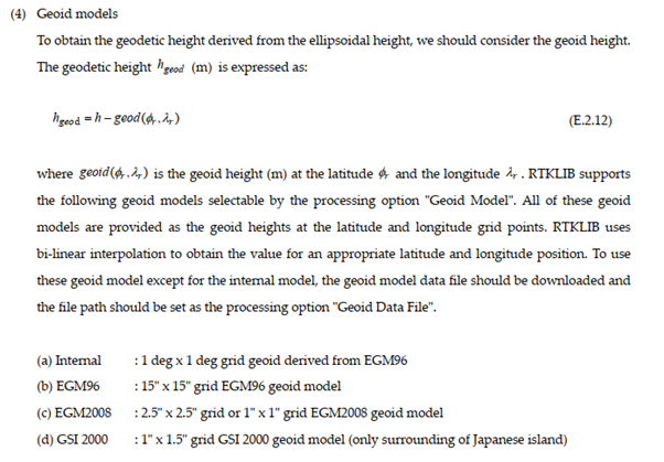
N = h - H
H = h - N
regards
Hi Gabriel,
You are right about RTKLIB’s ability to use geodetic height. Both ways can work out. Proposing QGIS looked more reasonable since it could be a more universal solution for such a working scenario.
This topic was automatically closed 100 days after the last reply. New replies are no longer allowed.