I always seem to get a 70mm height error when measuring in my Leica base station using VRS with the RS3, then connecting to this base station that was just measured via Emlid Caster pro.
See below workflow.
Setup iCG60 Leica base station
Measure in the base station point by VRS corrections using Emlid RS3 using, over 10 mimutes;
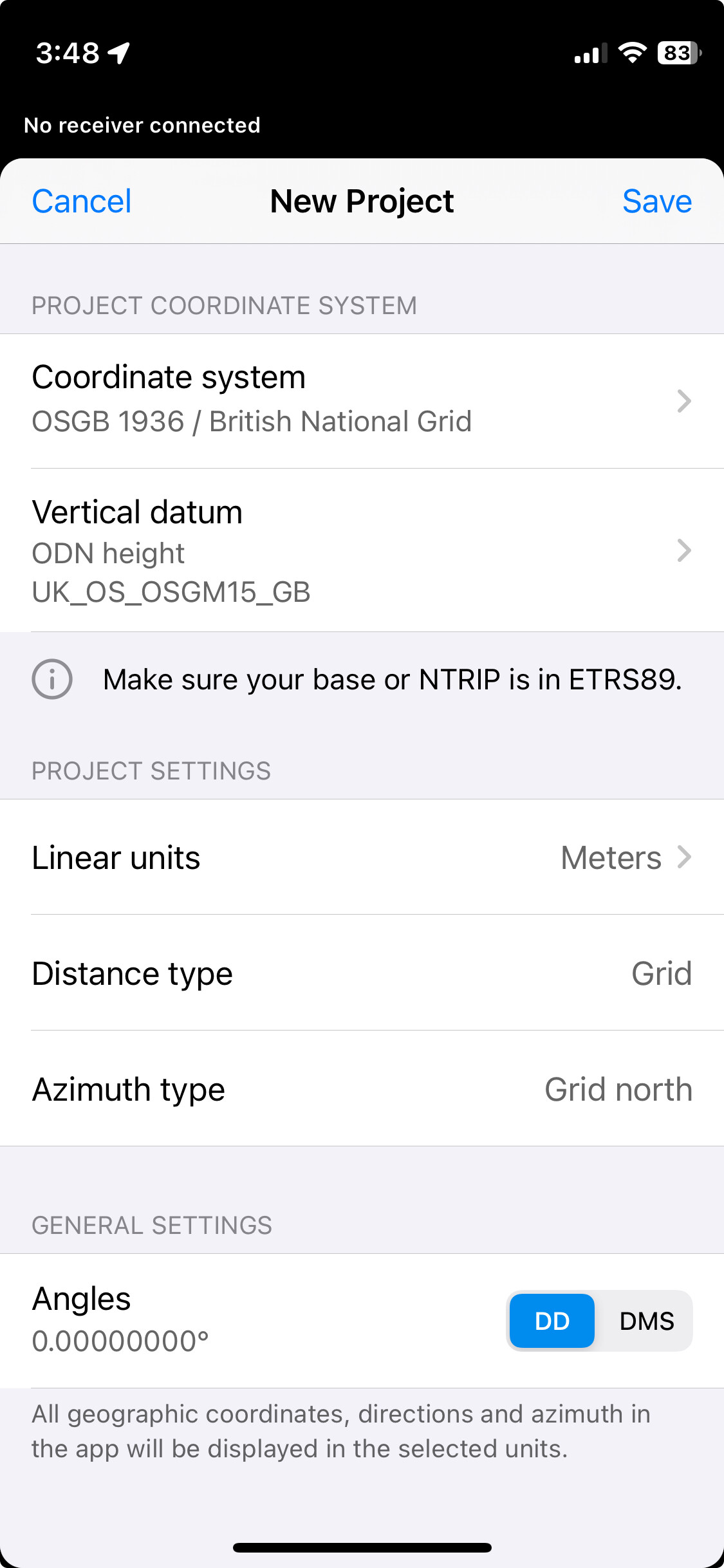
Coordinate system: OSGB 1936 / British National Grid
Vertical datum: ODN height uk_os_OSGM15_GB.tif
Connect gnss antenna back upto the iCG60 and carry out a single measure for 10 minutes.
Correct this position by inputting E,N,Z coordinates into Leica iCG60 base station which I believe uses WGS84 with an OSTN15 coordinate system applied.
Save base position
Stream via Emlid Caster corrections to Leica MC1 machine control & Emlid RS3
I always seem to have a 70mm error in height when connecting to the base station that was measured in by the same RS3 that now has an error.
I am assuming there’s something not correct with the vertical datum/geoid as I believe emlid used ETRS89?
Thanks, but im not sure that this is the reason for the error.
Method below;
Measure base point
(Measure using Emlid RS3, connected to Trimble VRS service, with OSTN15 geoid - I believe the Emlid RS3s global CS is ETRS89 but this is converted to OSTN15 Easting Northing Elevation)
Enter the above collected E N Z from Emlid Flow app into Leica iCG60 base station.
(Leica iCG60 base station co ordinate system set to OSTN15 - I believe the iCG60s global CS is WGS84 but this is also converted to OSTN15)
Save base position
Measure a point using Trimble VRS on the RS3, before switching over to the base station stream
Connect to the base station using Emlid Caster Pro, and remeasure the point previously surveyed in step 4
Between step 4 & 5 is where we notice the 70mm difference in elevation, but no error as such on Easting & Northing.
Between step 1 & 2 is where I believe the error is coming from where both Global CSs (WGS84 & ETRS89) are being converted to OSTN15. Position is correct, but elevation differs.
Maybe there is a slight difference between Leicas OSTN15 systems height & Emlids OSTN15 systems height?
Because we have around 8 base stations which move often depending on requirements. Its easier to just sit my RS3 onto the bracket and measure than to input VRS credentials into each base station using the small arrow keys and backlit screen. I would then have to logout and repeat for each station. Also, if I forget to logout I would have trouble using the VRS on my rover until I either change my password or go to the base station and logout
Quick question: how did you measure the base point with your RS3? Did you average it in FIX, or did you create a project in Emlid Flow with RS3 as the rover? If it’s the latter, you set the project in OSGB 1936 / British National Grid + ODN (OSGM15 height), right?
If you set up your project in OSGB 1936 / British National Grid, your base should broadcast corrections in ETRS89, as we use the OSTN15 grid to perform the datum conversion.
Since you copied the OSGB 1936-based coordinates to set up your Leica base, the corrections broadcasted are likely in the OSGB 1936 datum.
We require that the base or NTRIP corrections be in ETRS89 if the project’s CS is OSGB 1936. So, I think there were some unnecessary datum transformations here.
I suggest using ETRS89 when setting up the Leica base, and broadcasting corrections in ETRS89 as well if you want to use the OSBG 1936 datum in Emlid Flow with Reach.