Hi, I am located in Southern Illinois, US. Running a pair of reach modules. They are working absolutely perfect. Great FIX, great logging of data etc.
My questions mostly revolve around datum and wording in Reachview and Rtklib.
In reachview, setting up the base over a known point, I enter the lat, long and height, and below this I enter the instrument height.
Should the lat and long entered be in NAD83 or WGS84? Same question with the ellispsoid height of the station monument, do I enter NAD83 or WGS84 ellipsoid heights?
Pertaining to the logs that the reach creates and saves once the green light is achieved; are these raw datasets saved in any particular reference datum (NAD83 or WGS84, or ??)
When setting up a new survey in Reachview, you are warned that output is displayed using the WGS84 reference only. This makes me assume the rest of the reach and associated files also use WGS84 only. Any truth there?
RTKlib. What is the output (NAD or WGS). If it is one of those, can output be changed in rtklib without using a second conversion tool after post-processing?
In RTKlib, in options => positions =>base station, I’m not certain whether I should enter the station monument data here (lat, long, ellipsoid height) or not. This confusion is because I am assuming that since I am pulling logs from the reach, none of the setting in Reachview are retained in those logs (such as the base coords entered under base setup, especially since I have base corrections turned off since I am not using rtk). If I do enter the Nat. Geodetic Survey info for the monument into rtklib for the base station, do I convert to and enter WGS84 or the original NAD83? Using either reference datum, I assume I will still need to add the instruments antenna height to the monument data ellipsoid height to be correct.
This is the first time I have post-processed logs. Prior to this job I was using horizontal only, RTK, corrections over radio type surveys.
Giving you some info on my job may help you help me.
This job is as follows.
I need the true elevation of the top of a hill to start an elevation survey with optical levels. I have loacted a Nat. Geodetic Survey (NGS) monument apx 6 km away.
I sat my base overy the monument, achieved green light status and connected to reachview. I entered the monument data into the fields where the lat, long, hieght and antenna height go, but then had second thoughts and turned off base corrections. The data I entered was NAD83 (as shown in the NGS data link) with an antenna height in meters.
I left the base logging data and drove to the job site 6 km north. Set the rover up in the same manner (except without entering any of that base data into reachview). I measured and wrote down the antenna height. I let the rover log data for exactly 1 hour. Then I took down the rover, drove to the base and took it down as well.
I do not care what the output from rtklib or rtkpost is, as long as I know what reference datum it is in. As long as I know that, I can find the geoid height to determine the true ortho elevation of the job site.
I’m just not familiar enough with the rtklib or rtkpost to know what it requires for input, what it sends out as output or what the reach logs record in. It may also be worthy for you to know that I also do not know exactly what a UBX or RINEX file are or what they contain.
For now, you should assume everything ReachView/RTKLIB is WGS84. Coordinate transformations are one of the things Emlid is currently working on for release in a future version.
If you are not performing RTK, and only pulling the raw (UBX) log files for post-processing (PPK), then do not bother to enter base coordinates or antenna height. You will be entering base LLH into your post-processing software, and possibly entering the antenna offsets for base and rover as well (usually just the height).
For PPK work, you can simply run in single mode, with the satellite systems and update rate of your choice and with the raw (UBX) log turned on.
So for the job, I suppose you should take your NGS monument coordinate and transform that to WGS84, then use that to post-process your logs. Take the resulting WGS84 coordinate for the hill top, then transform back to the desired horizontal / vertical datum for your survey.
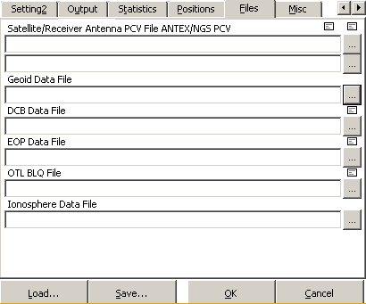
I have not used it myself, but you could also investigate the Geoid Data File input option for RTKPOST.exe: