


here is a link to the files cant attached because I’m a new user. Can some one please take a look at my data and tell me were I’m going wrong. I used emild studio for ppk processing with default settings.
Hello Aizen,
First welcome to our Community.
To better help you, please always indicate the receiver model and the firmware version.
Hello again,
According to my first analysis I noticed that you are working in a somewhat difficult environment (trees and buildings in urban areas…), especially with a single-frequency receiver (a lot of cycle slip causes a bad results).
I noticed that the base is badly positioned try to put it in an open place where you get the best signal from as many satellites as possible as indicated in the documentation Placement | Reach RS/RS+.
In fact I got only 43 points out of 139 were averaged in FIX.
1 Like
Receiver model is rs+ and its on firmware 29.2
I tried to place the base in a area that had a clear sky view, it was placed around 20 feet away from the building. Also for some reason the location showed on the survey for the base was wrong. its was place in the around the polices station. But with all that said in all cases both base and rover had connection to 19-24 satellites during the survey. I did the survey in 3 parts, the other 2 parts had a fix on all of the point I took. Same conditions and same location for the base. Also can you tell me what setting you used in elmid studio when processing. Thank
Hi Aizen,
- Can you give me a correct coordianates?
- How you move while collecting points?
With this setting you can get better 77 points out of 139 were averaged in FIX.
1 Like
Hi @Aizen,
I’ve checked your logs and can agree with @Zinou: most likely, you work in too harsh conditions for single-band Reach RS+.
Take a look at the base and rover logs’ quality and rover’s skyplot:
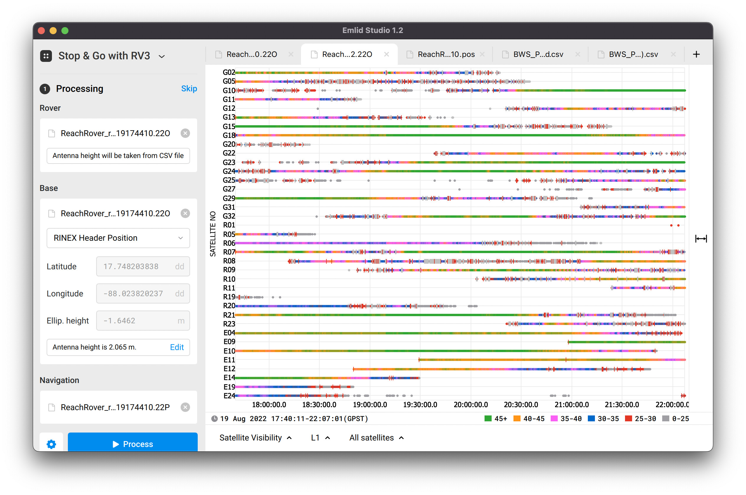
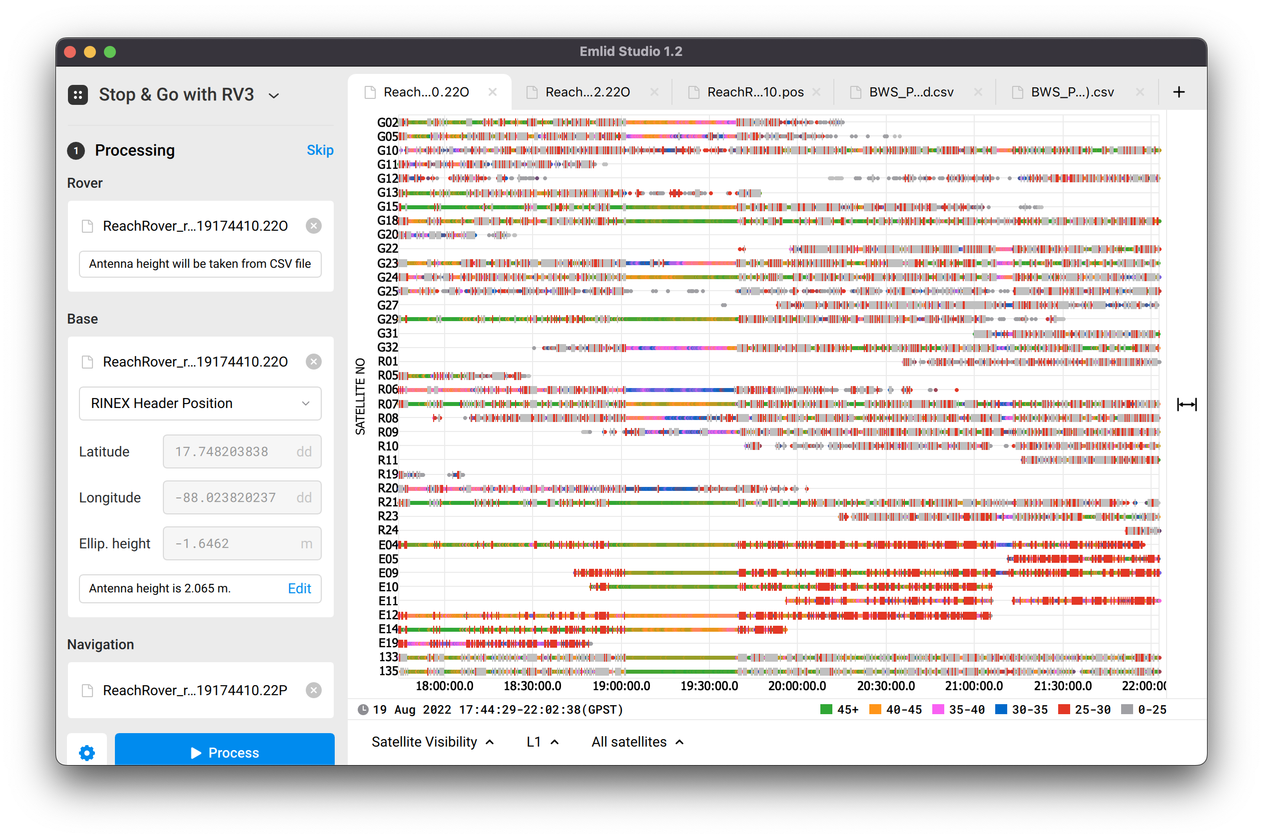
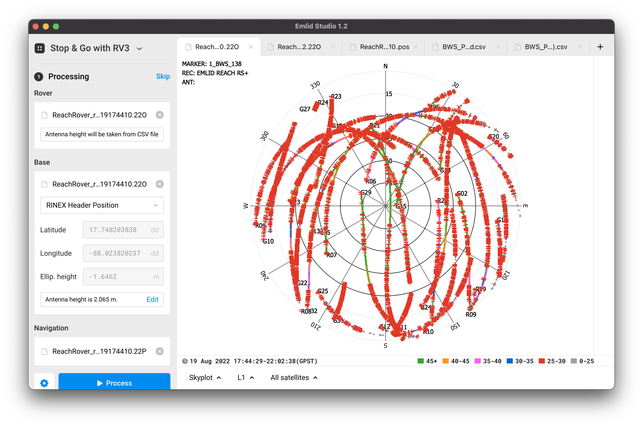
There are a multiple red and gray bars that mean cycle slips. Cycle slip appear in the log when a satellite signal is interrupted or there’s electromagnetic interference. According to the skyplot, a sky view was blocked during collecting the entire dataset. So, you need to provide it with unobstructed sky view to achieve better results.
thanks for the reply, so you are telling me that the data collected will not be correct. I ran it multiple times in emild studio with multiple settings and i got some of the points to be fixed. attached is a copy of the corrected csv. So base on the log are these point accurate. Also if I would use data from a CORS station as the base would that help.
BWS_PPK_corrected.zip (5.3 KB)
If you are surveying near buildings and cover, it is better to use GPS to establish control points away from the obstructed areas, then use a total station or some other optical method to measure in the obstructed areas. Buildings reflect GPS signals. By unobstructed, that means 15° or so from the horizon, so 20 feet from a building may be okay if it’s only 11 feet tall.
You can try increasing the elevation mask, but be aware that high mask angles also reduce the accuracy.
Also watch the AR ratio. You may have a fix, but it’s in a cycle slip which will push it 8 inches off of true location. If the AR ratio is in the 600+ range and stable, it’s a good point. If your AR ratio is bouncing around under 100 like when it first gets a fix, it’s most likely off. I like to see it pinned to 999 while I’m moving about.
1 Like
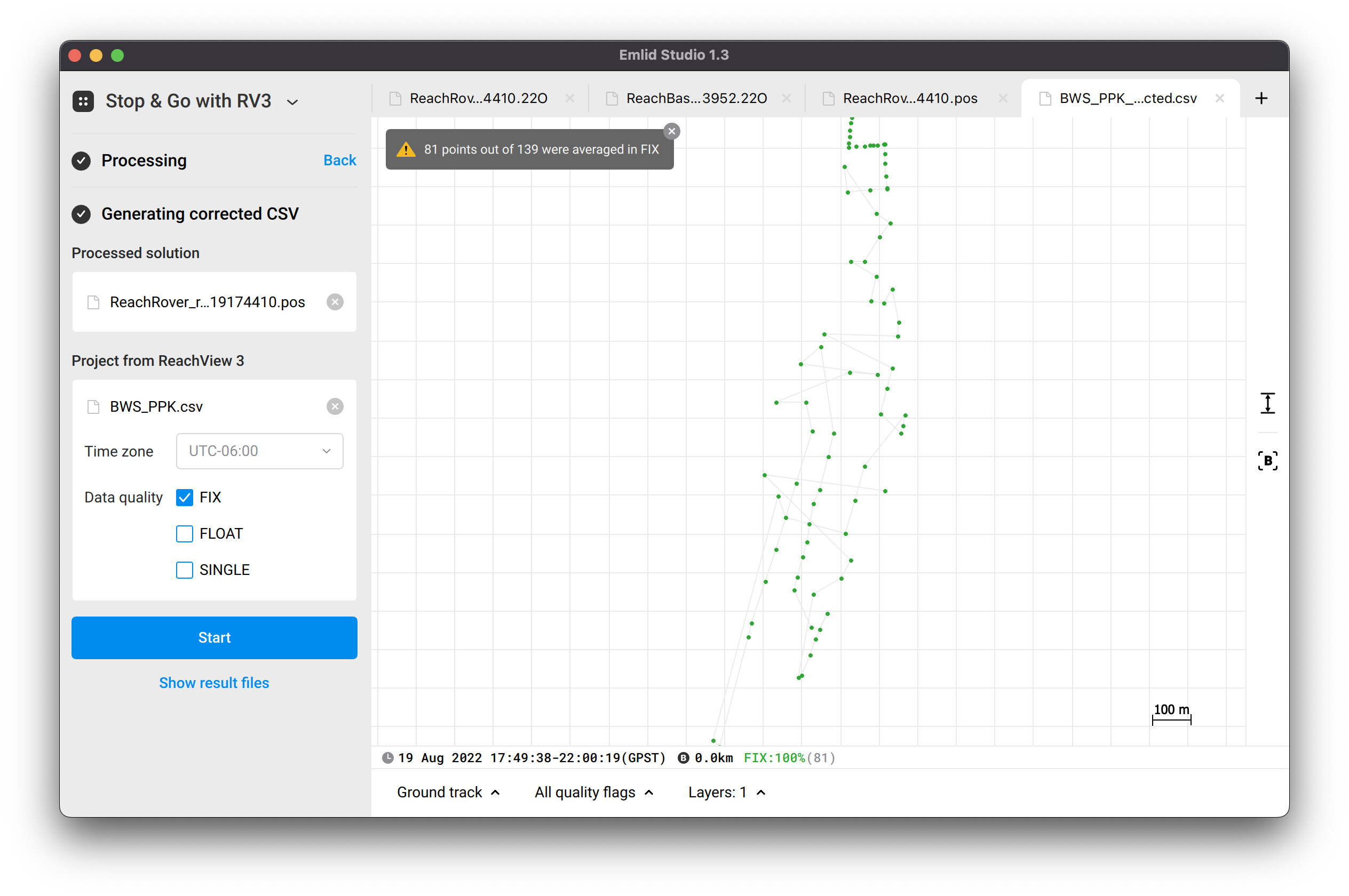
Hi @Aizen,
Indeed, I post-processed and obtained 81 points out of 139 corrected with FIX solutions.
Using the base log from CORS may help in some cases, may not. It may help if it has less obstructed sky view, mostly it is so. Otherwise, it may not help if it tracks less satellite systems, for instance, GPS and Glonass only. Meanwhile, your base log contains GPS, Glonass, and Galileo observations.
This topic was automatically closed 100 days after the last reply. New replies are no longer allowed.