


I’m a newbie when it comes to professional GNSS and my question is related to a recent one by l3technologycambodia.
I have one Reach RS and access to a free, national DGNSS correction service (http://euref-fin.fgi.fi/fgi/en/positioning-service/dgnss-service). I want to measure GCP coordinates for drone mapping. I get a connection to the service in the ReachView app, but I’m not sure which app settings to use to get it working at cm or even dm accuracy, it’s more like 1-2 meters. The manuals are generally referring to a base/rover setup with two Reaches.
Can someone please point me in the right direction?
Hi Romi
If you take a look at this picture
And info about DGNSS, and how accurat this type of correction is
http://www.novatel.com/an-introduction-to-gnss/chapter-5-resolving-errors/gnss-data-post-processing/
You see that, at best you get around 50cm accuracy and the accuracy of the correction decreases as the distance to the station increases.
Here is a picture of basic setup. You see i get a dropdown menu and are able to select mountpoints
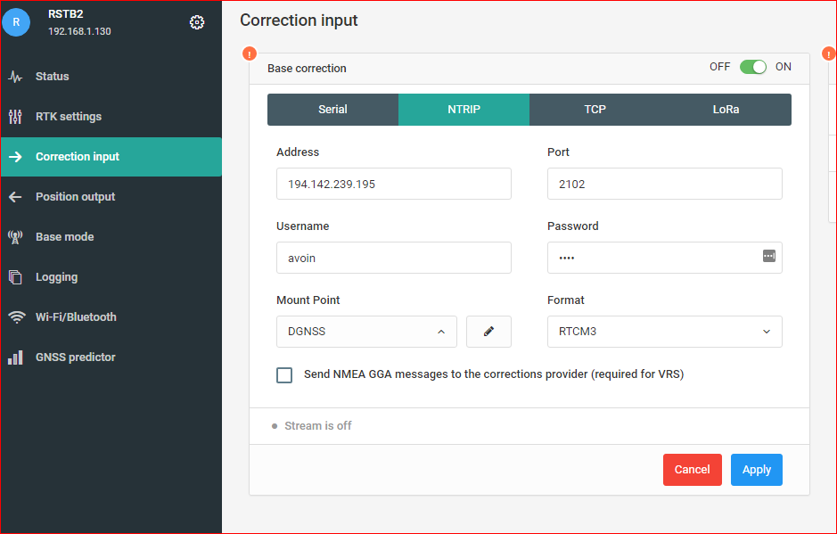
You might change the RTCM version as well.
Thanks a lot, this was exactly what I needed to know. PPP or another Reach RS and I will get <10 cm accuracy.