


Originally published at: https://emlid.com/survey-marks-for-rtk-and-ppk-data-collection/
Whether you are an experienced surveyor or just starting your first geodetic project, you probably heard of the term “survey marks”. Survey marks (also called geodetic marks or benchmarks) are certain points with known geographical coordinates. Usually, these points are marked with metal disks on the ground or concrete monuments.
Survey mark in New Hampshire, USA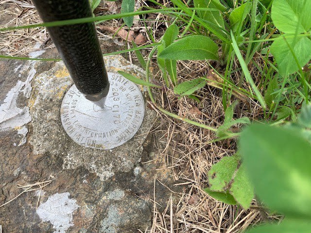
All over the world, there are networks of such survey marks. The national agencies, like the American National Geodetic Survey, keep track of these marks. When you come across one, you can see the credentials of the agency it belongs to engraved on the top or somewhere nearby.
What are Survey Marks Used for
When you use two RTK receivers to collect data, one of them should be set up as a base. For the topographic survey, it is crucial to use accurate base station coordinates to collect reliable data. Since the coordinates for the survey marks are known, you can use them for a more accurate point collection. Learn more about the differences between base modes in our video below.

Once you set up your base, configure corrections output and move on to the data collection with a rover.
How to Set Up a Base Using a Survey Mark
The national agencies keep records of the survey marks in their responsibility. They accumulate all the survey marks with the coordinates in datasheets. Keep in mind that some of this data is open and free to use, and some need a special request.
- NGS datasheet for the USA;
- Geodetic Reference Systems Tools for Canada;
- Ordnance Survey for the United Kingdom;
- Institut National de l’information géographique et forestière for France;
- And etc.
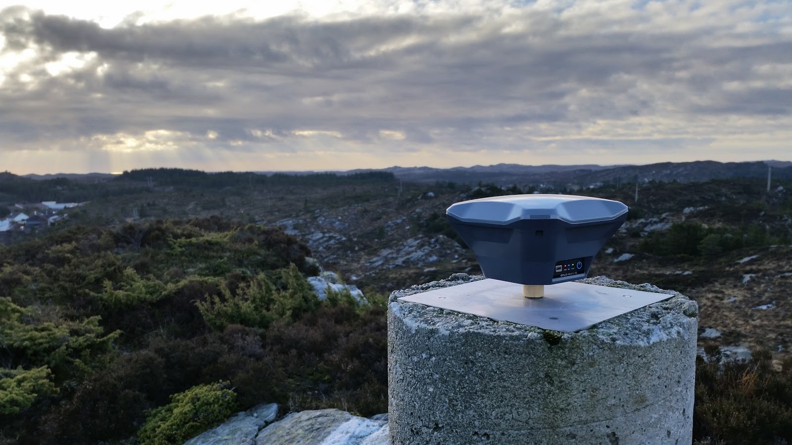
Once you get a hold on the survey mark’s coordinates, place your base over the survey monument and enter the exact coordinates in the manual mode. Remember, your base has to be accurately placed over the survey mark. Here’s a video guide on how to correctly place the RTK base over the known point – check it out for more information.
Double-checking the Coordinates with PPP
Throughout time, the coordinates of the points across the globe are changing due to the ground’s movement. Unlike the Continuously Operating Reference Stations (CORS), survey marks don’t gather the updated data from the satellites constantly. That’s why the coordinates in datasheets might not be absolutely accurate if they hadn’t been updated recently.
To get the most accurate coordinate, use the Precise Point Positioning (PPP) service in your data’s post-processing. There are numerous free online services to perform PPP. You can check the Precise Point Positioning Software Center website or look for the one that suits you more. All you need is one of the services and your RINEX log file from the base.
Always double-check your survey mark’s coordinates to make sure the data you collected is reliable and accurate. Especially if your project requires absolute accuracy.
Summing Up
Think beforehand of how accurate you need your final results to be. Survey marks work both for RTK and PPK. Using the survey marks in your data collection makes it more accurate relative to the Earth’s surface. Even if the coordinates are not absolutely accurate down to millimeters, setting the base over the known point can significantly improve the accuracy of the rover’s data.