Ground plane and interpreting .obs files with Rtkplot

Hi all,

I´m doing some tests with a Reach mounted on a fixed wing. I did 2 flights, one in the morning and another a few hours later.

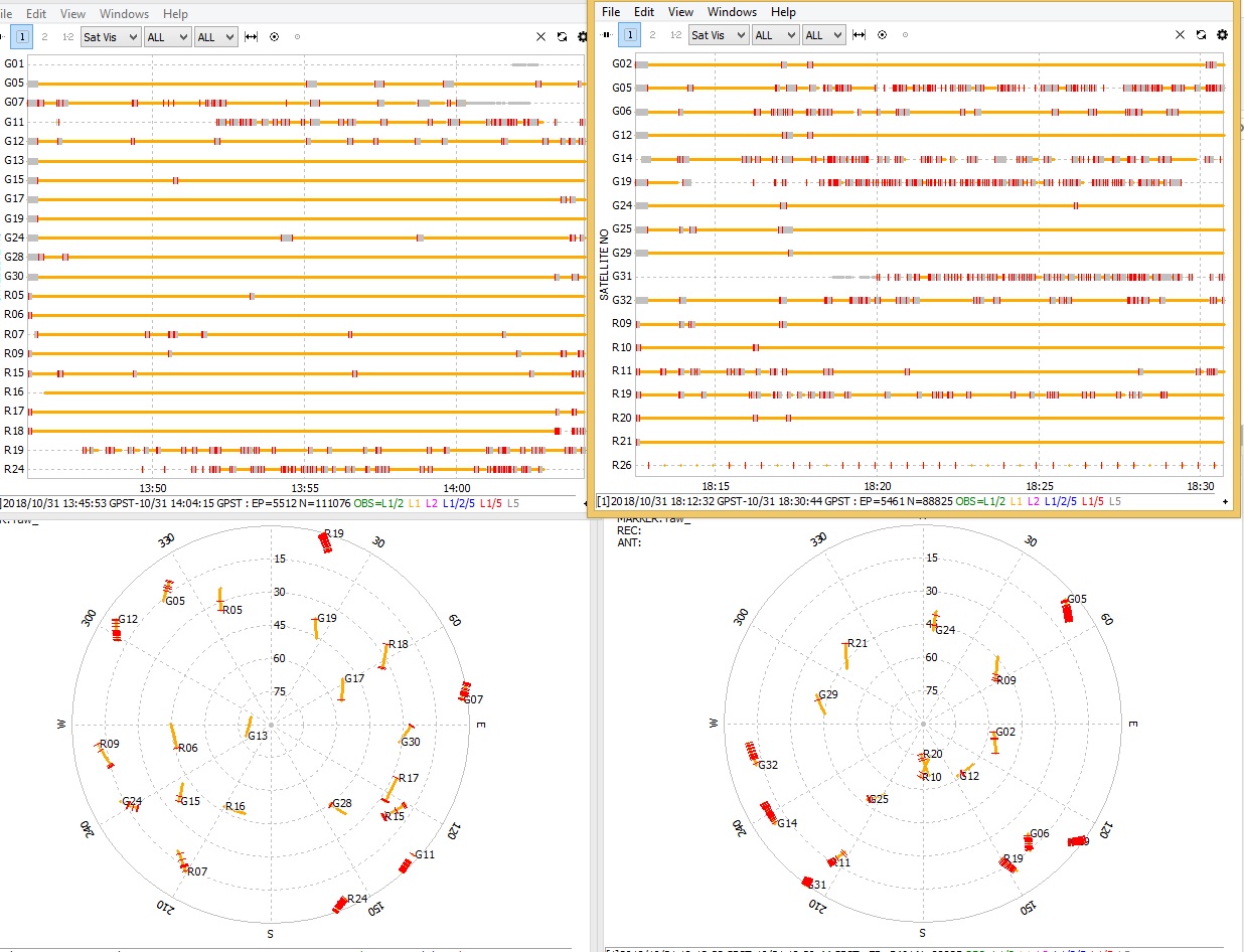
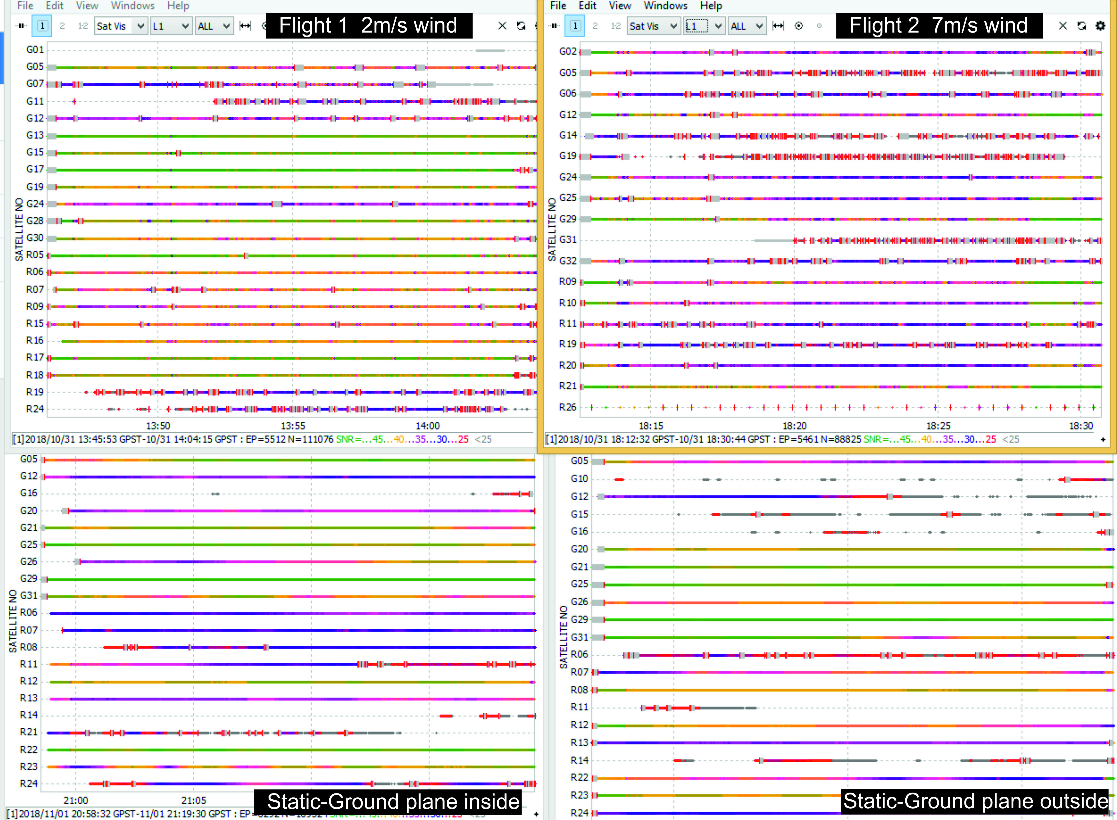
I would like some help about the obs files. I view them using Rtkplot. Are they ok? Or that “gaps” in the satellite view means that something can be improved?

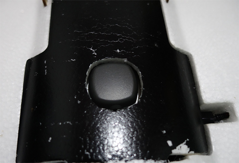
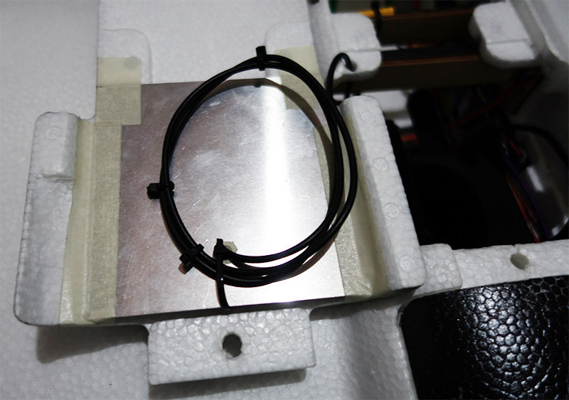
I use a 10x10 aluminium ground plane inside the plane and made a hole for the antenna.

In the next days I will have acces to a GPS to be used as a Base I would be able to Post-Process, but for now I’m trying to improve my Rover Reach.

Thanks!

Hi @Doppler_Uav,

That gaps are cycle slips. They show that the signal from a satellite was disturbed. It’s possible to reduce their quantity and improve the quality of the signal.

Let’s start with the antenna raising. In the meantime, the airframe of your plane seems to constrain the antenna satellite visibility. You should place the ground plane with an antenna above the airframe.

Thanks Tatiana.

I will perform some more tests withe the antenna above the airframe and see what happens with the signal

Hi, @tatiana.andreeva,

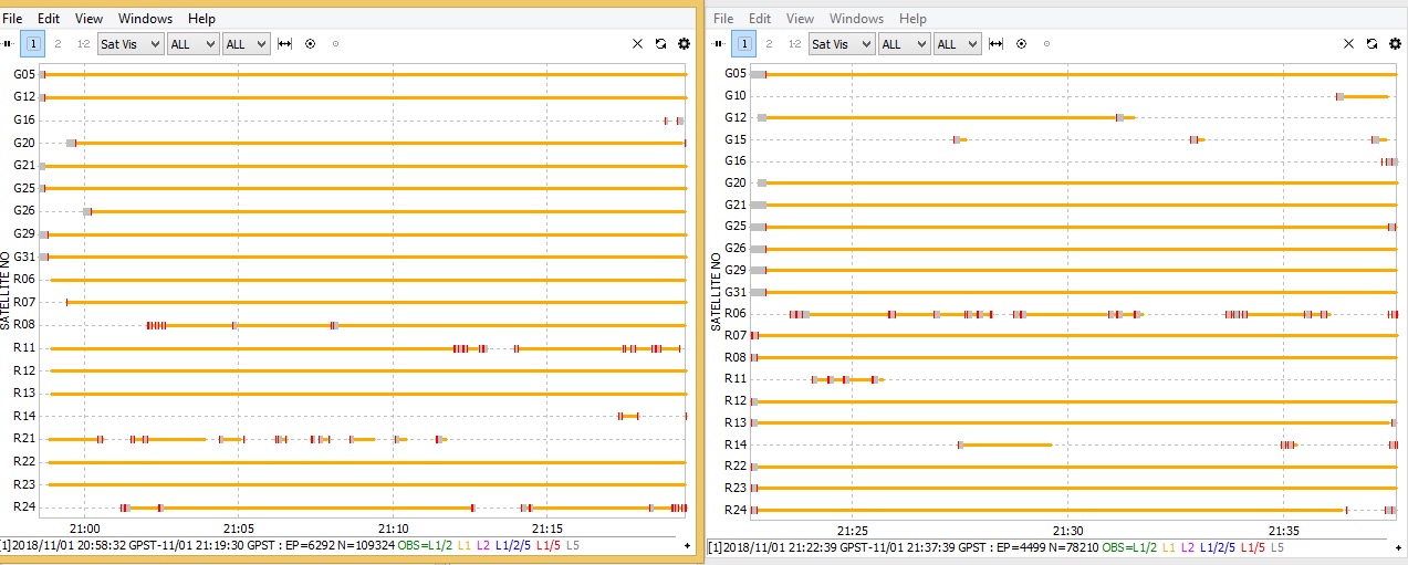
I did some tests on my house’s roof. The left log is with the ground plane inside the airplane and the right log with the ground plane outside the airplane.

Both of them looks similar and the signal is good.

Maybe that cycle slips appear when the plane is moving? In the second log of my previous post (the one with more cycle slips) I remember the wind was 7m/s and in the first one (less cycle slips) 2m/s.

What do you think about that?

Thanks!

Hi,
Hit that “all” button from dropdown menu and select L1 and post the result.

1 Like

Hi @TB_RTK,

Here are the results with L1 selected.

What do the different colours mean?

Thanks!

The colours represent different SNR values.(bottom line in RTKplot window)

Hi @Doppler_Uav,

The SNR values with the antenna placed outside look much better.

Could you please send a photo of your current hardware setup?

Hi @tatiana.andreeva,

I did some test flights with a Trimble GPS as a base and I had very good results, ground plane inside the UAV.

All camera positions fixed!

2 Likes

This topic was automatically closed 100 days after the last reply. New replies are no longer allowed.