I am a farmer and want to use the plot points to make fields and import the shape files into my crop software.
Is there conversion software that will join the plot points to make a boundary for a field.
Thanks
I am a farmer and want to use the plot points to make fields and import the shape files into my crop software.
Is there conversion software that will join the plot points to make a boundary for a field.
Thanks
You could log LLH at the rover and then convert the .llh text file to shapefile via ESRI or QGIS. The. String the point shapefile to a line using the time field as sort order.
The LLH won’t be corrected though.
I would take the corrected POS file, use RTKPost to convert to GPX, and then convert that GPX to shapefile. I think QGIS can do that conversion
Hi,
As im new to most of this where would I find the POS file is that the shape file i can currently export via the app anyway?
Thanks
Hi @sam2,
There are some possible ways to accomplish that. First, could you share which crop software you’re using? It might have some import settings that can shed some light on alternatives for this workflow.
The method you’re using to collect your data is also crucial for providing advice. If you’re logging your points with Reach, you’ll have POS or LLH files available to work with. If you’ve created an Emlid project and are manually collecting your points, you can export them to CSV or Shapefile for later import into third-party software.
I’ll assume you’re logging your data since that’s common in farming applications.
You can download your logs from Reach in the logging menu of your Emlid Flow app. This is also where you can set your preferences. If you need help, check this guide.
Once you have your points file (either from logging or Emlid project export), you can import it into GIS software like QGIS or ArcGIS. The further steps on how to do that will vary, but I can assist you with that once I know more about your current workflow.
I’d like to mention that creating polygons from points is a straightforward process in GIS software, but there’s a caveat. The way points are connected is crucial. For example, four points can be connected to form a square but also as the letter Z. So the order in which connections are made matters. Additionally, having information on the relationship between points may be necessary for good results.
Let me know a bit more about your workflow. Also, if that’s a recurrent task or something you’ll be needing one time.
Hi Jorge,
The is the platform link: www.cropwise.com Its widely used across the world.
If its possible to find a way of getting the correct format for the files it would be used a lot as in some countries there are payments offered for looking after habitats and these area need to be accuratly mapped.
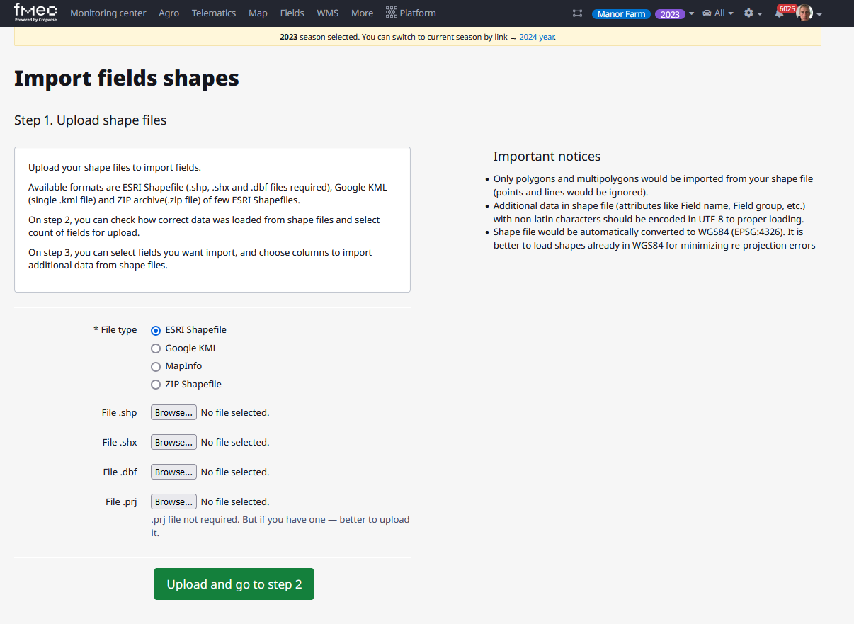
I attach a screen shot of what files are accepted on the platform currently:
Thanks
Hi @sam2 ,
Thank you for your feedback on this. I noticed from the image you shared that you can also import Google KML into the platform. Have you considered using Google Earth to create the polygons for the fields?
Software like QGIS can provide a more automated solution. Let me know if you’d like me to guide you through the process with it. First, let’s ensure you are familiar with importing the logs from your Reach. Have you managed to obtain the POS or LLH file from your receiver?
Hi @jorge.antunes,
I would be happy to use kml files and google earth I just wanted to be able to bring in the RTK accuracy of the points plotted from my RS3. If you could give me some guidance to making the process easy that would be great. I have plotted a small area on my app so if you can let me know which file type to export from the app to get started that would be a good first step.
Thanks
I would definitely steer clear of Google Earth, it’s generally rubbery and inaccurate and made worse by it’s underlying warped Web Mercator projection intentionally distorted from an ellipsoid to a sphere for social gratification purposes.
If you trialed a survey plan in EMLID Flow 360 you could export a shape file from your PC. And it could be in lines, so much easier for someone to help you simply close them to polygons without having to play join the dots.
Closed lines (polygons) is still on the Emlid to-do list, put in your vote to help it along.