GPS Example - Python vs C++

Hello

I have run the c++ and python GPS examples. The python example gives different output to the C++ example.

Python Longitude = 428
C++ Longitude = -1.2

I believe the c++ example to be correct though I do not fully understand the code. Can anybody explain the differences?

Thanks

Where do you have your antenna? If it’s inside the building then probably there’s no proper coordinates at all and these numbers are just some rounded random.

Thanks for your response.

I have just tested with the antenna outside. I get the same values as before. All other values but the longitude are the same in python and c++. The C++ values match what I expect to see. I’d appreciate any help you can offer.

Changing position of the antenna makes no difference to the readings. Do any modules/libraries need to be updated? Is any initialization required before running the python example?

Thanks for any help offered.

Could you please post a couple of screenshots (one for Python, another for C++) with the antenna outside?

Here are the screenshots.

C++

python

Hello dezzed!

The C++ example shows gpsFixOk flag to be false. If it is false, then the info shown is not reliable. Maybe the antenna is not connected reliably?
You can also check what is going on with Ublox’s u-center. To do that, you can transfer your ublox stream to a tcp port with a utility from Navio repository and connect to that port with u-center. Please, let us know if anything worked out.

Would the vertical and horizontal accuracy estimates also reflect (or extend) the gpsFixOk flag? Could you add those to the C++ library (I mean emlid on github), I’m using decodeSingleMessage directly in my code (tho the quad isnt using gps for anything atm). Something like

20 U4 - hAcc mm Horizontal Accuracy Estimate
24 U4 - vAcc mm Vertical Accuracy Estimate

// Horizontal Accuracy Estimate
data.push_back ((*(message+pos+6+23) << 24) | (*(message+pos+6+22) << 16) | (*(message+pos+6+21) << 8) | (*(message+pos+6+20)));
// Vertical Accuracy Estimate
data.push_back ((*(message+pos+6+27) << 24) | (*(message+pos+6+26) << 16) | (*(message+pos+6+25) << 8) | (*(message+pos+6+24)));

at line 206 in ublox.cpp

Edit: those accuracies on python are pretty bad, all gps systems I’ve seen before can show you the number of satelites that are being received from too. sometimes it takes a while to pick them up. I did a little analysis on Navio gps a while back, and it took 10 mins or more to pick up all the satelites, this is normal when the initial state isnt preloaded. The ublox chip has a capability of backing up its state to an external flash for reinitialisation. But the example programs dont use it (I’ve not tried to use it either, so I’m not sure if it can backup over SPI)

Just as an FYI the python version has print "Height above Ellipsoid: " + str(aaa[3]/1000)
The C++ library suggests in the comments // printf(“Height: %lf\n”, position_data[3]/100); but the example does use /1000
the pdf says its in mm, which suggests the /1000 is correct.

Also is anyone able to comment on if this code looks correct, I’ll test it over the weekend. (worst case scenario is the thread dies keeping the spi locked, this will lock up the whole program and result in the quad continuing with its current pwm state not a good one, but will test it unarmed)

void *agpsthread(void *args)
{
    std::string gps_spi_device_name = "/dev/spidev0.0";
    unsigned char to_gps_data = 0x00, from_gps_data = 0x00;
    unsigned char *todata = new unsigned char[1024],*fromdata = new unsigned char[1024];
    memset(todata, 0x00, 1024);
    memset(fromdata, 0x00, 1024);
    int idlecount = 0;
    while(!quiting)
    {
        pthread_mutex_lock(&spimutex);
        SPIdev::transfer(gps_spi_device_name.c_str(), &to_gps_data, &from_gps_data, 1, 5000000);
        if (from_gps_data==0xff)
            idlecount++;
        else
            idlecount = 0;
        if (from_gps_data==0xb5) // All UBX messages start with 2 sync chars: 0xb5 and 0x62
        {
            SPIdev::transfer(gps_spi_device_name.c_str(), &to_gps_data, &from_gps_data, 1, 5000000);
            if (from_gps_data==0x62)
            {
                // message, read the message type first
                SPIdev::transfer(gps_spi_device_name.c_str(), todata, fromdata, 2, 5000000);
                if ((fromdata[0]==0x01) && (fromdata[1]==0x02)) // nav_posllh is 0x01 0x02
                {
                    SPIdev::transfer(gps_spi_device_name.c_str(), todata, fromdata, 2, 5000000);// read length
                    int len = fromdata[0]+(fromdata[1] << 8);
                    if (len<1022)
                    {
                        SPIdev::transfer(gps_spi_device_name.c_str(), todata, fromdata, len+2, 5000000);// read length
                    
                        //0 U4 - iTOW ms GPS Millisecond Time of Week
                        //4 I4 1e-7 lon deg Longitude
                        //8 I4 1e-7 lat deg Latitude
                        //12 I4 - height mm Height above Ellipsoid
                        //16 I4 - hMSL mm Height above mean sea level
                        //20 U4 - hAcc mm Horizontal Accuracy Estimate
                        //24 U4 - vAcc mm Vertical Accuracy Estimate
                    
                        //iTOW
                        unsigned int tiTOW = ((fromdata[3] << 24) | (fromdata[2] << 16) | (fromdata[1] << 8) | (fromdata[0]))/1000;
                        //Longitude
                        double tlongitude = ((fromdata[7] << 24) | (fromdata[6] << 16) | (fromdata[5] << 8) | (fromdata[4]))/10000000;
                        //Latitude
                        double tlatitude = ((fromdata[11] << 24) | (fromdata[10] << 16) | (fromdata[9] << 8) | (fromdata[8]))/10000000;
                        //Height
                        double theight = ((fromdata[15] << 24) | (fromdata[14] << 16) | (fromdata[13] << 8) | (fromdata[12]))/(10*100);
                        // Horizontal Accuracy Estimate
                        double thacc = ((fromdata[23] << 24) | (fromdata[22] << 16) | (fromdata[21] << 8) | (fromdata[20]))/(10*100);
                        // Vertical Accuracy Estimate
                        double tvacc = ((fromdata[27] << 24) | (fromdata[26] << 16) | (fromdata[25] << 8) | (fromdata[24]))/(10*100);

                        pthread_mutex_lock(&gpsmutex);
                        latitude = tlatitude;
                        longitude = tlongitude;
                        iTOW = tiTOW;
                        gpsheight = theight;
            
                        //hAcc = thacc;
                        //vAcc = tvacc;
                        pthread_mutex_unlock(&gpsmutex);
                    }
                }
                else
                {// unhandled message for now
                    SPIdev::transfer(gps_spi_device_name.c_str(), todata, fromdata, 2, 5000000);// read length
                    int len = fromdata[0]+(fromdata[1] << 8);
                    if (len<1022)
                    {
                        SPIdev::transfer(gps_spi_device_name.c_str(), todata, fromdata, len+2, 5000000);// +2 so we read the checksum
                    }
                }
            }
        }
        pthread_mutex_unlock(&spimutex);
        if (idlecount>50)
            usleep(10000);
    }
}

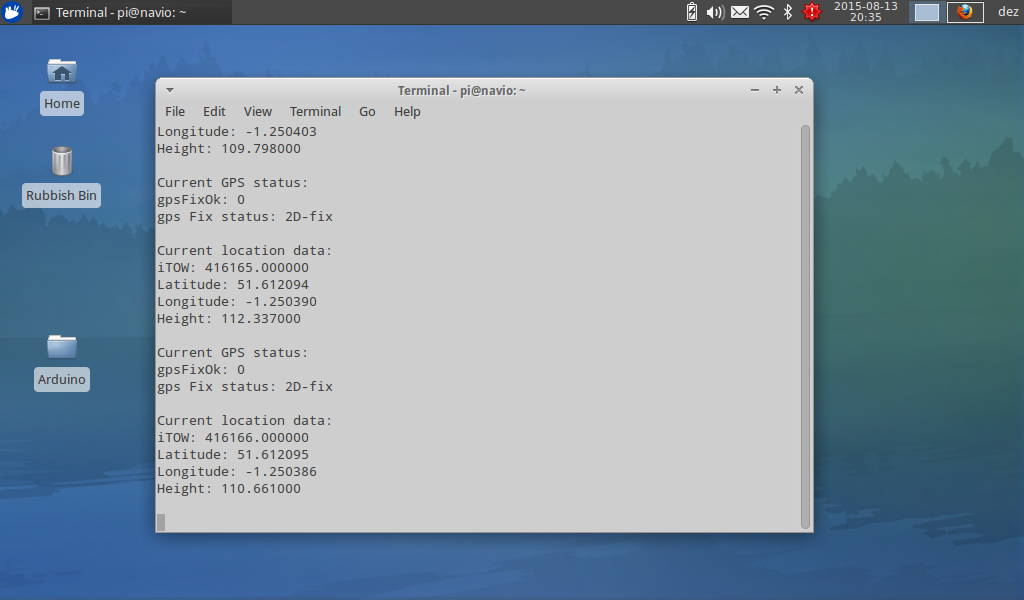
Edit: Looks like that works fine, couple of small code changes, making sure the spi buffer is idle before the usleep and setting the spi speed to 5000000. had an issue with the antenna connection not sitting correctly on the connector, added a bit of tape to hold the cable down.

A post was split to a new topic: Navio2 GPS activation