Hi, I’m getting started with my new Reach RS+. I would like to have it feed live positions into a Linux laptop running QGIS 3.10. I know there is a tutorial video about connecting RS+ to QGIS, but it is out of date and the GPS Tools plugin on QGIS has changed out of all recognition with that in the video.
GPS Tools in QGIS makes use of GPSBabel to translate GPS data from an input source and to output it to QGIS. However, there are a whole load of variables to setup to get it to work.
Has anyone got this to work? If so, any help would be gratefully received.
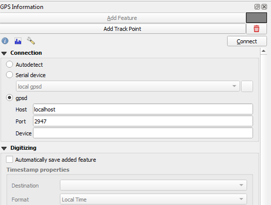
You should be able to follow the old tutorial once you can see the screen from my first screenshot.
To enable it, go to View/Panels/(not toolbar)and select “GPS Information”
Let me know if you have any other questions.