


Hi Eric,
It seems to be pretty apparent because the base is located on the ground while the drone flies.
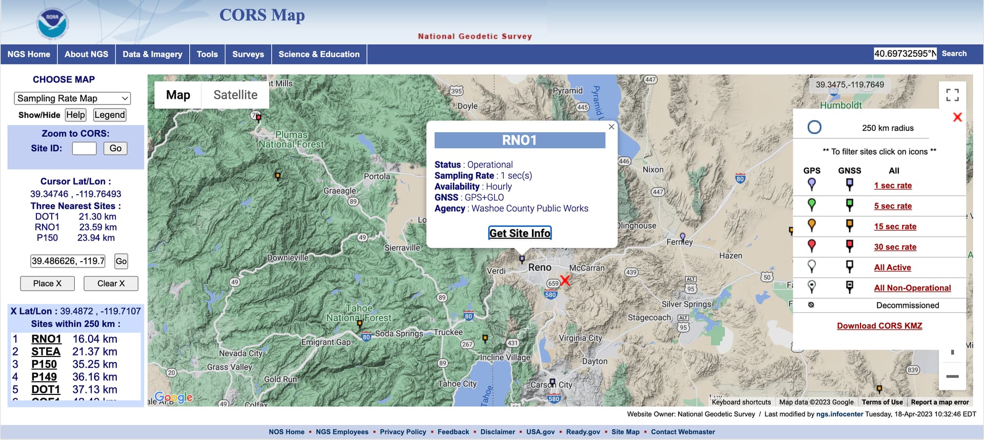
I’ve decided to check the Z-accuracy of the base log and downloaded the log from the nearest CORS station located in Reno. The red cross shows the base position:
I’ve used the Static processing in Emlid Studio with the All solutions setting. This allows you to get the ground track of the base.
The resulting position log is shown below:
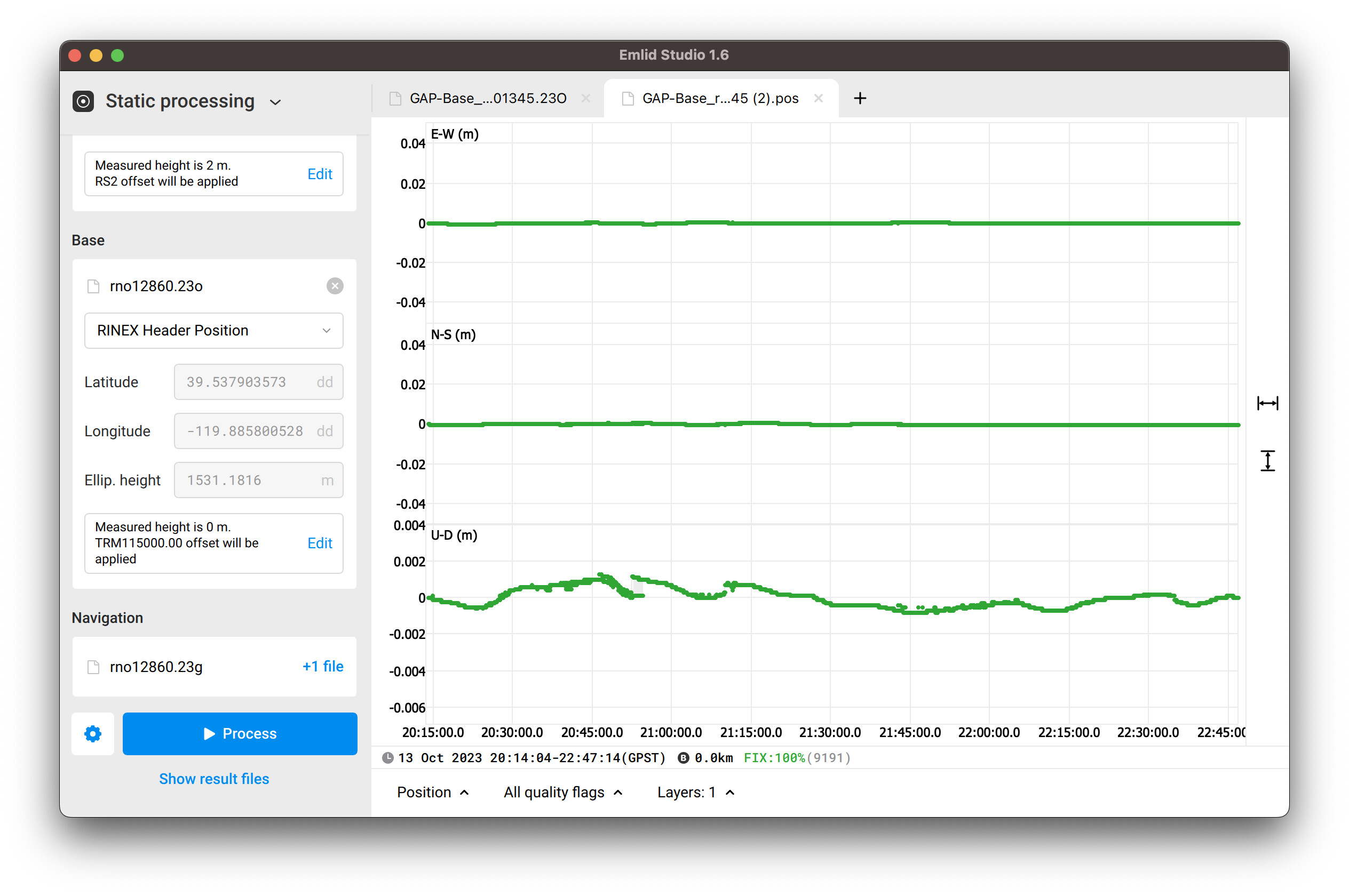
The U-D (m) represents the changing of the elevation of the processed log. As you can see, the elevation fluctuates in the range that doesn’t exceed 2 mm.
So I’m not sure what they meant about the discrepancy in the Z value.
I don’t think this is the root cause at all. The error shown in the screenshot made me think that there was something related to the CSV file. It’s probably just not the real cause.