


The request about the introduction Geotag RTK / RTN images. I would propose this to introduce on the basis logs NMEA. You should introduce this is and custom Emlid NMEA message from time stamps.
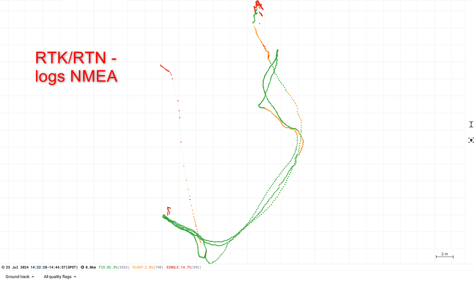
He executes measurements photogrammetric from the ground (not from drone). The method RTK/RTN gives the solution „FIX”. However the method PPK does not give the solution „FIX”.

Hi Pawel,
I see that using the positions from the NMEA log for post-processing would be helpful. I’ve noted your request.
RTK and PPK are two different processes, so they may provide different results. Speaking of PPK, it can also provide FIX solutions. If the results aren’t good, it’s worth playing with the post-processing settings in Emlid Studio by, for example, modifying the elevation mask or excluding some satellites, as they may improve the final solution.
Can you please also share your dataset with me? I’d check what may cause this result of only FLOAT solutions. You can also email it to support@emlid.com as it may contain sensitive information.
2 Likes
Hi, Kornel
For the good ustawień of the option PPK can occupy a lot of time. If I have good given RTK/RTN can them use.
Hi Pawel,
Thank you for sharing your data!
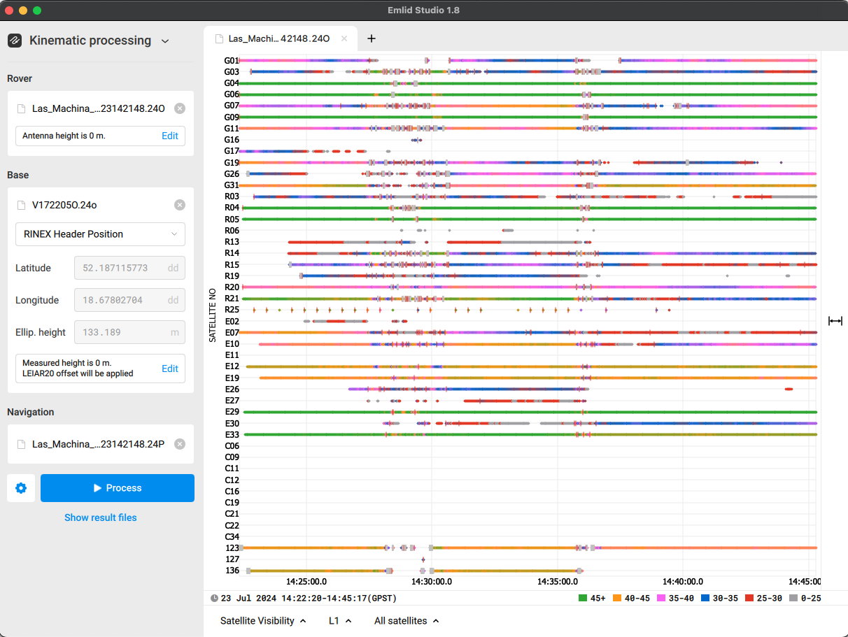
PPK can provide a FIX solution, even with the default settings, for good-quality raw data logs. I’ve checked your data and noticed that the rover’s logs contain some cycle slips and several satellites have lower SNR values. These may result in having not only FIX solutions after the post-processing.
I’ve also registered your request about using the NMEA log for PPK processes.
2 Likes
Hi, Kornel
I will remind that he executes measurements photogrammetric from the ground (not from drone). Often near obstacles such as the building. That is why my satellite observations, there will often the weak quality.
In the method the measurement RTK/RTN I can see in the real time if I have the solution FIX. That is why my proposal of utilization of journals NMEA would solve my problem.
THX
1 Like
Hi Pawel,
I see. Thank you for the details! I’ve noted them.
I will temporarily try to write such a program myself. However, I need confirmation that the time recorded in the RINEX file is provided in GPS time, while the time in the NMEA file is provided in UTC.
I also wanted to ask whether Emlid Studio, when geotagging using the PPK method, applies coordinate interpolation, considering that the recording frequency can be up to 10 Hz.
I believe such interpolation must be applied, as in my case, the recording of satellite observations will be performed while the GNSS receiver is in motion.
Hi Pawel,
Yes, you’re right. The RINEX files contain GPS times, while the NMEA message is streamed in UTC.
Yes. This interpolation is of the solutions from the timemarks based on the results in the POS file.
Hi Kornel,
Thank you for your response. Could you confirm that the difference between GPS time and UTC time is exactly 18 seconds?
Time(GPS) = Time(UTC) + 18 seconds.
This might be of use for you…
Hi Pawel,
You’re right. There is indeed an 18-second difference between GPST and UTC.
Hi Kornel,
Thank you for your response. However, for my solution, I need additional information. I need to know whether the PPS-3 pin on the C1 connector of the Reach M2 has 3.3 V, as described in the documentation Specification | RTK Modules , or 5 V, as indicated in this post
[Reach M2 - Output RS232 and 1 PPS - #11 by cmura]
Hi Pawel,
The maximum voltage on the PPS pin is 3.3 V, as marked in the documentation you linked.
1 Like
This topic was automatically closed 100 days after the last reply. New replies are no longer allowed.