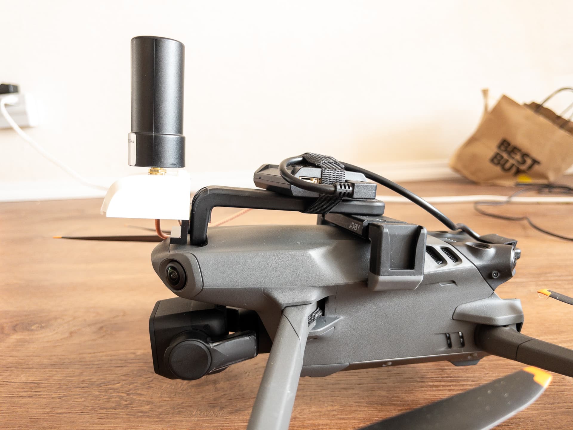
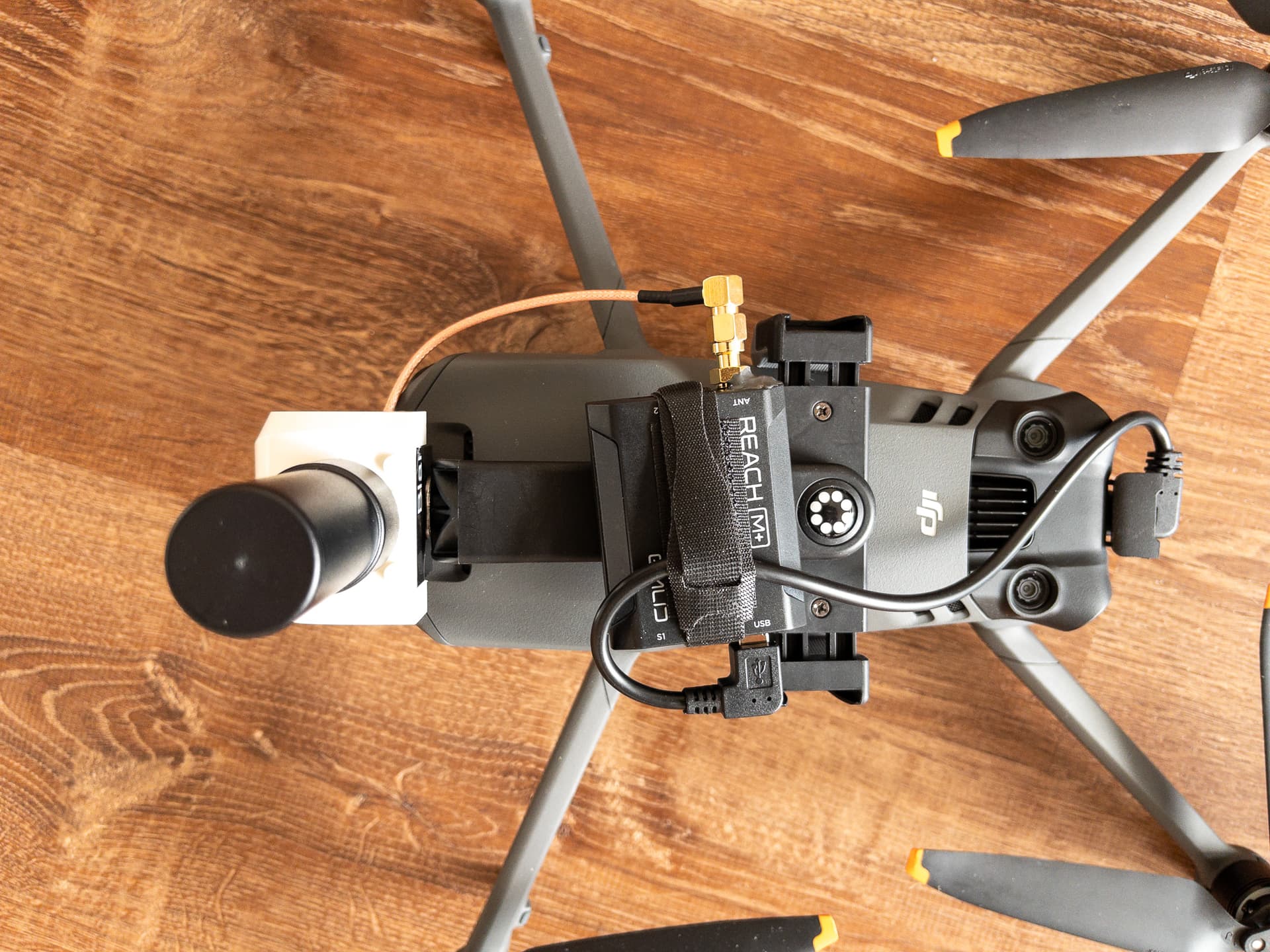
Hello folks, this is my experiment. I mounted an Emlid M+ and antenna to my Mavic 3 Classic and am powering it with the USB-C on the drone. Yes it does work, the M+ collects a 5hz log which I then correct using a CORS base station and an Emlid RS+ mounted on my car!
The drone has no method to trigger the M+ to log photo locations, so I can only geotag photos after the fact. It’s not perfect because EXIF timestamps are only precise to 1 second, but stopping for each photo helps. I process the logs with Emlid Studio and then generate GPX files with RTKpost.
But the first problem I have is RTKPost generates glitchy GPX files with some invalid timestamps.
Lightroom doesn’t read the GPX files correctly and thinks the year is 1601. I’m not sure if this is because of RTKPost or an internal Lightroom bug that others have reported.
GeoSetter reads the GPX and can display it, but fails to geotag with an arcane error message.
Has anyone used an Emlid GPS to collect a tracklog and tag photos after the fact? What method did you use?