


Originally published at: https://emlid.com/georeference-gcps-get-repeatable-contour-lines/
As many mapping companies operating DJI drones for surveying, Colombian KiteMap uses ground control points to accurately georeference aerial images. The company uses Emlid Reach RS to set GCPs accurately and in a cost-effective way.
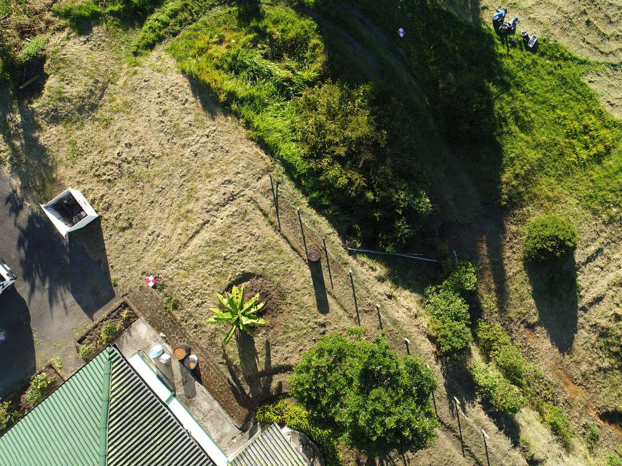
Test site with ground control points
To verify the accuracy of orthophotos and DEM obtained with GCPs, KiteMap team conducted a test on one of their sites. The goal was to demonstrate the necessity of ground control points by comparing contour lines (lines with the same height) extracted from models at several flight altitudes (30m, 40m, 60m and 90m) and obtained with and without ground control.
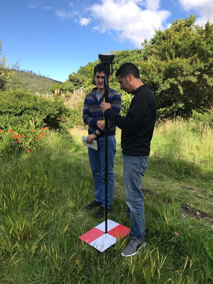
Setting ground control points at the test site
Workflow to create contour lines of the site:
- Distribute the GCPs around the site of interest.
- Survey GCPs coordinates with Reach RS.
- Fly the mission with DJI Phantom 4 Pro to acquire aerial imagery.
- Process the data (GCPs and images with geotags) using image georeferencing software.
- Process orthophoto and DEM.
- Extract contour lines from the model (in places with dense vegetation it is also necessary to apply some filters).
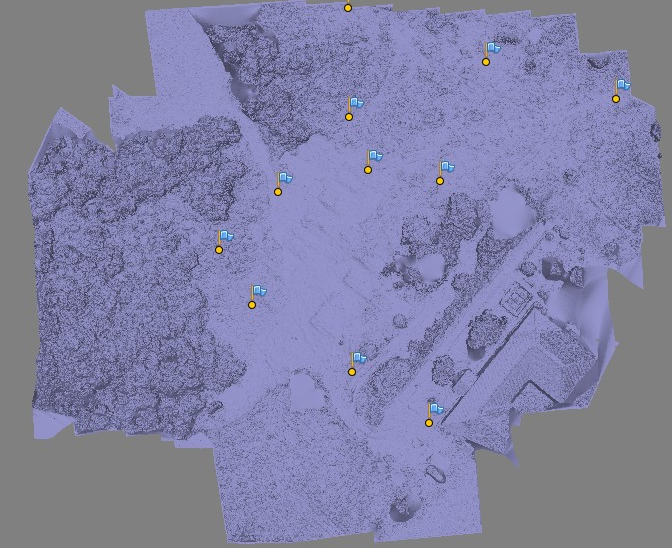
GCPs in the DEM
The most important outcome of the test is clearly seen in the images below. In the left image, the contour lines are extracted from the models with GCPs. We can see that all the lines are almost identical and have the same shape.
The right image represents the contour lines extracted from the models processed without GCPs. Unlike the left image, this one shows that the contour lines diverge and in some places don’t match at all. This example once again shows that setting ground control points is an essential part of mapping workflow.
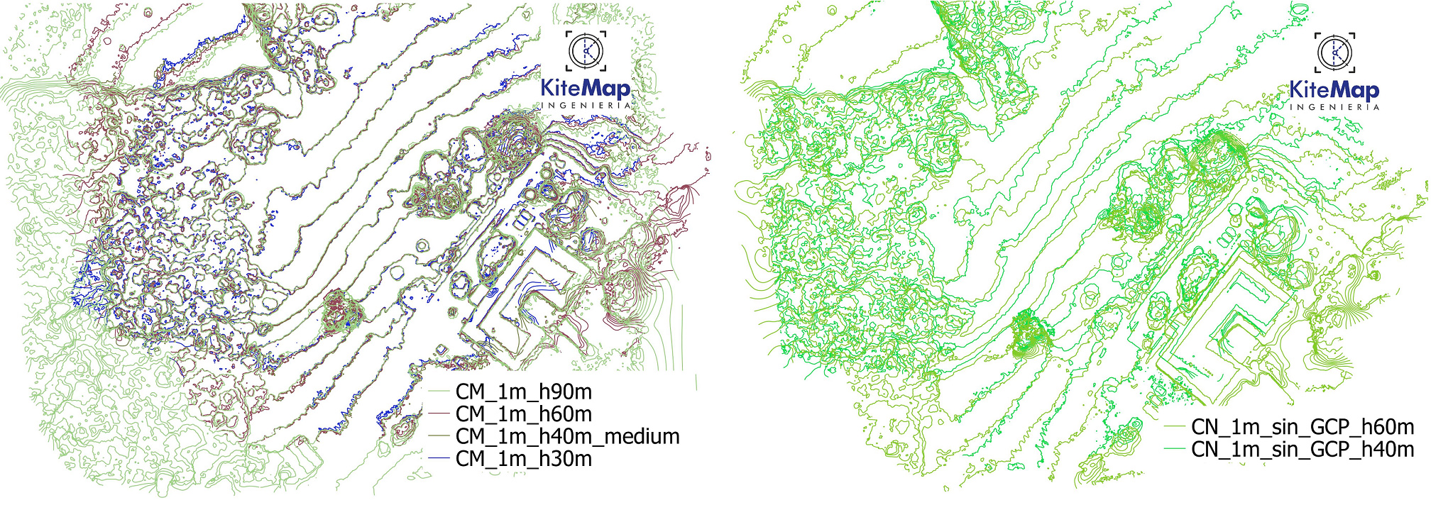
GCPs/ No GCPs
With a set of Reach RS communicating via built-in LoRa radio you can set as many GCPs in RTK mode as it is required. The process is quick and does not require the Internet connection. Control points locations are recorded with ReachView app available for iOS and Android. After the fieldwork is done you can export data to your preferred mapping software in CSV, GeoJSON, DXF or ShapeFile formats.
About KiteMap
KiteMap Ingenieria is based in Bogota, Colombia and run by Juan Felipe Chaves. The company contributes to the development of Colombian drone services market and specializes in civil engineering applications such as excavation and slope monitoring. Visit KiteMap’s Facebook page for more information.
All images used in this post are courtesy of KiteMap.