


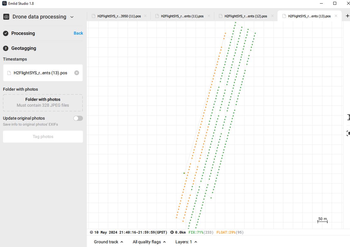
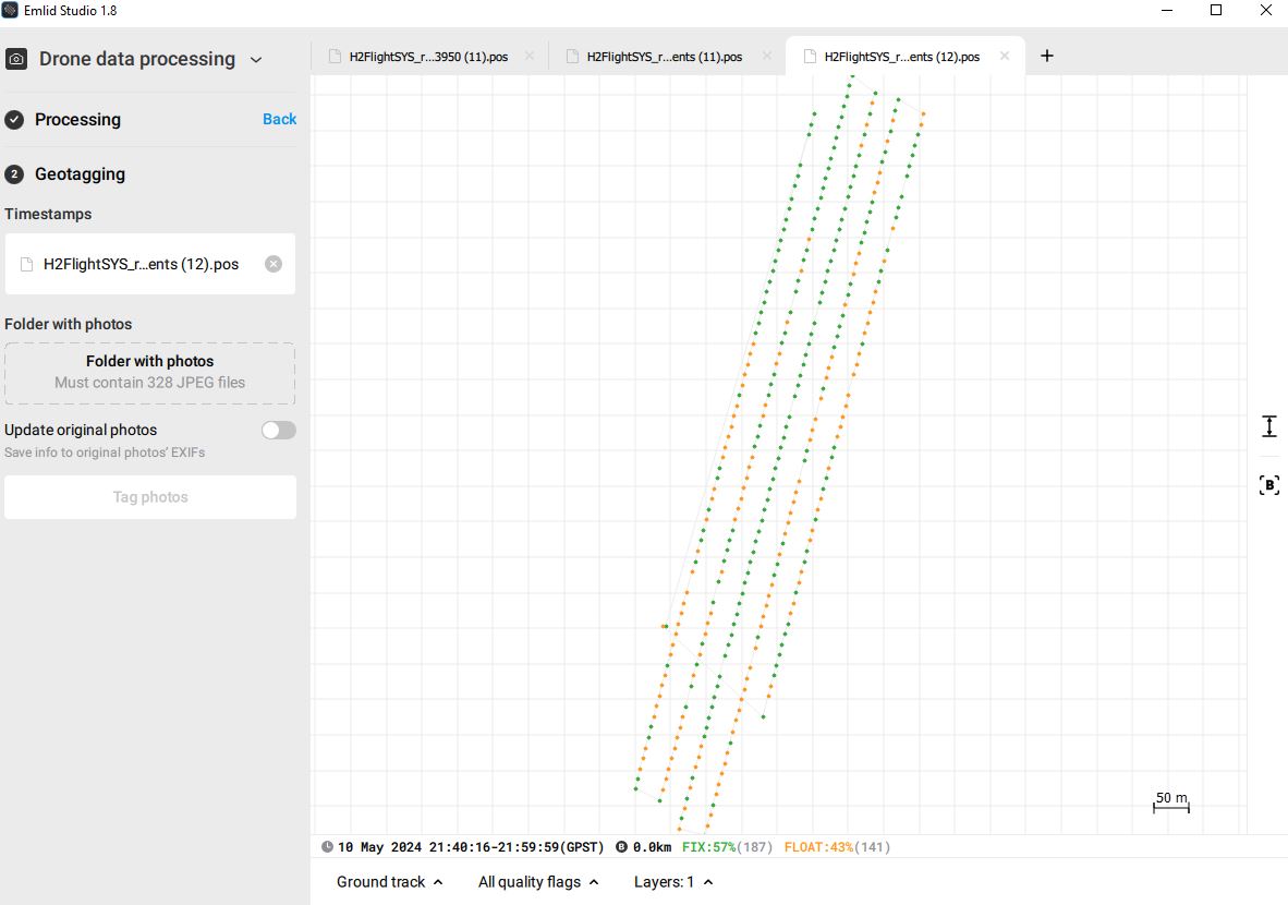
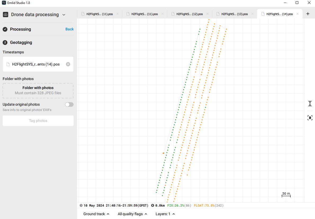
Thousands of processed flights and never a problem. If I get the odd float point, a tweak to the elevation mask and or a combination of forward and reverse processing always gets a fix solution for the flight. Now I’ve got 6 of 13 flights a total mess. Float points in different positions depending if I’m processing forwards, reverse or combined as well as missing time stamps. All the other flights are perfect as usual. Any ideas to what’s going on?
It’s possible the current Solar activity has affected the results. I haven’t dealt with it myself yet, but I am sure someone else on here might be able to explain more about how much it affects observations.
Joel
1 Like
Hello SRBell,
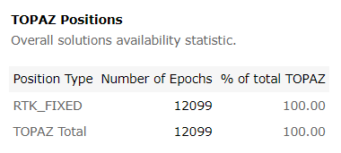
100% FIX using TOPAZ PPK w/o need to play with settings. Just convert UBLOX UBX files to RINEX using RTools and do TOPAZ PPK.
GGA_topaz_1165.log (1000.5 KB)
CSV_topaz_1165.log (1.9 MB)


4 Likes
Wow, thanks for taking the time to process that. I used the Rinex tools and converted the UBX to rinex. Processed the ppk and got a fixed solution. But I have no idea how to mark the images with this lol! There’s not a lot of information I can find on Topaz other than that I used it years ago for resizing commercial photography.
2 Likes
TOPAZ just does GNSS data postprocessing. Output is baseline components dX,dY,dZ or/and absolute rover positions as Base coordinates + BaseLine components.
What do mean under ‘mark images’?
1 Like
Hi @SRBell,
I checked the files you shared and couldn’t get 100% with the data. Inspecting the logs, it looks like the base and the rover suffered from cycle slips and fluctuating SNR values.
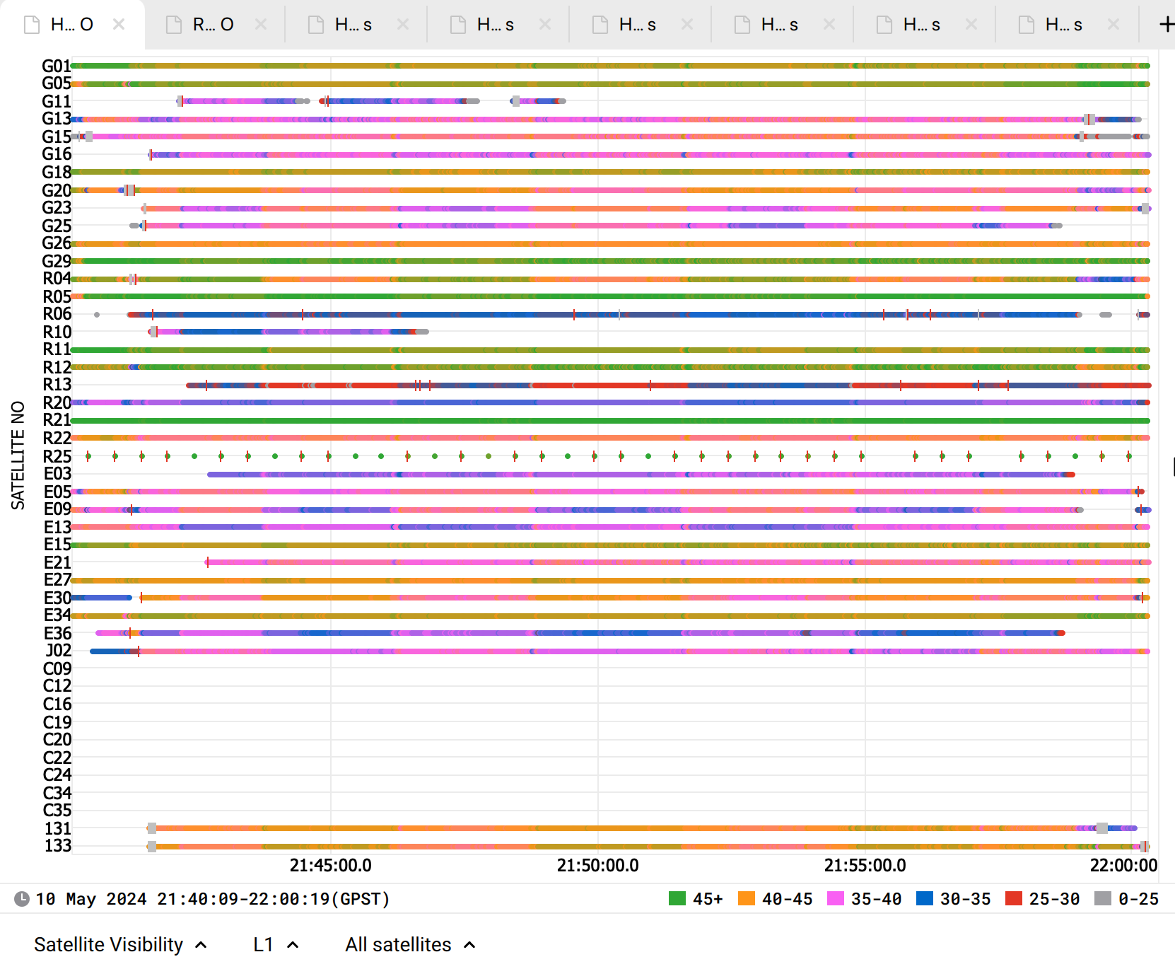
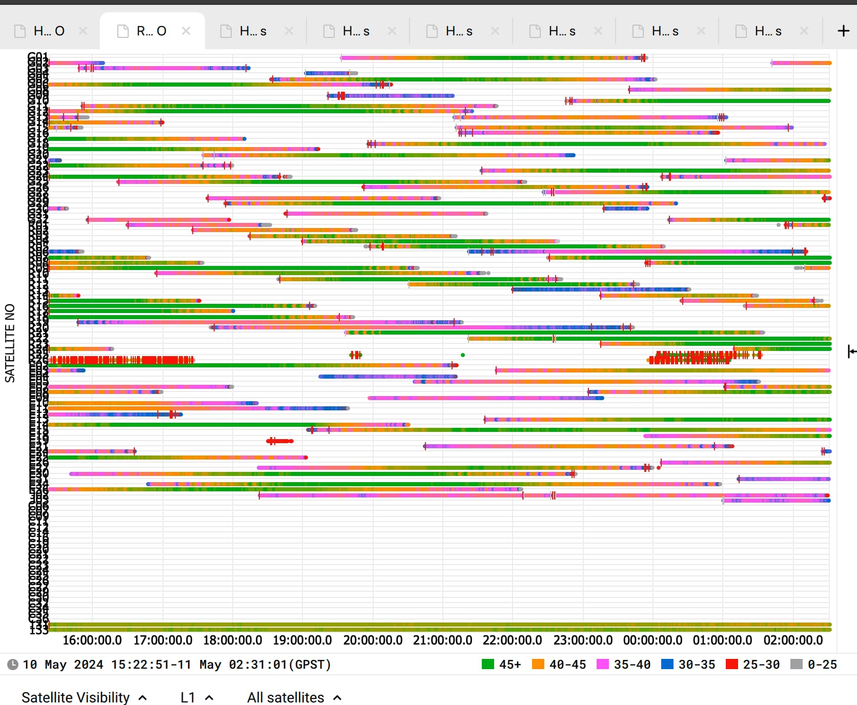
This is the SNR-multipath plot of the Reach base. The base suffered from multipath and many observations with low SNR, which could explain why achieving a FIX solution is difficult.

I can hardly say why you achieved 100% FIX with TOPAZ, but it’s highly likely due to a difference in the algorithm and filters in the app.
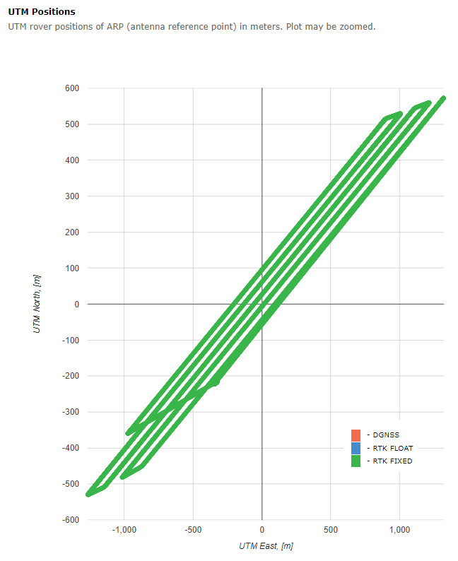
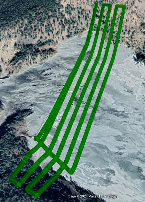
I believe the results from TOPAZ are the drone’s trajectory, and the timestamps weren’t interpolated. I am not familiar with TOPAZ nor have access to the software, so I’m afraid I won’t be able to help you with the geotagging process.
This topic was automatically closed 100 days after the last reply. New replies are no longer allowed.