Hi Forum community. I’m looking at selling some equipment that is used very min. since purchase. I would like to sell as a bulk package and will wait about a week to see if I can. After that any individual interest I will come back to the forum and respond in order of dated interest. Was looking at getting into the UAS mapping market, but it did not pan out. My lose your gain. Here are the survey items I have for sale. I’m located in Pensacola, Florida (USA). I would prefer to sell here state side, but I could ship internationally. All shipping will be included in final item cost.
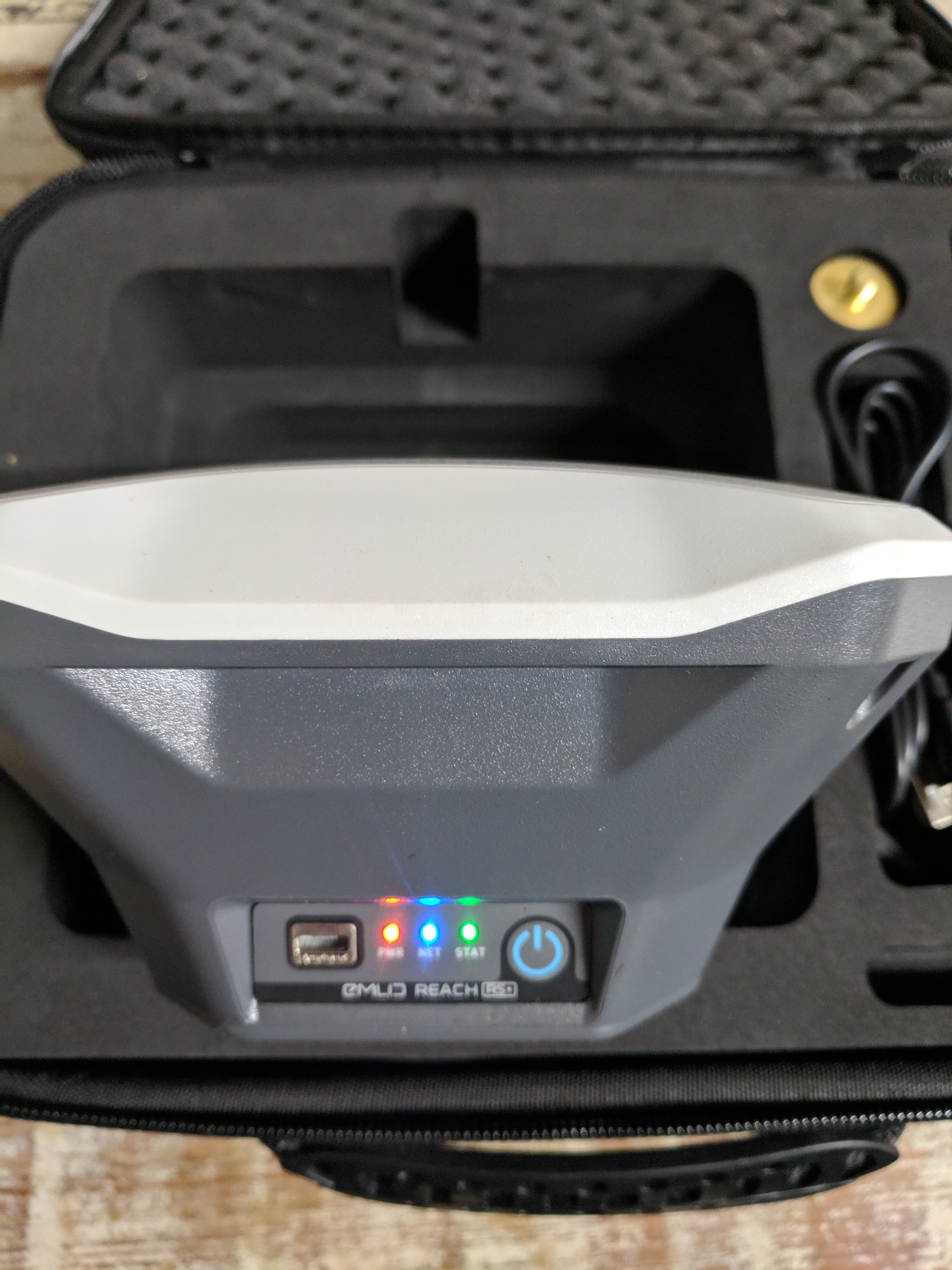
-Emlid RS+ (only used to connect to our local NTRIP internet provider in my yard)
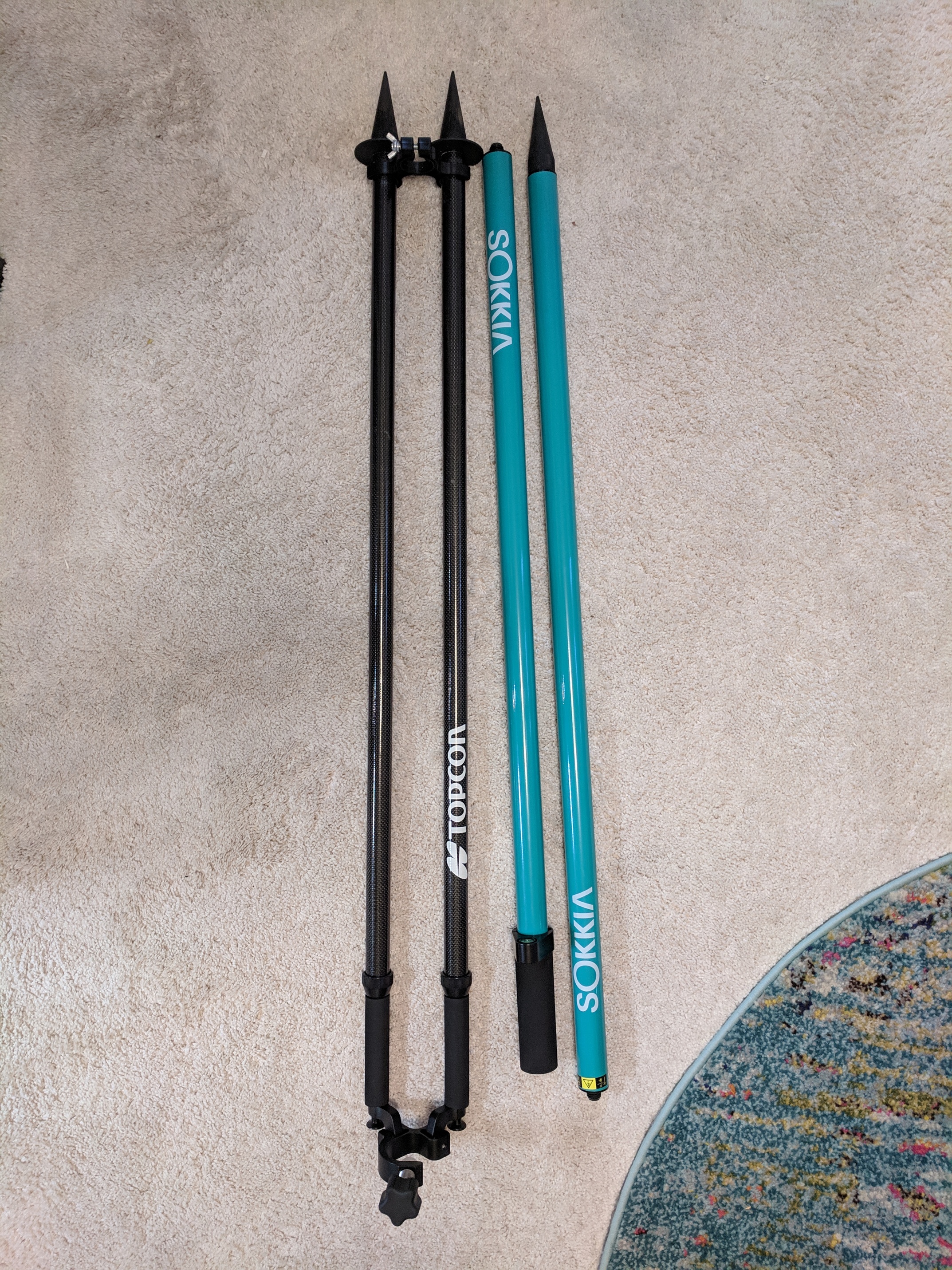
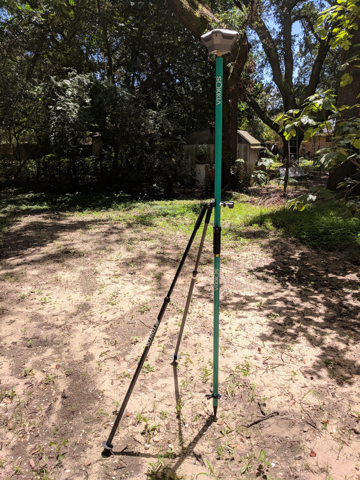
-Topcon carbon fiber bi-pod (w/travel bag)
-Sokkia aluminum GPS range pole (w/travel bag)
asking = $850.00 US
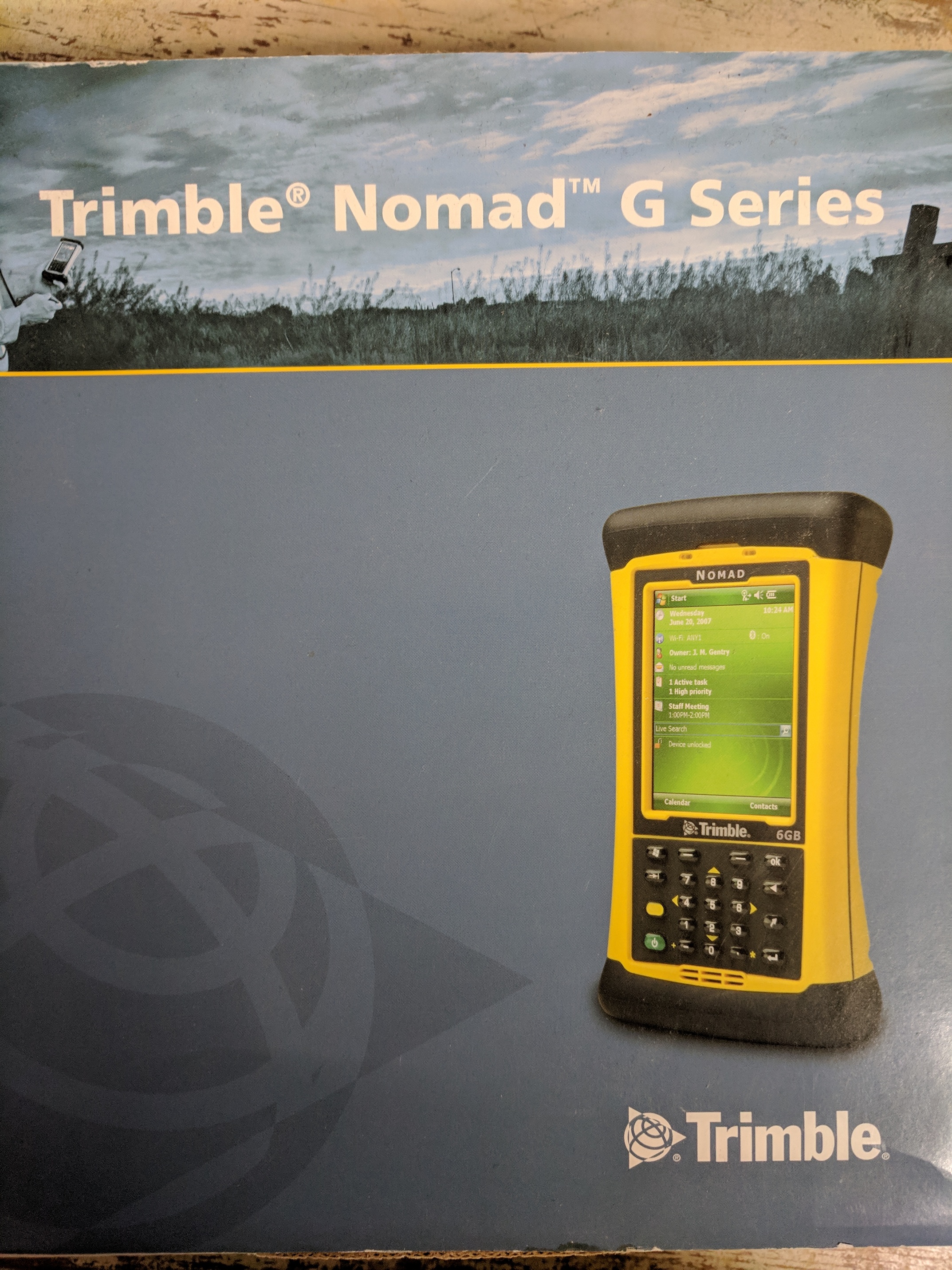
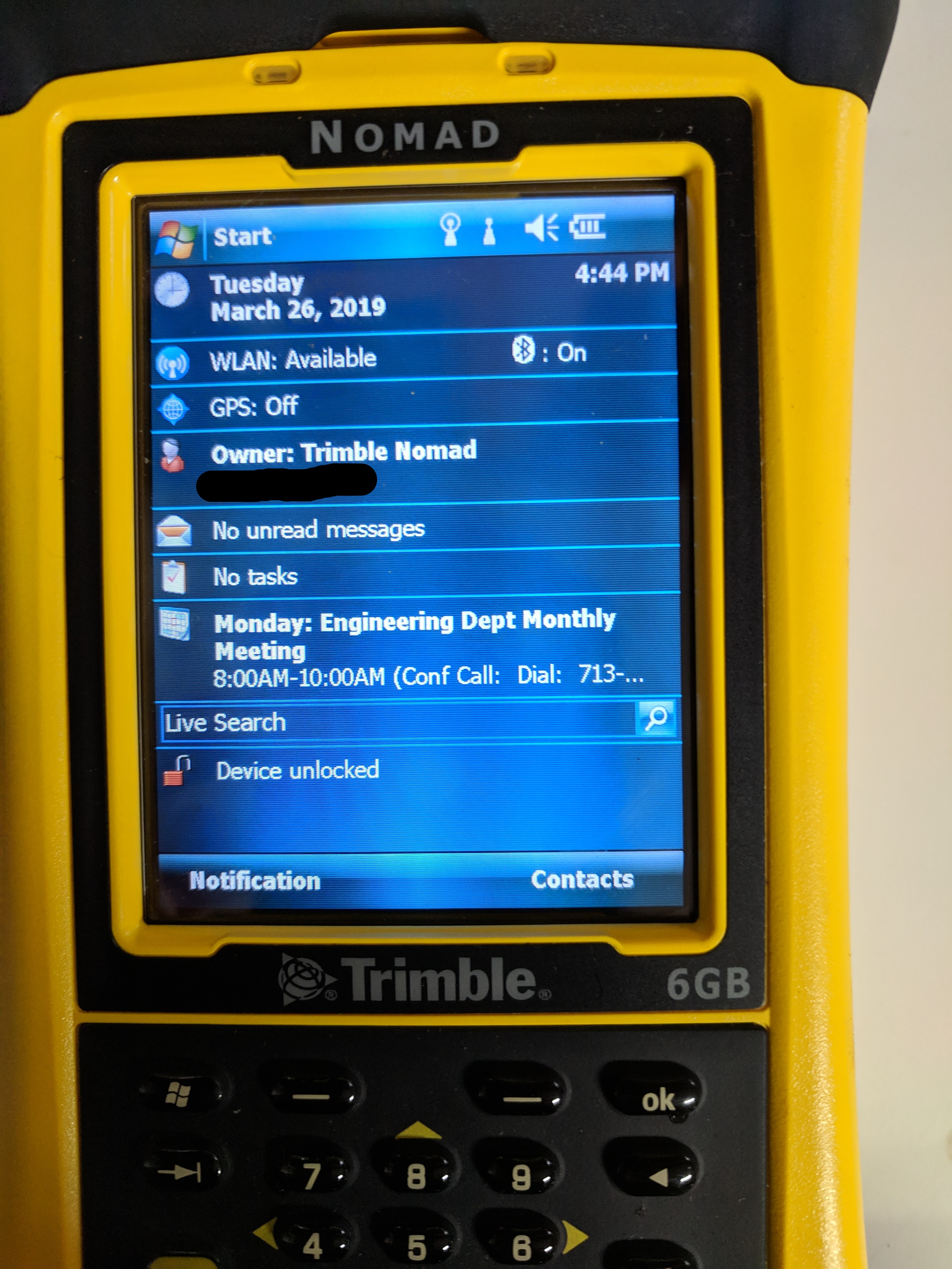
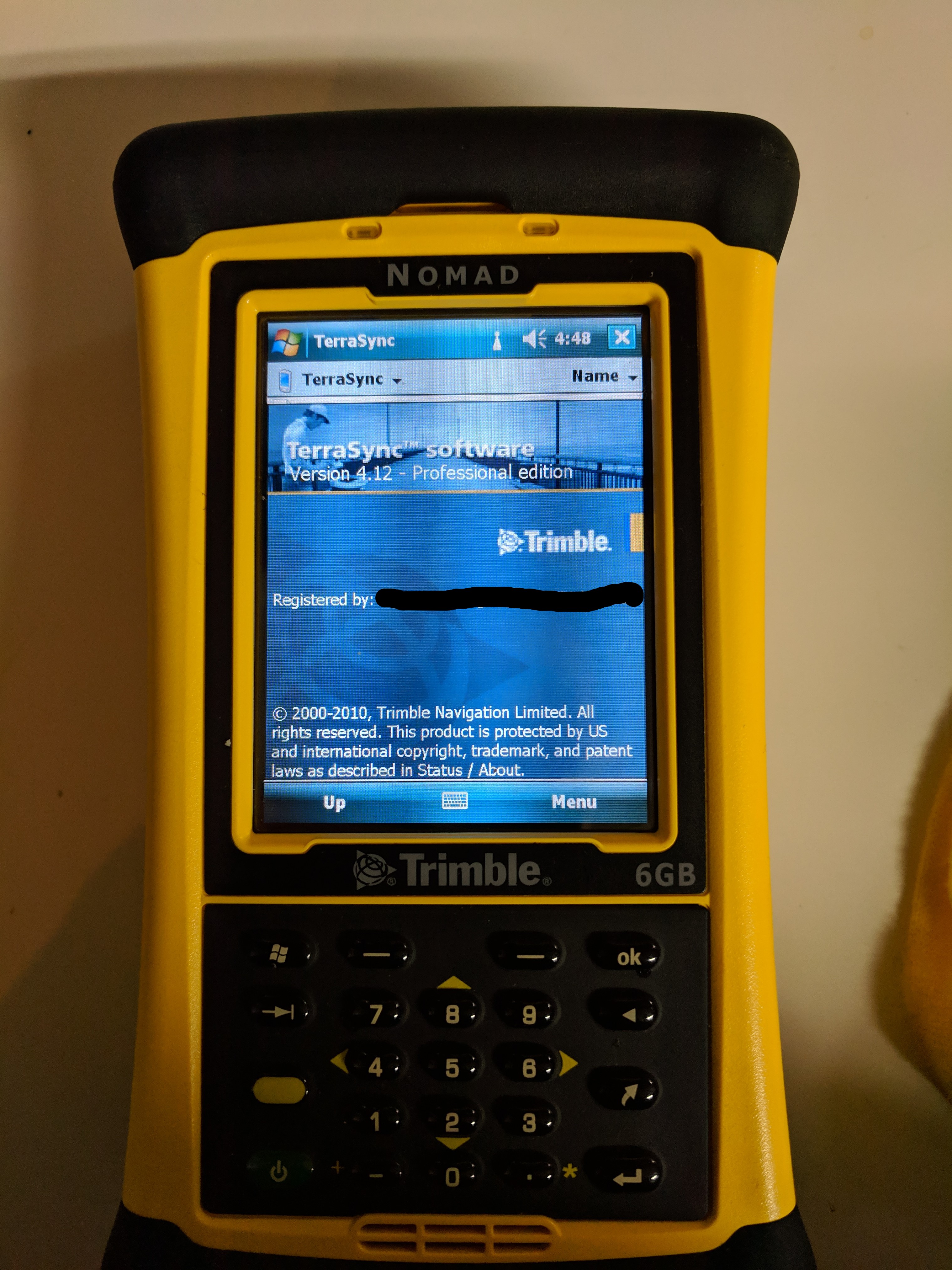
I also have a Trimble 800glc Nomad datacollector w/Trimble terrasync survey software. I have a brand new battery for this and it has all other data collector features wifi/bluetooth, camera, stylus, hand holder etc.Operates on Windows 6 and has all windows software, word, excel…etc. My intension was to use this for the Emlid data collection and capture points in a state plane coordinates as this is what we use here locally. I never have connected to the Emlid receiver as you need to buy a DB9 female connector from the Emlid store.
asking = $800.00 US
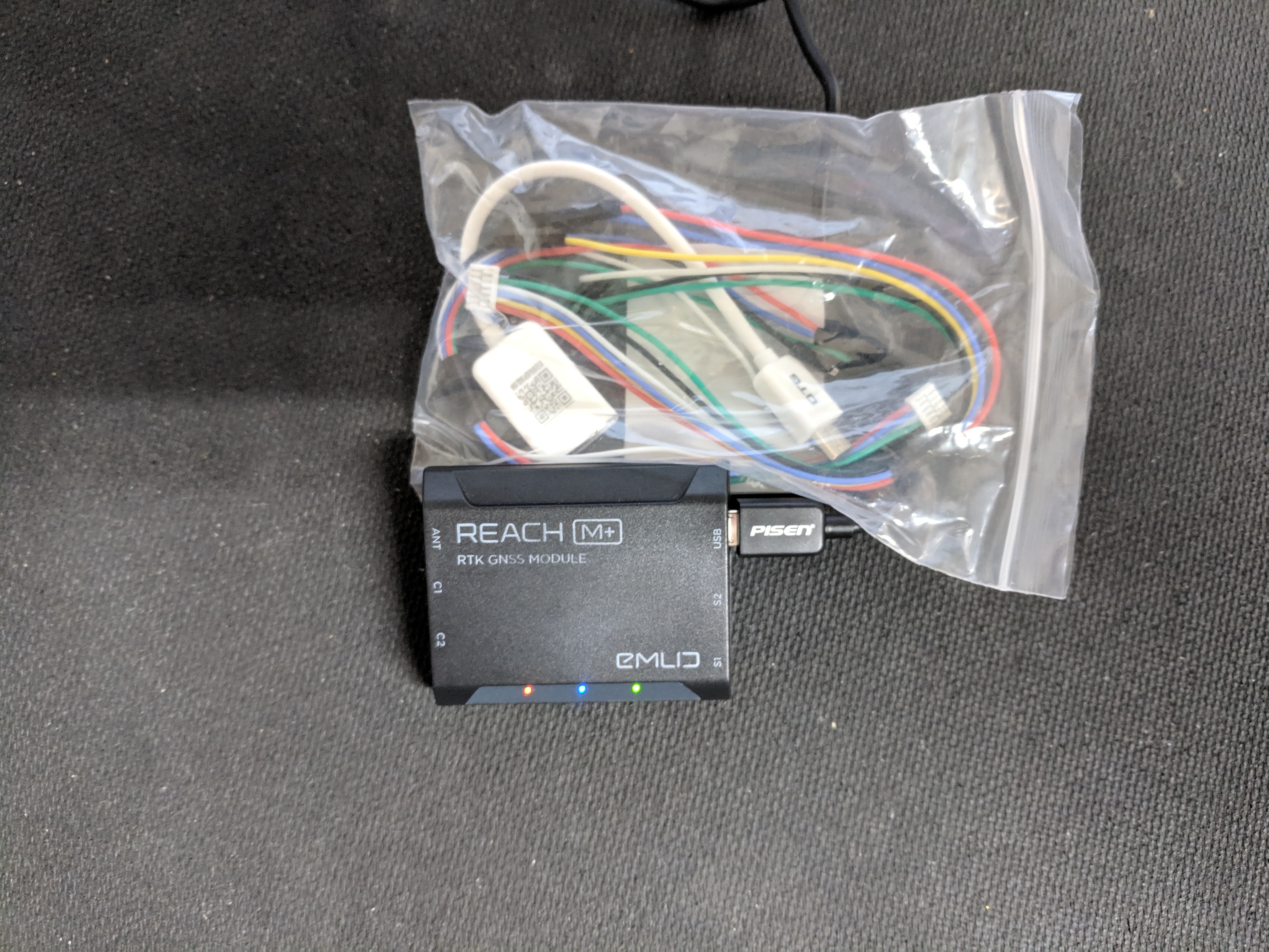
New Reach M+ (only used to connect to wifi)
asking = $200.00
If you’re getting into UAS mapping for ground control this is a good kit. Also for doing environmental work. I’ve never sold through a forum, but I’m assuming people use paypal. If you buy both items I will discount $75.00 off the total, remember you pay shipping. Please no low balling on cost. Thanks for looking!
Hey there!! I found your post on Reddit. I created an account here to be able to reply here.
Please consider me very interested. My only concern is it’s compatibility with the Phantom 4 Pro. I DO NOT have the RTK so I wonder if this equipment would be used to establish GCP’s ONLY for later input into the mapping software. I ask because I’ve seen conflicting info on other forums and on r/uavmapping. What has your experience been with establishing GCP’s to later upload into Pix4D, Drone Deploy or similar?
EDIT: I also wanted to ask if this version of GNSS is compatible with any phone apps.
Hi Ashley, the GPS is a great solution for establishing GCP’s. Depending on what type of accuracy you are needing? This GPS is an L1 that has the capability of connecting to a local NTRIP provider. Here in Florida we have department of transportation GPS reference stations that I use as my base for triangulation. You can however post process your data that you continuously collected with this GPS (typically a RINEX file) with another GPS station (RINEX file) and get better absolute accuracy.
For the DJI phantom drone itself you are limited to adding equipment for RTK solutions with imagery. Unless you buy the RTK Phantom or spend 7-10k for RTK add-ons. If you are needing centimeter imaging it will require the drone having some type of high end GNSS. That said, if you you are wanting to be within a few feet of your images. The Emlid GPS accomplishes better accuracy of your mosaic. The Emlid GPS uses a web app for communication. you can set your settings and collect points with the phone app (Droid or Iphone)