Dear Reach team,
I know that you are planning to use the reach sensors. I have an idea how this would help in practice.
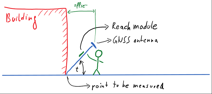
Application: Measure the position of something that is not accessible. Typically a GNSS antenna is at the mast of lets say 2m. the bottom part is pointing to the feature that needs to be measured. The at the top the GNSS antenna is mounted. If the reach module is also mounted at the mast then the tilt sensors and the length of the mast can be used to correct the position of the bottom of the mast.
What do you think?
with best regards
Franz
3 Likes
That is a good idea! We have been thinking about using IMU for leveling of the antenna, but tilted tripod is something we will look into as well. Thanks!
1 Like
Franz,
2 things:
- you’ll still have multi-pathing problems being so close to structures (buildings). By tilting the antenna so that it’s no longer parallel to the ground might only increase these multi-pathing problems due to the GNSS antenna’s intended use design (upright orientation, not tilted).
- you’ll need to know/obtain the azimuth (direction of tilt from the point to the antenna) in order to apply the offset since it is a vector.
Other than those two items (unless I’ve missed something), this is a very simple trigonometric problem to solve.
In practice, it’s easier to measure a point where you have a good satellite signal and then measure the offset (vector) to the final point you want. The most efficient method will depend on how accurate you want/need your final point to be. I wish there were a simpler method as I have run into this issue as well (it’s common). I read a post that suggested using a very tall mast so that the antenna clears the roof of the building. Obviously, a taller mast will not be feasible for all buildings.
regards
3 Likes