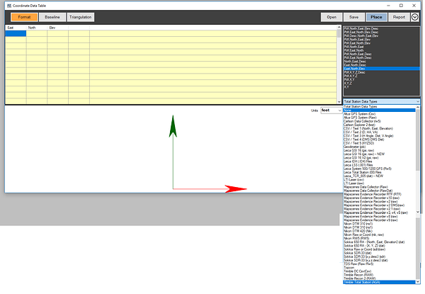
Has anyone successfully imported their Reach RS data into Faro Zone 3D? I’m new to gps and want to create diagrams from the points I’ve collected.
Seems like it would be just a simple import of your collected points using standard export formats from ReachView?
https://docs.emlid.com/reachrs/common/reachview/survey/#exporting-data
I’ve tried every export file type, no luck so far. I’ve tried entering the data manually in a table with no luck. I was hoping to find someone with experience with both.
Hopefully someone here is familiar with it, but you may have to get support from Faro also. It’s probably just a matter of the correct column names and order in the CSV file.
CSV TEMPLATE
https://docs.emlid.com/reach/common/reachview/survey/#points-import
Do you have a test file you can import in Faro Zone without any issues?
Can you share it here?
I’ve tried all the exports from the Reach RS and none open properly. Basically they just import as a row of dots fractions of an inch in a row. This is the coordinates it allows. I’ve basically tried everything.
It looks like there are two solutions:
-
Email the support at Faro Zone 3D and ask them to implement the ReachView CSV template (or GeoJSON template). See @timd1971’s link above.
-
Acquire a working CSV file that you can import into Faro Zone 3D and modify the columns of the ReachView survey project export file to make it mimic the look of the working CSV file. I think this might be what @andrew.yushkevich had in mind with his question.
This topic was automatically closed 100 days after the last reply. New replies are no longer allowed.


