


Hi Julia, the issue come from the app, when I export from 360 everything comes well
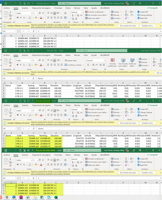
The usual CSV for people that work with Civil 3D or any surveying software is the PENED, we use the other CSV to postprocess the point, because you have to manipulate the file to get the information and that cut the workflow that we use
Danilo