I have exported point and lines with dxf and it works fine.
What is te best and easiest way to export surfaces?
Can you define surfaces from lines and points in Emlid flow?
Is it only land XML files that works for surfaces?
Have a nice day!
John
I have exported point and lines with dxf and it works fine.
What is te best and easiest way to export surfaces?
Can you define surfaces from lines and points in Emlid flow?
Is it only land XML files that works for surfaces?
Have a nice day!
John
Sketchup? I’d love to hear more about a use case like this because it typically uses relative coordinates like Revit and inherently isn’t designed for geospatial work. What kind of use are you envisioning?
Hi John,
At the moment, defining surfaces in Emlid Flow is not supported. However, we truly appreciate user feedback, so I’ll add your request as a feature suggestion.
You can use CAD or GIS software like Civil 3D and QGIS to export points and lines. Currently, LandXML is the only supported format for surfaces.
Let me know if you have any other questions. Have a great day!
Hi Michael,
I’m using sketchup with a coordinate system shifted as far as possible towards the project (“take away” as many leading figures that is the same for the project).
If the origo in sketchup is too far away the grafics get “strange”.
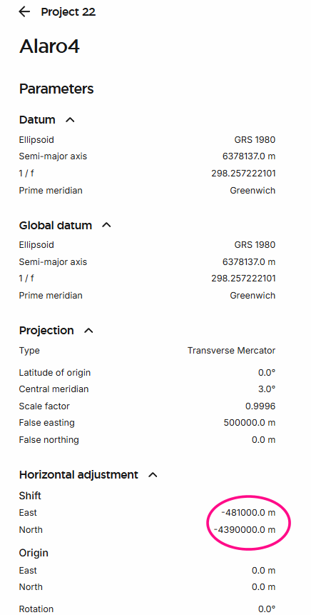
See example for Mallorca origo will then be in E481000 N4390000.
Works great with import/export dxf in sketchup
Have a nice day!
John
Hi Merryna,
Thanks for the quick reply.
Another question regarding the coordinate system.
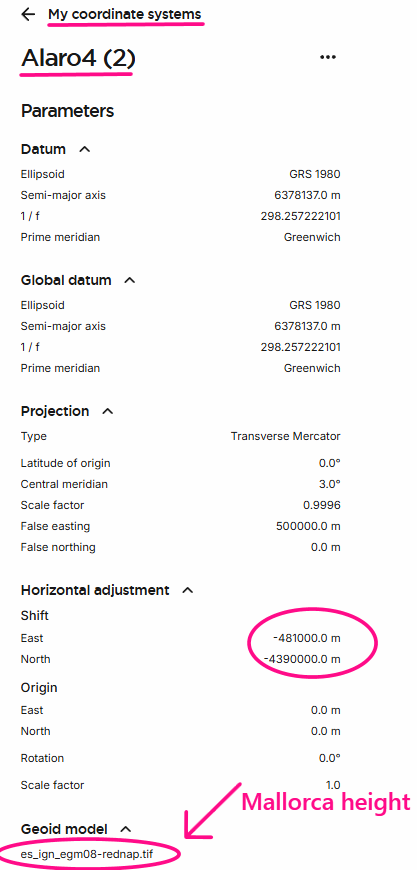
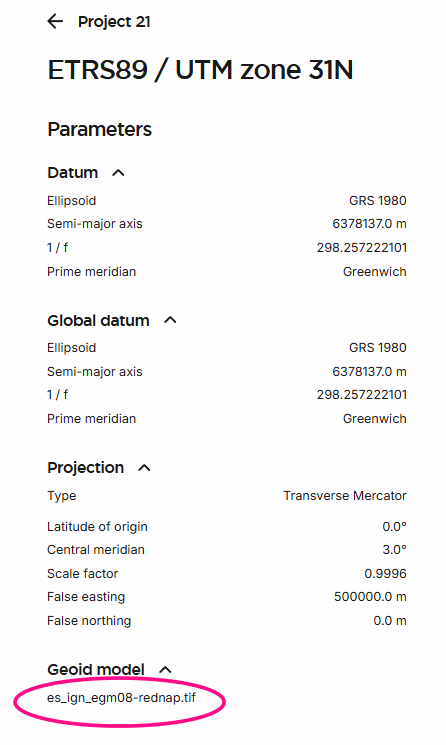
I did all my measurement in ETRS89 / UTM zone 31N + Mallorca height
for the terrain model.
For staking out I defined a shifted cs see picture.
But I didn’t find Malloca height?
Is the correct es_ign_egm08-rednap.tif to get Mallorca height
Thank you for a really nice reciever!
Have a nice weekend!
John
Hi again,
Sorry forgot one thing.
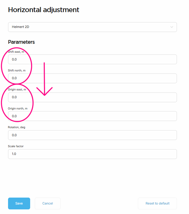
What’s the difference shift east/north ant Origin east/north?
I would like a cs with origo in E481000 N4390000 in cs ETRS89 / UTM zone 31N + Mallorca height.
Is shift E-481000 and N-4390000 right or should I use origin? Any difference?
Sorry for the complicated question just wanted to be sure.
Have a nice day and weekend!
John
I’ve experienced that same graphical and regen issue when importing points drawings in our State Plane system, similar to Revit. I’ve done a few conceptual layouts and been able to localize so the software coordinates don’t matter but never tried anything legit Survey-grade out of Sketchup. Good luck!
Hi John,
I hope you had a great weekend, I certainly did! Also, thank you for your kind feedback about our receiver.
Regarding the Mallorca height, yes, that is the correct geoid model for Mallorca.
As for the Shift east/north or Origin east/north, if only a horizontal shift is needed, the origin can remain at (0,0) and only fill the shift values. This is because the origin is the reference point at which rotation and shifts are performed.
Hope this helps, and have a great day!