


Ordered 2 rs2 units today, I think they’ll do what I want, weather with FG or not. I have a Microsoft surface that I may run FG on for now but I’ll wait till I get the units and use up the free trial and the see if I need it but it seems like a good software from what everyone says.
3 Likes
Awesome, congrats! I myself just ordered an RS2 survey kit and will be relegating my RS+ to being drone PPK base stations so we can learn the hardware together.  You should be able to get a trial of the Android version of FG as well. There’s a slew of rugged smartphones on Amazon for around $100.
3 Likes

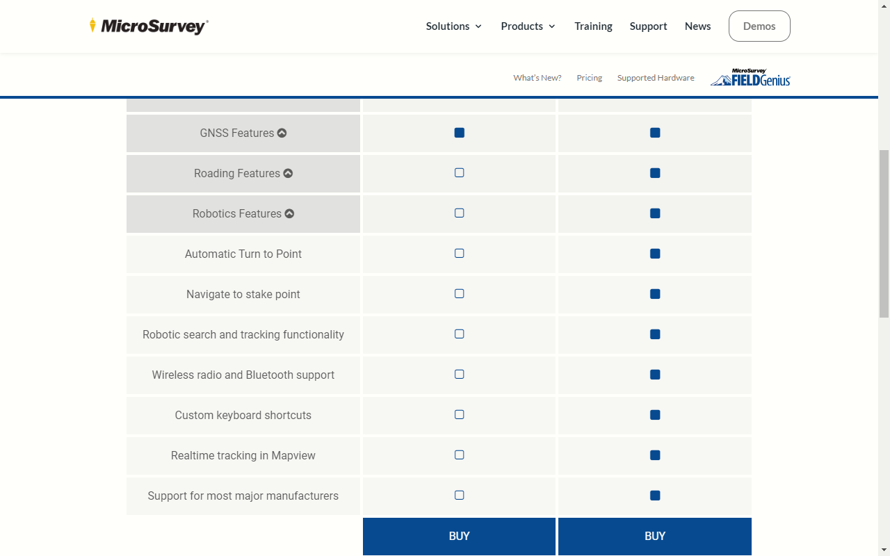
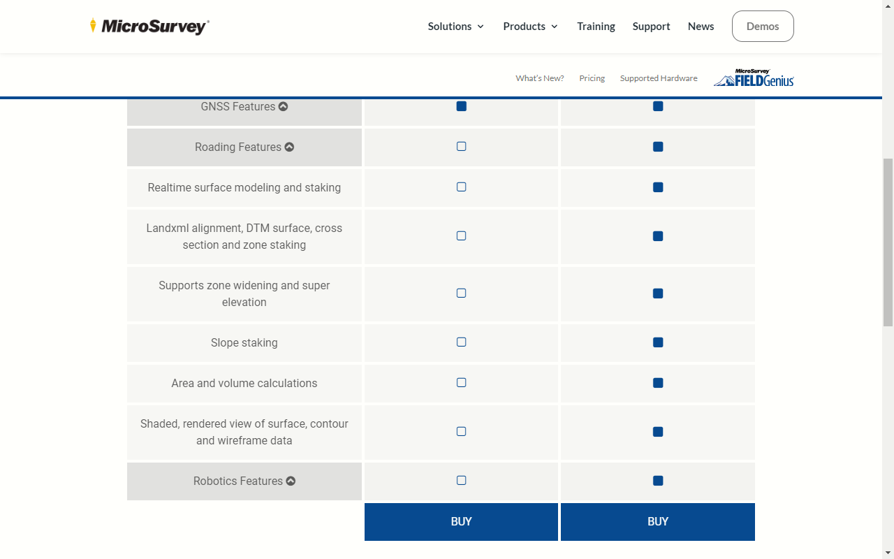
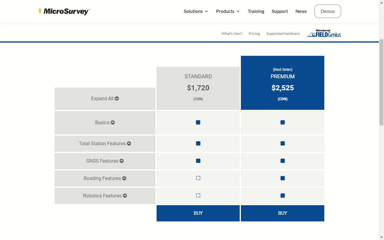
Do you have standard or premium FG? What features do I need to grade and check grade?
I had standard on Windows mobile, but I think Android is just Android. When I had standard it did everything that we’ve talked about.
I have the premium version but for what you want the standard is good enough
So you could do what you’re doing with the standard version then?
I think it would be worth a call to them. They are very nice folks and receptive to questions. Dave is running Windows so I need to ask the question if there are any levels of the Android app. I don’t think so as when I purchased it there were no options, but things may have changed.
All I know is that FG has at least one android level, but I have always run windows and that way I could use it for other things too, But it seems that FG is the best option for this time and day I do not see any other software that can match the capabilities of FG in the way I would like right now
2 Likes
I ordered from Roboshop in the US and ordered monday and got it today with “next day air” or whatever the mid range shipping was. Just got it out of the box and am learning how to get my NTRIP setup.
5 Likes
You can make such a grid in GIS with a “fishnet”. In QGIS it lives in many places but can be found in the vector processing toolbox -> Create Grid.
If need help PM me and I can get what you are looking for.
5 Likes
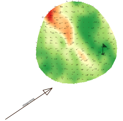
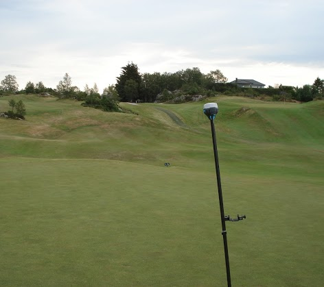
I did a slope analysis of a golf hole some time ago, this process in Qgis produced a DEM and a user defined mesh that could easly be extratet as points for stake out, in any size.
So yes, its possible to do wide area slope and ditch with Qgis.
5 Likes
That’s very interesting I will have to do some more research on QGIS,
2 Likes
Me too! @TB_RTK, do you have any good resources? I have other software for all of our 3D work, but it could be handy to see what QGIS does. Any specific plug-ins?
3 Likes
Not really, all my answers was found all over the internet. But those weird guys over at gis.stackexchange is always helpfull in their own way.
My most used plugins? Mostly the native ones (you should get a long way with those) build in the latest Qgis like those in the GDAL section, CAD stuff, and QuickMapService and Terrain analysis.
2 Likes
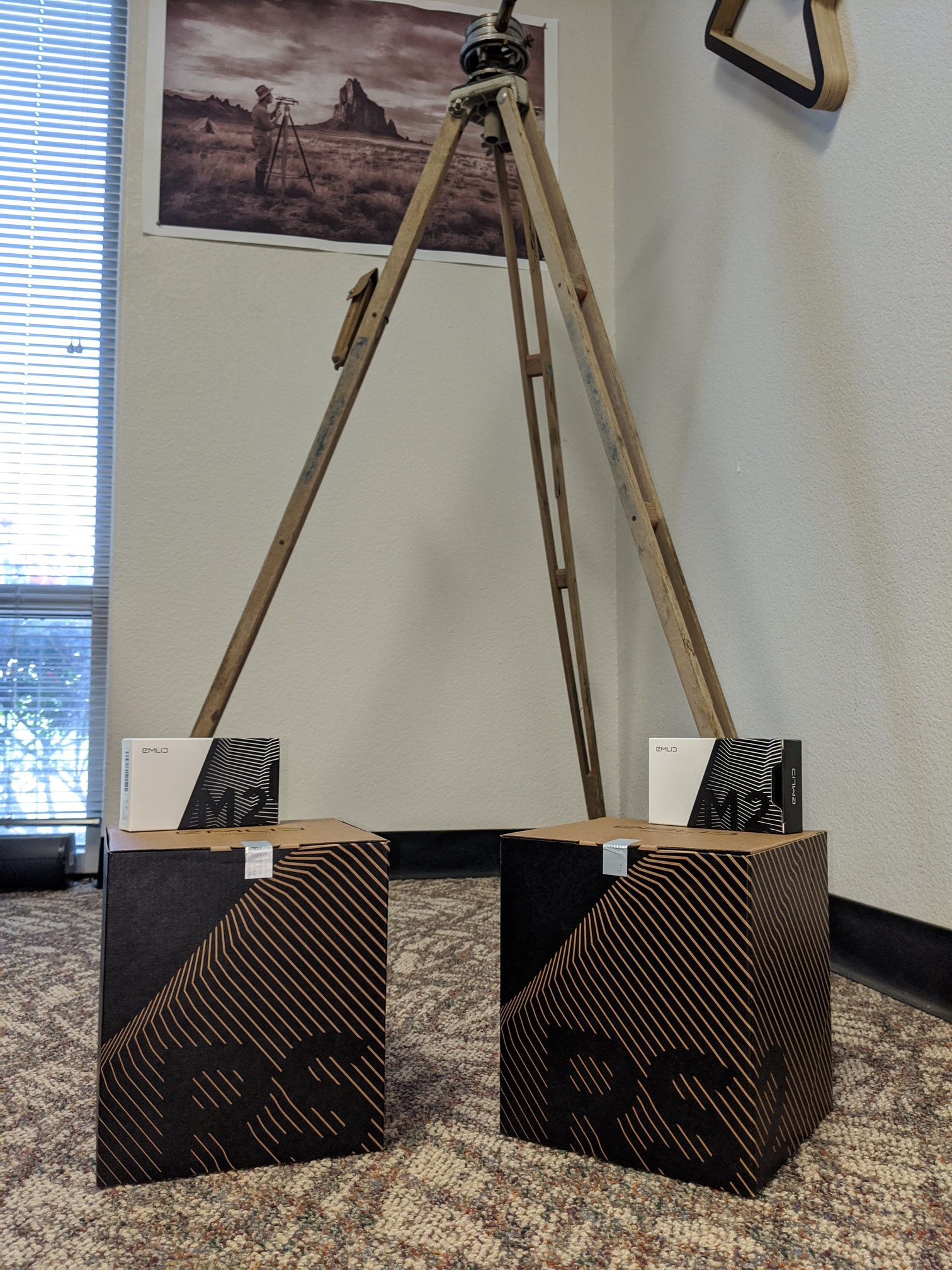
Are they both RS2s? Did you order from Emlid directly? I ordered through robotshop because it was cheaper than direct in Canada at least.
Yes, 2 x RS2 and 2 x M2. I used Event38.
Has anyone used apglos survey app? i just stumbled upon it a few minutes ago. Maybe it will do what I want for grading, but as usual I may be wrong.