Hi All,
maybe someone can shed some light here , or have a found a bug in Reachview3.
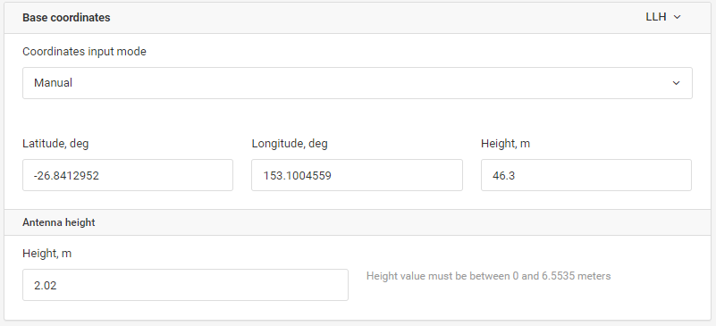
conducted a survey yesterday in GDA94 , converted my known point to WGS84 and Ellipsoidal HT
as below. And imputed it into reachview2 as a manual base.
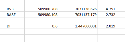
(GDA94 coordinate was Base1 509980.108, 9031137.179, 2.732 )
would that explain why the RV3 app has added the difference to the base , Also in the base setup , the height of instrument, should it have 0.134 added to that or is it being added in the background?
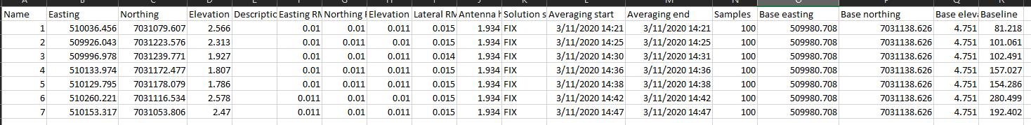
RV3 did not add anything. Because your base coordinate is provided in WGS84 and not in GDA94, all your survey is in WGS84. RV3 just adds MGA projection to the coordinates. The differences that you are seeing are between GDA94 and WGS84.
When entering base coordinates you need to account for 0.134m offset manually. This is inconvenient and will be addressed as this functionality migrates to RV3.