


Greetings,
I post processed (PPK) some Mavic 3E drone imagery using Emlid Studio and got 100% fix, however the updated geotags are not being read correctly in Agisoft. See photo below for example. Thank you!
Link to geotagged photos:
Greetings,
I post processed (PPK) some Mavic 3E drone imagery using Emlid Studio and got 100% fix, however the updated geotags are not being read correctly in Agisoft. See photo below for example. Thank you!
Link to geotagged photos:
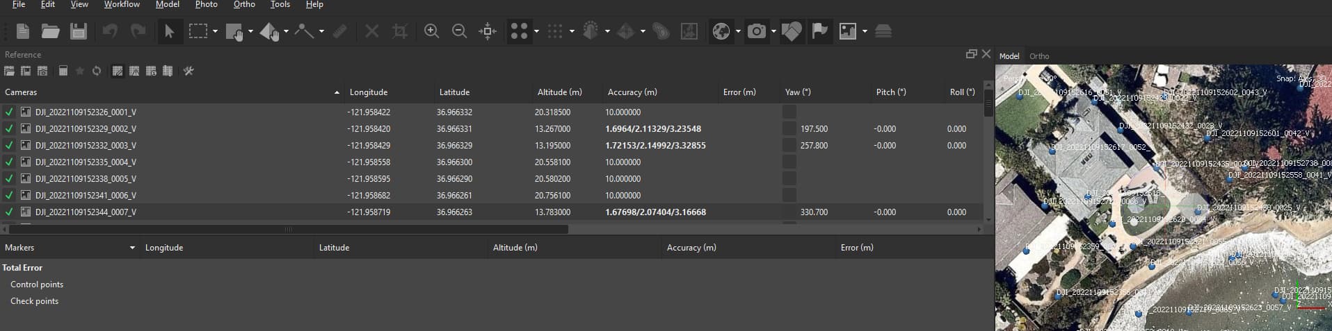
Are you referring to the Accuracies or the coordinates themselves?
The coordinates do not seem correct, see the altitude correction in the values with accuracy values
Did you mix in corrected and non-corrected images? In your MS screenshot, some appear corrected and some do not.
Can you share your non-tagged images along with your GNSS raw-data?
Hey @Scott_Walls,
I have the same question as Dave: are these photos mixed? Like, part of them is geotagged in Emlid Studio and another part is right from the DJI drone?
Thanks for your replies. These are all from the “tagged” folder, but for some reason they don’t seem to be tagging correctly or Agisoft is not reading them correctly. Is there a way to export a CSV of the geotags with the filenames from Emlid Studio or something similar? I will get the GNSS data posted soon.
Emlid Studio outputs coordinates of time marks to the _events.pos file. They are listed there in chronological order without the names of the exact photos. In geotagging, Emlid Studio goes through the photos and matches them with time mark coordinates from the first to the next.
Did the geotagging go well? Did Emlid Studio ask for the right number of photos after you process the logs? Can you please share with me your processing data (base/rover logs and MRK file) so that I can check if the number of time marks matches the number of photos?