


In the ReachView 3 app for logging and base mode, it asks for antenna height. I’m using a 2m pole. So would I put 2m or 2.134m?
For base setup & logging , which is WGS84, where the ground mark is random/unknown I do a 2-5min Single Average. Then hit the download icon to make it a Manual LLH (I dont do XYZ)
On the Base, the Ant Height referers to the ground mark to the base of the RS2. This is known as the Ant Ref Point (ARP). Not to be confused with the Ant Phase Centre APC which is another 0.134mm up into the unit. So get a tape measure and record from ground up to the bottom of the RS2 where it screws in. Thats the figure you put in there.
On the rover, the default is a 2m pole and internally it adds the 0.134mm
Hope that helps
Hi Garrison,
Welcome to our community forum!
You need to put the pole height 2 m. This is a Measured height - distance from the benchmark to the bottom of the receiver.
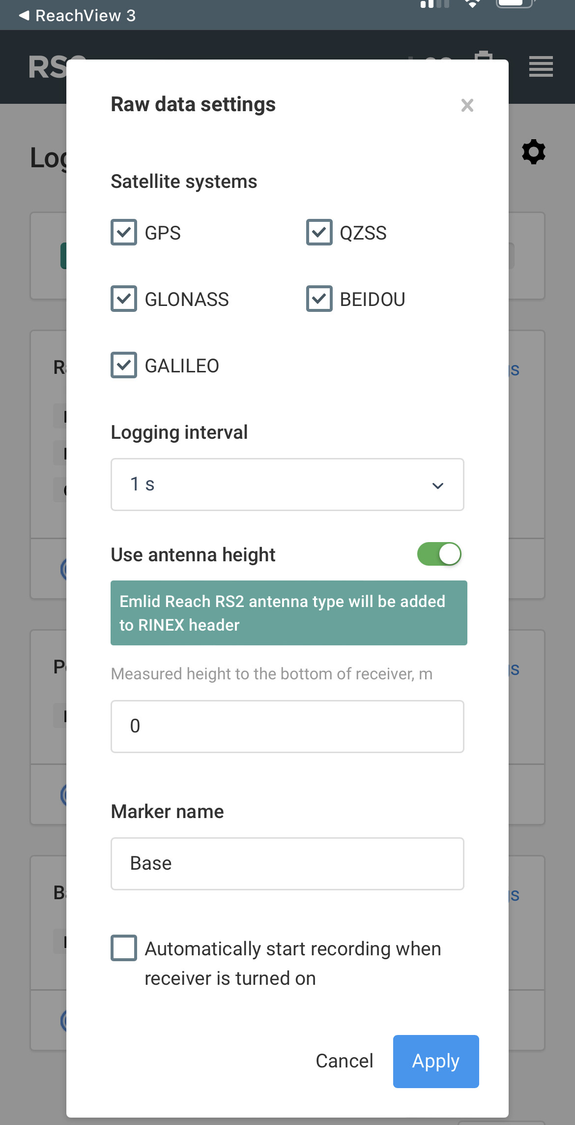
As I see from your screenshot, ReachView 3 isn’t up to date. Please update it on AppStore or Google Play. Then, the Base mode configuration will look like on the screenshot below. Antenna phase center (APC) offset 0.134 m is applied automatically.
There’s the antenna name EML_REACH_RS2 in the RINEX header. So, you can measure height as well as for the Base mode. Reach RS2 antenna is included in the IGS database. Various PPP services or post-processing softwares can recognize it.
Hey Kirill,
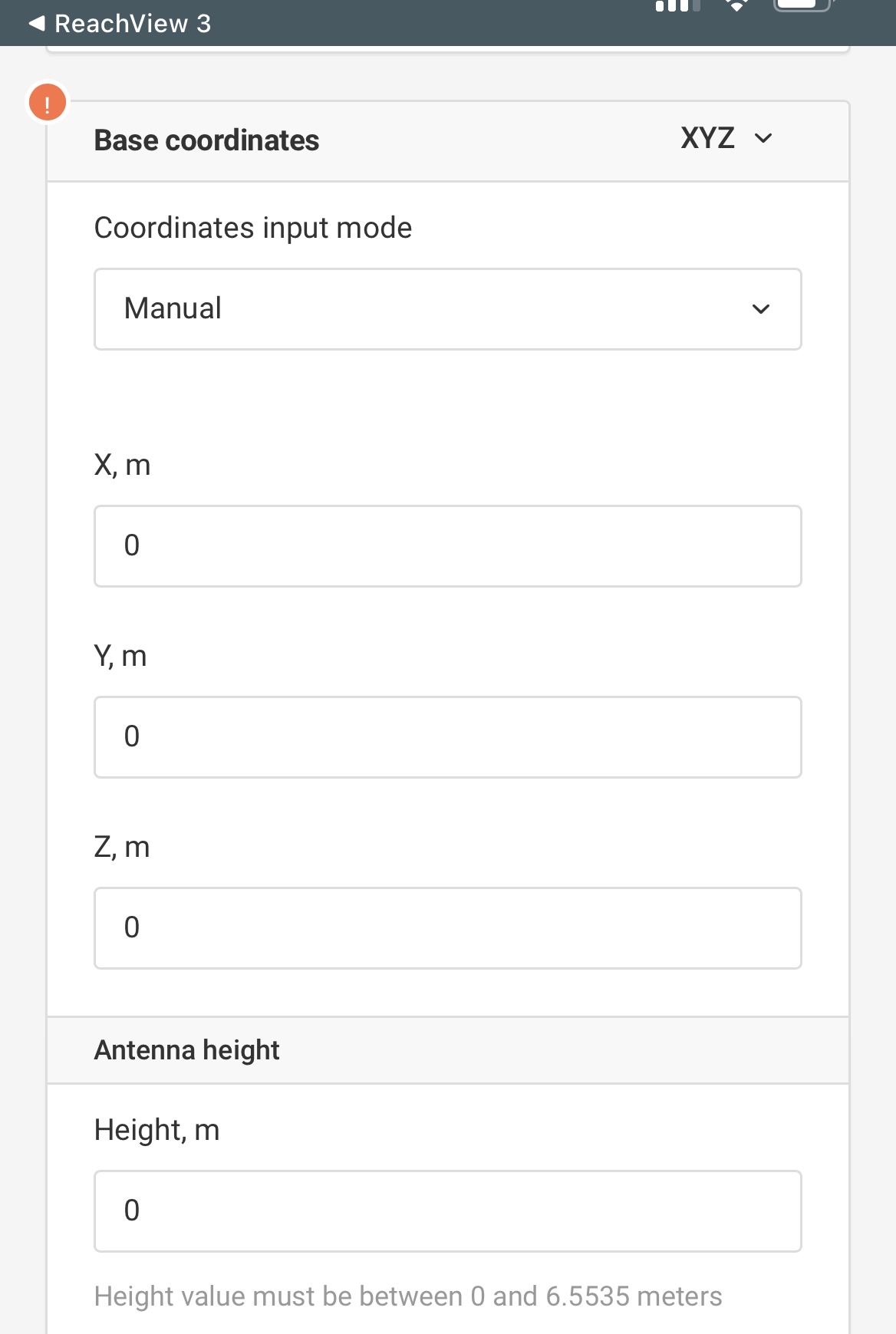
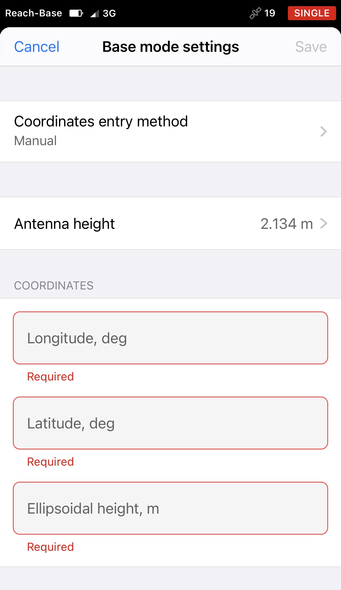
I do have the latest version of the ReachView 3 app, but I prefer to use the ‘Reach Panel’ as it has more options than just the app. For instance, in Base Mode the app only allows for manual input in LLH format, but the Reach Panel allows for XYZ manual entry as well. As for logging, I don’t even see the option in the app. I only see it from the Reach Panel. Does the Reach Panel automatically include the 134mm like the app does or do I need to add it manually to the 2m?

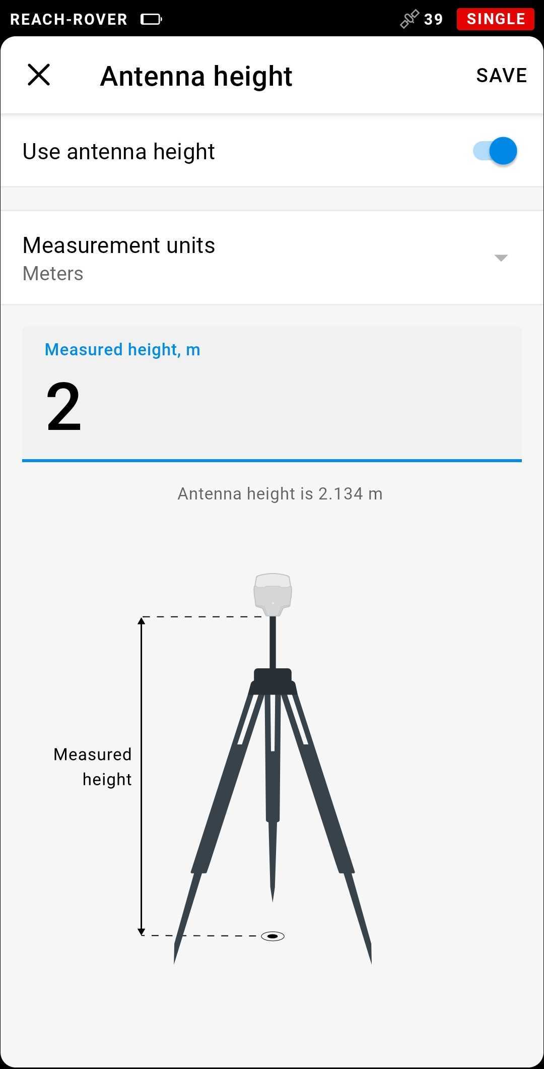
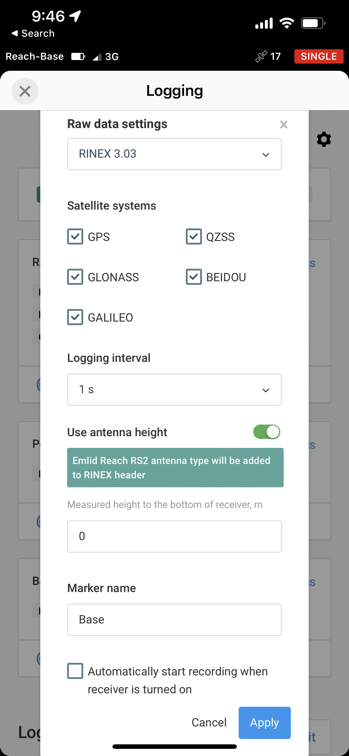
Correction. I do see the ‘Logging’ tab in the app. I was in the ‘Settings’ tab and could not find it. Here is a screen shot of what Logging looks like through the app. So I’m assuming I put 2m for this, even though it doesn’t mention the 134mm like Base Mode does?
Hi Garrison,
Though Reach Panel allows you to enter XYZ, these aren’t projected coordinates. They are ECEF (earth-centered, earth-fixed). It’s just an interpretation of LLH in meters. Even though you input Base coordinates in XYZ, Reach Panel collects LLH coordinates.
I’m assuming I put 2m for this, even though it doesn’t mention the 134mm like Base Mode does
Yes, it’s the correct assumption. You should enter the same height as well as in the Base mode.
1 Like
Hi Kirill,
Thank you so much! You have been very helpful. I submitted a static collection logging file to OPUS and they sent me corrections. Could you help me understand how to interpret LLH here?
" REF FRAME: NAD_83(2011)(EPOCH:2010.0000) ITRF2014 (EPOCH:2022.16100)
     X:       710344.825(m)   0.010(m)            710343.922(m)   0.010(m)
     Y:     -5190289.912(m)   0.023(m)          -5190288.439(m)   0.023(m)
     Z:      3626487.333(m)   0.016(m)           3626487.223(m)   0.016(m)

   LAT:   34 52 24.03926      0.005(m)        34 52 24.06565      0.005(m)
 E LON:  277 47 35.17246      0.007(m)       277 47 35.14510      0.007(m)
 W LON:   82 12 24.82754      0.007(m)        82 12 24.85490      0.007(m)
EL HGT:          243.672(m)   0.028(m)               242.311(m)   0.028(m)
ORTHO HGT: 274.964(m) 0.032(m) [NAVD88 (Computed using GEOID18)]
                    UTM COORDINATES    STATE PLANE COORDINATES
                     UTM (Zone 17)         SPC (3900   SC)
Northing (Y) [meters] 3859661.866 337789.295
Easting (X) [meters] 389696.416 499256.038
Convergence [degrees] -0.69013056 -0.66910278
Point Scale 0.99974995 1.00001447
Combined Factor 0.99971171 0.99997622
US NATIONAL GRID DESIGNATOR: 17SLU8969659661(NAD 83)
BASE STATIONS USED
PID DESIGNATION LATITUDE LONGITUDE DISTANCE(m)
DO2638 SCWR WHITE ROSE CORS ARP N345857.038 W0811157.440 92858.3
DK7758 SCUN UNION CORS ARP N344558.605 W0813855.699 52423.4
DJ9536 TN13 TDOT DISTRICT 13 CORS ARP N355637.031 W0831226.416 149527.9
DE8425 GAST GASTON CORS ARP N351839.791 W0811119.541 104774.1
AH6714 COLA COLUMBIA CORS ARP N340451.557 W0810718.015 132908.3
DF9211 GACC COLUMBIA COUNTY CORS ARP N333244.706 W0820801.700 147419.5
NEAREST NGS PUBLISHED CONTROL POINT
ED3592 42 437 N345228.216 W0821157.368 709.1"
Also, when I’m uploading to OPUS what do I put for antenna height? 0 or 2m or 2.134m?
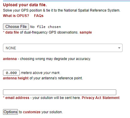
You need to enter the dist to the ARP (base if antenna).
Also, you need to select the correct antenna model in the drop down list for antennas. Select “RS2”.
If you select the wrong antenna model or use “NONE”, your final processed coordinates will be wrong.
Hi Garrison,
You can use these NAD 83(2011) coordinates to put in the Base mode:
- Latitude: 34°52’24.03926’’
- Longitude: -82°12’24.82754’’
- Ellipsoidal height: 243.672 m
Antenna height is still 2 m for OPUS as well as in the Base mode. You should only choose EML_REACH_RS2 NONE antenna type.
1 Like
Hey Kirill,
The Reachview 3 app and the Reach Panel would not allow me to enter
" * Latitude: 34°52’24.03926’’
- Longitude: -82°12’24.82754’’ "
In this format. Any other suggestions? Thank you so much for your help.
Hi Garrison,
To input these coordinates properly, you need to convert them into decimal degrees. For example, 34°52’24.03926’’ = 34.873344 degrees. There are a lot of online converters on the web.
1 Like
This topic was automatically closed 100 days after the last reply. New replies are no longer allowed.