


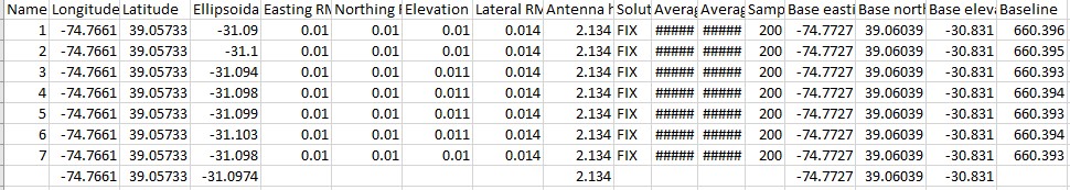
We did our first test using NTRIP corrections. I noticed there’s a set of columns with the headers “base_easting”, “base_north”, “base_elevation”, & “baseline”. The values are simlar but not the same as the long, lat, ellipsoid. Can anyone clear up for me the differences? And if one is more ‘accurate’ than the other?
k.
1 Like
Hi @kvand,
The coordinates in the columns starting with Base name correspond to the base coordinates received from your NTRIP service. You can see that they stay the same during the survey.
The Long, Lat, Ellipsoidal Height fields correspond to the coordinates of the points you’ve been collecting. So they mark the rover’s coordinates.
1 Like
Thanks for the prompt response!
That’s what I assumed. What still puzzles me is why the ‘base_elev’ doesn’t match the geodetic marker elevation (-30.99) in which we placed the base over. After positioning the tripod over the marker we set the manual coordinates and then measured the height to the Emlid base and then added 134mm–per the Emlid video. Any thoughts on where the error is arising?
@kvand, do I get it correctly that the ellipsoidal height of the geodetic marker is -30.99 m?
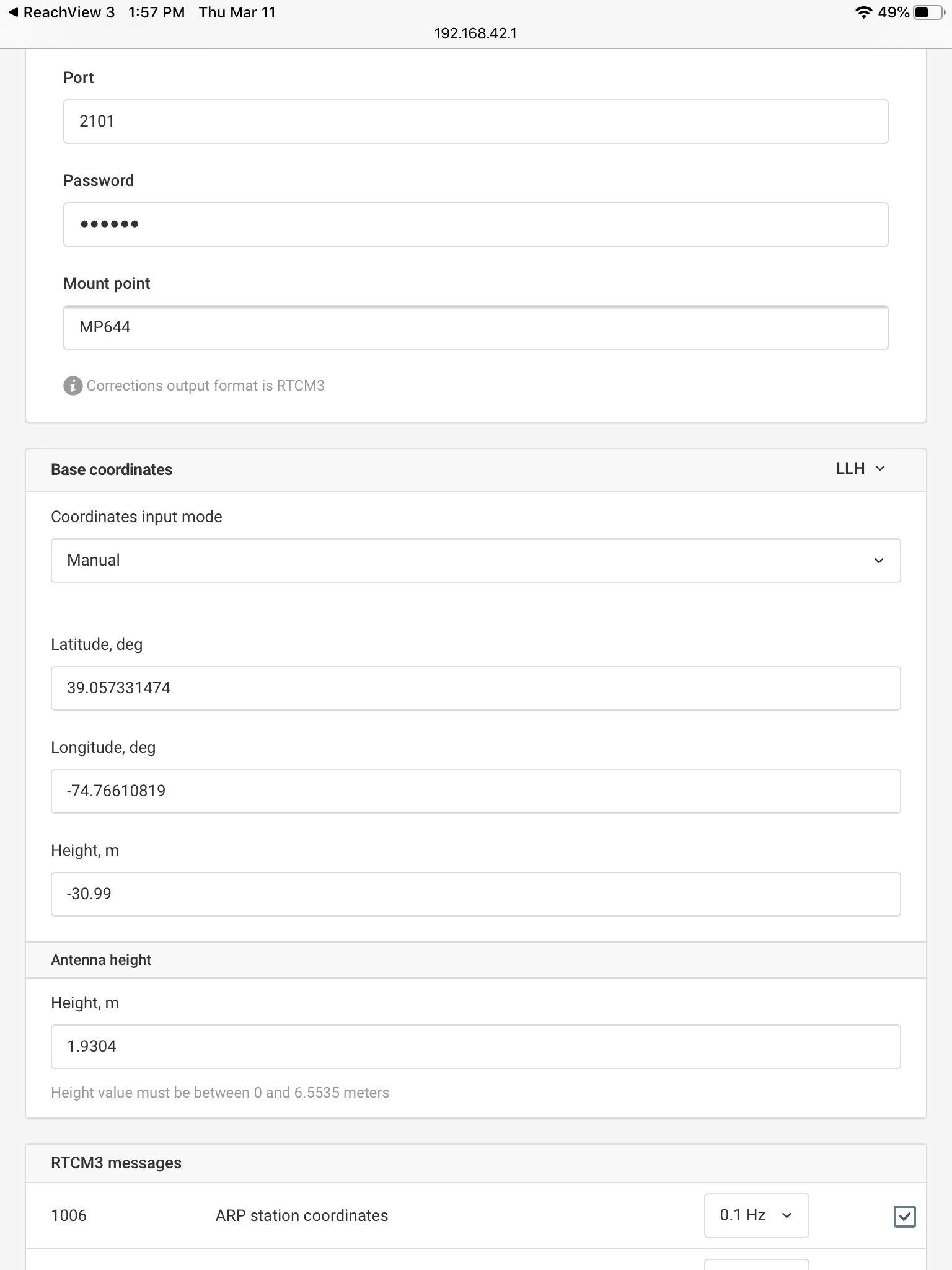
Could you please take a screenshot from the Base mode tab on your base receiver and share it with me? I’ll need to check the height and antenna height set. You can do it in PM if you don’t want to share your coordinates publicly.
Yes, the geodetic marker elevation is -30.99 m.
We matched the marker coordinates in the manual setting & then measured from the bottom of the Emlid to the marker and added the 134 mm/ .134 m to that distance = 1.9304 m. See attached screenshot:
Please let me know if you have any questions or ideas regarding the error.
k.
Hello kvand,
I see that Height =-30.99 m is normal because Height in reachview represent Ellipsoid height (Altitude) and can be negative, but if you convert it (using Quadratic interpolation) to Geoid EGM96 height (Used by Google Earth for example) you will find that Elavation = 5.353 m
Also Geoid Height can be negative and positive.
Below you can see a relationship between orthometric height, ellipsoid height, and geoid height.

3 Likes
Thanks Zinou but I’m not looking to convert the elevation. I’m trying to determine why there’s a small error from the manual elevation input and the geodetic marker–both are in NAD83 (2011) ellipsoid. I can always convert the elevations later using NOAA’s VDatum tool, but that’s irrelevant to the purpose of my question/post.
1 Like
Sorry for misinterpreting your question.
No worries. I appreciate that you took time to respond. Thanks.
k.
1 Like
Hi @kvand,
Could you please elaborate on the firmware versions of your reach and rover? Do I get it correctly that you get the ellipsoidal height from the officially located geodetic marker?
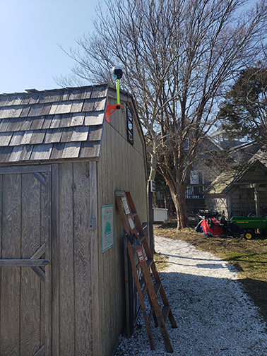
We’re running the latest firmware (v2.4.2). We repeated the NTRIP tests in both Philadelphia, PA and Stone Harbor, NJ. We used a nearby geodetic marker as a ‘known point’ to then send corrections to a ‘new known point’ nearby (400m baseline)–see pic. We then used that 'new known point as a base to resurvey the original and two other nearby NGS geodectic markers. In both locations we got about 1-4 cm height variation. This seems fairly accurate though not perfect. Is this the accuracy you’d expect?
Hi @kvand,
Thanks for sharing your results and sorry it took a time to get back to you!
1-4 cm of accuracy is within the limits of the possible accuracy for our receivers. Apart from the baseline, it also depends on the overall observational quality. So I’d say this is a good result.
This topic was automatically closed 100 days after the last reply. New replies are no longer allowed.