Emlid Flow in action: Drone mapping

Recently, we started exploring Emlid Flow in action, and today, we’ll dive into how it’s used for drone mapping.

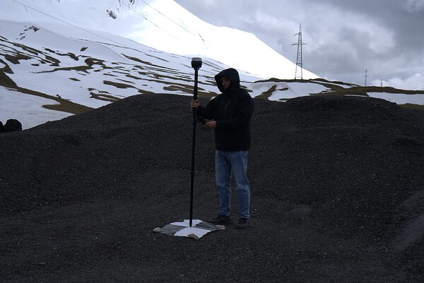
Collecting GCPs


High precision is critical for successful aerial mapping, and Ground Control Points (GCPs) are essential for achieving it. Emlid Flow offers tools to streamline the process and help you achieve the best possible results.

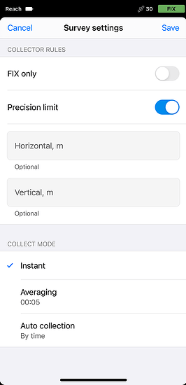
Once connected to your rover in Emlid Flow, create a project and select an appropriate coordinate system. Then, start collecting GCPs with the Collector tool. You can set the precision limit to ensure your data meets your job requirements and use the averaging option if needed.

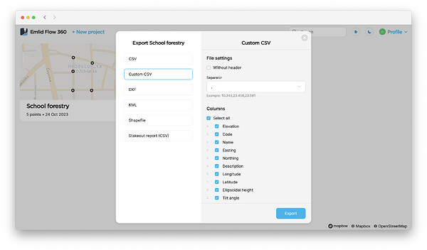
For convenience, you can sync data between Emlid Flow and Emlid Flow 360 by logging into your Emlid account. This is especially helpful if your photogrammetry software requires a specific CSV format. With the Custom CSV option in Emlid Flow 360, you can customize the file to meet the software’s requirements.

When finished, export the coordinates of the collected GCPs from Emlid Flow or Emlid Flow 360.

Establishing the connection between your base and drone

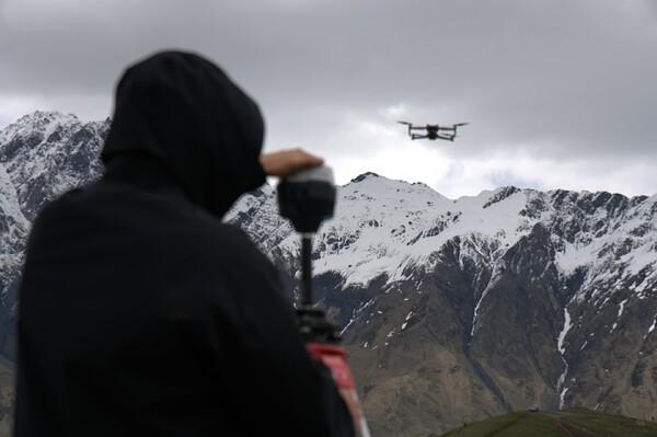
Let’s move on to setting up the RTK link between the base and the rover. Emlid Flow and Reach receivers provide two connection options—online or offline, depending on whether you have internet access:

  • If you have a reliable internet connection, you can send NTRIP corrections from your Reach base to your RTK drone through Emlid Caster.

  • If there’s no internet access, you can use the Local NTRIP option in Emlid Flow. This allows your Reach base to act as a caster on its own, broadcasting corrections via the Reach’s built-in hotspot.

Learn more about the connection from the guides for Autel and DJI RTK drones in our documentation.

Whether you’re mapping for agriculture, civil engineering, or conservation, the Reach base, rover, and NTRIP workflow usually deliver precise and dependable results.

Are you a drone mapper? Which workflow works best for you? Let us know in the comments below. If you need assistance, feel free to reach out at support@emlid.com.

10 Likes

Our drone program is in such a good place because of this community and Emlid’s commitment to support and innovation! Just solid.

11 Likes

This is an important use case for us and it works perfectly.

Because we have multiple devices, all needing a network connection, we use a mobile WiFi router. It works flawlessly, once the network is set up in the device’s WiFi settings, the device - whether a Reach or a drone RC - just connects automatically when turned on.

If the mobile WiFi router has a cellular connection then we use that, if it doesn’t, everything is still on the “local” WiFi network and we can use Local NTRIP.

That single purchase of the mobile WiFi router has turned the connectivity that was a bit of a hassle into a really simple and streamlined process.

4 Likes

I have been of this mindset for years and will never understand why I should have 5 lines of service to lite up all my field devices versus two.

4 Likes

Thanks for this, @natalia.botygina !

We also use Aeropoints, and I’m considering using them as checkpoints rather than GCPs in our workflow.

Currently, we’re using the Mavic 3E RTK, connected to a local CORS provider via NTRIP, with Aeropoints acting as GCPs. We process the data in DroneDeploy.

Recently, we bought a Reach RS2+ and, based on @MikeH’s comments, we’re exploring using the Reach RS2+ as a base station. The idea is to connect it to the CORS network using NTRIP where there’s cell coverage (though in many of our projects in Mexico, cell coverage is spotty). Using the Reach as a base, we could cast corrections to the drone, improving precision and avoiding the risk of the drone or controller losing connection to the CORS.

The Aeropoints would then serve as checkpoints. We’re also considering using Starlink for stable connectivity, but with this setup, it might be overkill.

Any thoughts or suggestions?

Thanks!

Martin.

Can you post a link to the brand/model you find works well?

Hi Adrian, different country and all that…we bought a Netgear Nighthawk M6 Pro. They’re usually a bit expensive but we got a good special. It seems to do the job well.

1 Like

Thanks
I’m not in the US by the way

1 Like

Hey Michael,

We’re really glad to hear that! Thank you so much for your kind words!

Hi Mike,

Could you please provide more details about your case? Are there any specific conditions you’re dealing with when mapping? The local NTRIP caster option is usually sufficient.

Hey Martin!

It was interesting to read about Aeropoints. Am I correct in thinking that they can connect to NTRIP on their own, without needing a receiver?

Do you need to connect your Reach RS2+ to a CORS to determine the base position? If so, you can follow our Average in Fix guide, as long as there’s cellular coverage in the area. If there’s no coverage, you can use online post-processing services, AUSPOS or OPUS should work out, or static processing. Once you’ve determined the position, you can connect to your drone using either Local NTRIP or Emlid Caster.

2 Likes

All Aeropoints do is log static data. I personally don’t care for them. We are forced to use Propeller, Aeropoints & their Corrections network at my full time job and they are more trouble and time consuming than they are worth. Especially if you have a flight of 1 battery or less or are around structures. Time to go set them out and wait 15-20 minutes before you can do anything and then wait 15-20 minutes after you fly and going to pick them up is money out of my pocket. Not to mention that you have to have a separate subscription to the corrections network. In my experience their network is a little inconsistent and for a lot of people who are just trying to hold a couple of inches it’s fine but I am trying to get every 0.01ft I can get and a static base on a known point via LOCAL NTRIP IS THE ONLY OPTION at this point.

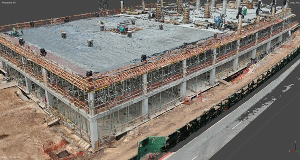
I just flew a slab edge inspection for insertion into a BIM model about an hour ago and you’re not going to get close to this on their PPK. Plus the flight only took 7 minutes and they will flag it as being to short and put off any inaccuracies on the client at that point. This would have taken terrestrial scanners over an hour to just scan 15 positions and would have been overkill.

7 Likes

Hey @michaelL!

Thanks for the clarification! I should’ve caught that earlier with a closer read, misunderstood the reference to the corrections network. I see now that they can be time-consuming and lacking the precision needed in some cases. It really seems to depend on the specific job requirements.

I really appreciate you sharing the details of your case. They help me better understand the situation.

1 Like

Hi Natalia,

We can usually rely on AusCORS or can occupy a known point and then use Emlid Caster. It’s rare for us not to have network.

Totally agree.

We started with them before having our RS2+ and not being able to connect to a local NTRIP with our drone nor having a known points for GCPs – believe me, this happens :wink: – they have been great, granted we are not down to the level of detail you are mentioning.

Would love to see your workflow in action someday!

Thanks @michaelL

2 Likes

Hey Mike,

I see, thanks!

I don’t know where you are but we are lucky to have plenty of CORS sites that while we can’t connect realtime (nor would I want to) we can download PPK logs. If there aren’t any available how is Propeller doing their PPK? Think about that for a second. There are sites out there and you can PPK a base point and your GCP’s/Checkpoints if you need to. Then you just edit the header in the Rinex and PPK your drone images. A little bit of a workflow but I guess it depends on how often this actually happens and if you really need it whether or not $4K+ up front & $600/year is really worth it. For those who do use them please make sure that they are stored horizontally on a flat surface because they will warp over time if you don’t. Especially if you live in a place that gets 90F.

4 Likes

This is good, practical knowledge from industry experience. Thanks for this.

2 Likes