Hello
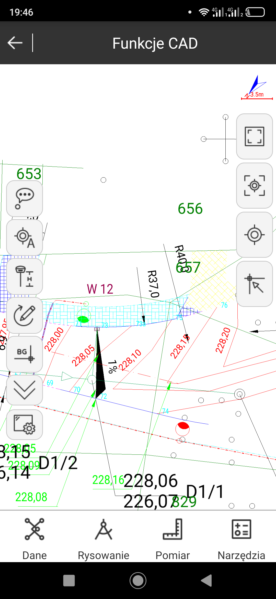
Can EmlidFlow software load DXF files as in the attached screenshot?
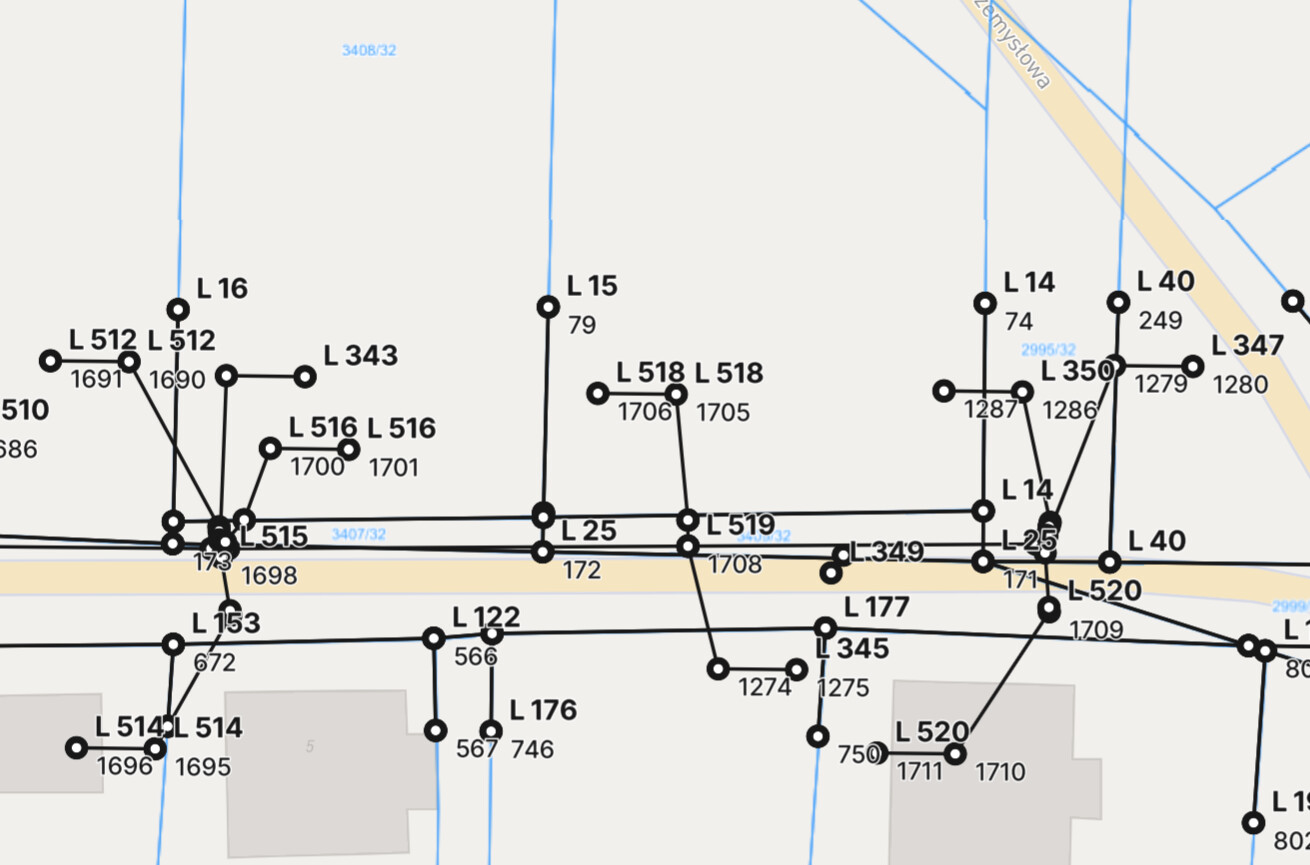
Currently, points and lines are created during DXF import. They are difficult to read and I do not have a map preview as in the attached photo.
Emlid Import:
Hello
Can EmlidFlow software load DXF files as in the attached screenshot?
Currently, points and lines are created during DXF import. They are difficult to read and I do not have a map preview as in the attached photo.
Emlid Import:
Not in its current form, it strips everything out and shows it how you are seeing it.
I do wish it was able to handle DXF/DWG better like some other products out there.
The ideal feature would need to implement as importing DXF (2D/3D, .dwg and other formats) as a LAYER with visibility / color level controls.
It would also need the ability to select certain needed elements (points, lines, arcs, circles, curves, splines, txt) to convert to the survey project for staking etc.
Prior to all of this, the user needs to minimize the complex DXF file anyways before import into Flow.
Hi guys,
Thank you for the feedback!
For now, Emlid Flow indeed shows the geometry from the imported DXF file. Can you please specify which features related to the DXF you’d like to use? I’d like to pass your words on to the team, but the most straightforward way would be to mention the exact features or workflows. Thanks!
The ideal feature would need to implement as importing DXF (2D/3D, .dwg and other formats) as a LAYER with visibility / color level controls.
It would also need the ability to select certain needed elements (points, lines, arcs, circles, curves, splines, txt) to convert to the survey project for staking etc.
Prior to all of this, the user needs to minimize the complex DXF file anyways before import into Flow.
+1 for timd1971 echoed points regarding layer visibility & color controls.
And not just for DXF, the features and behavior should be consistent for any background vector layer including .shp.
Previous feedback here: DXF and/or other formats as background map - #2 by Wombo
Hi guys,
Thank you for the requests! I’ll add them as +1.
Hi. I’m new to Emlid Flow. Any news about importing dxf? I don’t like how it creates points on every line. I think it would be best if it could just import dxf file as it is. Only lines without creating points I usually import points from txt or csv.
Hi @matija.geoplan,
I understand how the proper handling of CAD files is important for you.
However, there is no update that I can share about this at the moment. If there are any updates on this, I will let you know.
Take a look at Microsurvey Fieldgenius or others. (SurPad, SurPro etc)
You can import DXF / DGN files (etc) as layers… then choose certain elements to convert to points, lines, curves etc for staking etc. You can toggle layers off/on and they come across in color.
+1 on this with high priority! DXF import as background layer is a fundamental function in every surveying app, sadly i found this out after buying multiple RX Antennas for the whole team… So meanwhile we can use the antennas only for collecting data, not for stakeout. The cost of upgrading to the survey plan without this option is too high, but we look forward to this.
While implementing the function, remember to add compatibility to 3D Triangles inside DXF to be used as a stakeout DTM. With this functions FLOW 360 would be a very good and easy to use app for everyday filedwork, even for non-professionals!!!
Hi @jacopo,
Welcome to the forum! Thanks for sharing your feedback and providing a detailed description.
I totally understand how important having DXF import as a background layer is for workflows like stakeout. I’ve passed your suggestion on to our team and if there are any updates, I’ll keep you posted.
Hi everyone,
I am happy to say we’ve rolled out a new feature supporting DXF files as CAD drawings in Emlid Flow 360. We have a guide on working with them that you can check out. Let me know what you think!
Just to mention, this feature is included in the Survey Plan. You can subscribe and get the free 30-day trial and try it out.
I am happy to say we’ve rolled out a new feature supporting DXF files as CAD drawings in Emlid Flow 360. We have a guide on working with them that you can check out. Let me know what you think!
Can I see the ‘Guide’ in English,
never mind I figured it out, thanks