


I am using an Emlid Reach RS2+ GNSS RTK Receiver, the Emlid Flow App, and Point One Navigation GNSS RTK Corrections Service. I primarily use this system for positioning GCPs for Drone Survey. Point One Navigation uses the POLARIS mount point using RTCMv3.2 in the ITRF2014 Datum (most recent Epoch). As I understand it, the lat, long, and height values need to be transformed between datum reference frames using tools like HTDP Computations (https://geodesy.noaa.gov/cgi-bin/HTDP/htdp.prl?f1=4&f2=1). Unless otherwise specified by the customer, I typically use WGS 84 / UTM zone 15N, 14N, or 13N, here in Texas. I capture the positioning data I need for each GCP using the Emlid Flow App as Projects and Objects (GCPs). Since I am new to Point One Navigation, is there an easy and accurate workflow to capture GCP location data?
Hi Mike,
I’ve checked the website of Point One Navigation. I noticed that their bases provide corrections in WGS84, too. Is there a chance you can connect to a mount point with this datum?
If yes, you won’t need any transformation, and you can easily use WGS 84 / UTM zone 15N, 14N, or 13N for collecting GCPs.
I’m having the same issue. I used Point One Navigation and ALL elevations were off by minus 3 feet. I typically use NAD83 South Central Texas for my drone data as well as Civil 3D data in grid coordinates.
I’ve used Smart Net also in the recent past and had no issues. But, it’s a lot more expensive for a license vs. Point One Nav.
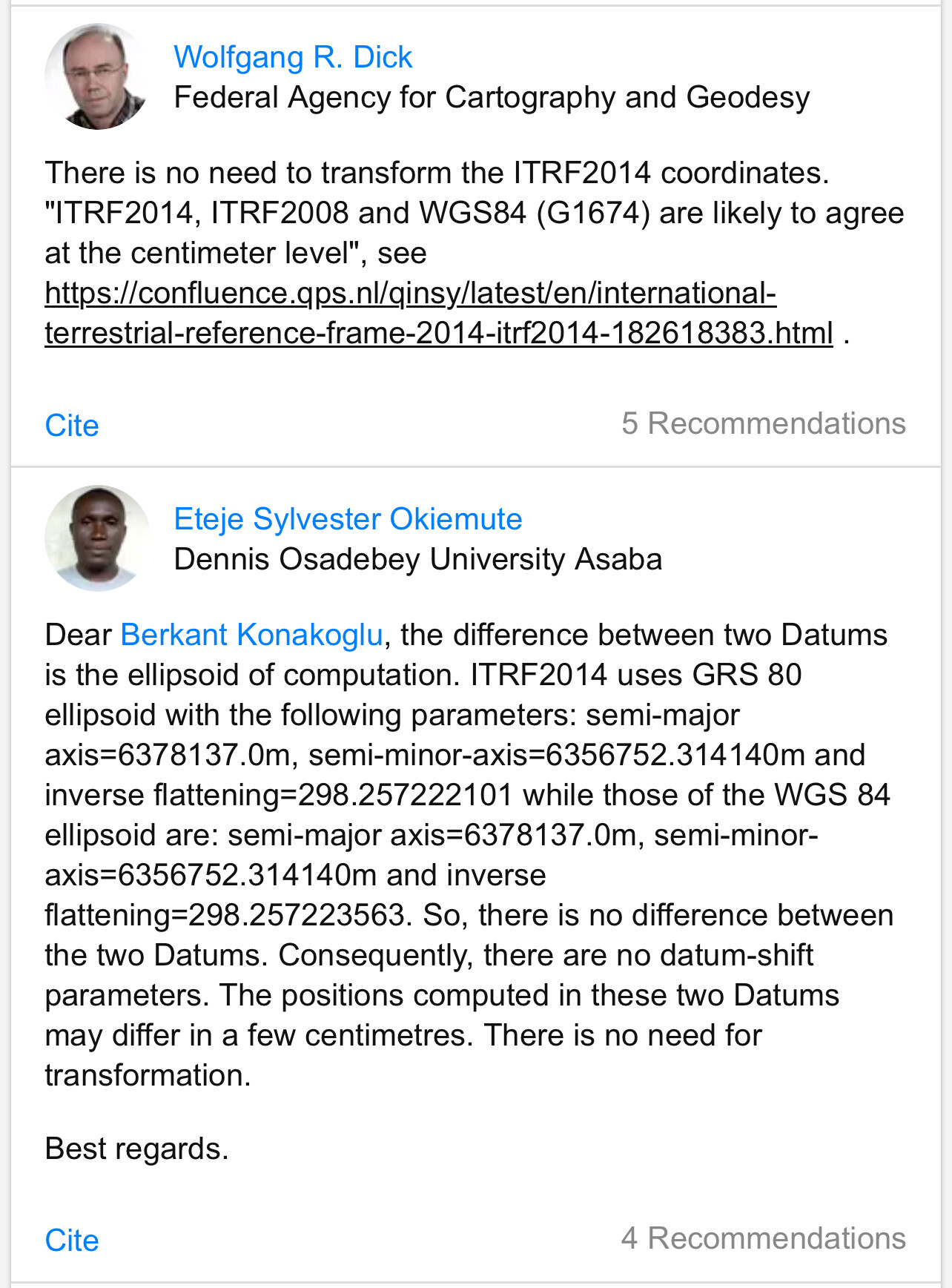
Same issue for me, my nearest Point One Nav base(s) are all ITRF2014. I was researching for a solution and found this thread. My research suggests that ITRF2014 and WGS84 are same if using the same epoch. I have not tested this though. Maybe someone else can provide details.
I have chatted with Point One Nav people about getting more options. They assured me they are going to have things updated to allow local state plane use “early 2024” and to watch for announcements on their board and social media posts.
Hi Mike,
It indeed seems that you can use WGS84 with corrections in ITRF2014. Brad, thank you for your research!
Using ITRF2014 with NAD83 is different. We’re discussing it in this separate thread.