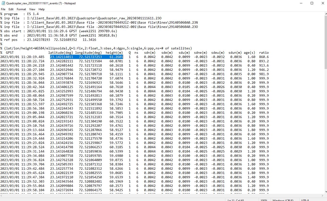
I am getting problem while processing data after getting 100% fixed solution, After using base & Rover file, I got POS event files in which elevation is some what matching with google earth elevation.
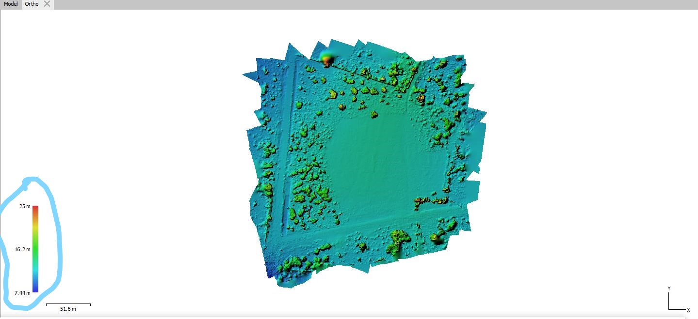
I geotagged data using same event POS file and process it in AGISOFT in which elevation value is very low(Max value = 25meter, Min value = 7.44meter)
I am attaching 3 screenshots :
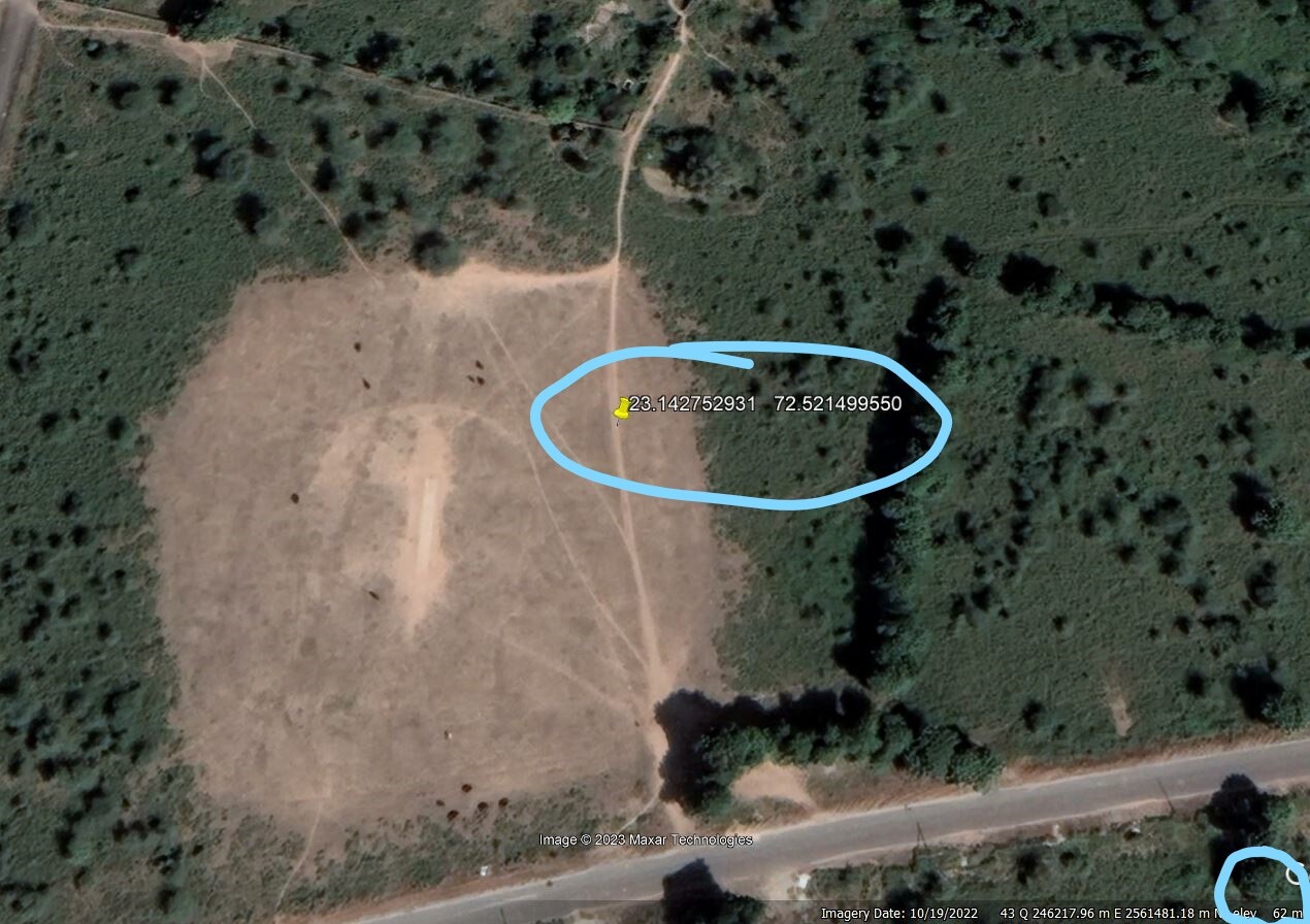
1.Google earth showing elevation value of the geotagged location.
2.Event POS Text file showing relatively close elevation value to google earth elevation.
3.Elevation value of the geotagged location after processing (Which is showing around 50 meter decreasing value compared to google earth and event POS file)
Drone is flew around 50meter height. So, i want to know reason behind this elevation difference after processing the data as i face this kind of problem in PPK processing in elevation every time.
The locations in the POS file is for the location of the drone, right? Your base had an elevation of 11.3 meters and the highlighted line has an elevation of 61.3, so your drone was 50 meters higher than the base. Seems to fit your story unless I’m missing something or not understanding your problem.
@snillor999 while processing I am getting elevation of max=25METER but the value on google earth is 62meter so it is not matching with mean sea level value
I see your problem better now after rereading and looking into Google Earth myself. I’m not familiar with elevation datums in that part of the world, but could you and Google be on two different datums? Also, are there any known benchmarks in the area you could test.
But back to my original statement - your base has an elevation of 11 meters. I’m making the assumptions that the base was setup on a pole or tripod, onsite in or near your project, and around the same elevation as your model, then I would expect all the elevations in your model of the surrounding ground and trees to be around the 7m to 25m range.
Elevation datum of google earth and data we process is same (WGS-84 - 43N) still we are getting this issue. So why this variation after using same datum if you could elaborate that will be helpful.
what method did you determine the height of you base? Is it set over a known or did you let Emlid determine location and elevation?
I’m thinking you maybe in ellipsoidal heights and Google (not the most accurate source for elevations) may be in another datum. Like said earlier I am unfamiliar, but I did type in the base location here:
Using the fault geoid that was in the webpage when I opened it of “egm2008-5”
Assuming your base is ellipsoid of 11.3416m the webpage gave me an answer of 65.82m. That is pretty close to the difference in what you are seeing between your data and Google. You may want to investigate further and is there any geodetic survey control in the area you can determine local elevation datums?
Yes you are right. I don’t have any problem with my Event POS elevation and Google earth elevation as they are close. I want to know why this difference after processing as I want mean sea level elevation in my processing data.( want elevation between 58meter to 65meter real world elevation (mean sea level)
During processing i tried with EGM96 Model it gives me relatively better result as it is a geoid model and on other hand WGS84 which is Ellipsoidal model, using EGM96 just having variation of 6 to 7 meter
Emlid Studio outputs only ellipsoidal heights in the datum of your base station. So, as @snillor999 suggested, you’ll need to transform the data after that to obtain orthometric heights. Usually, it’s possible to do it when building a map in 3rd-party software. For example, you can use points with orthometric heights to tie your data to the local vertical datum.