Hello,
for there is a second big missunderstanding with exported *.dxf.
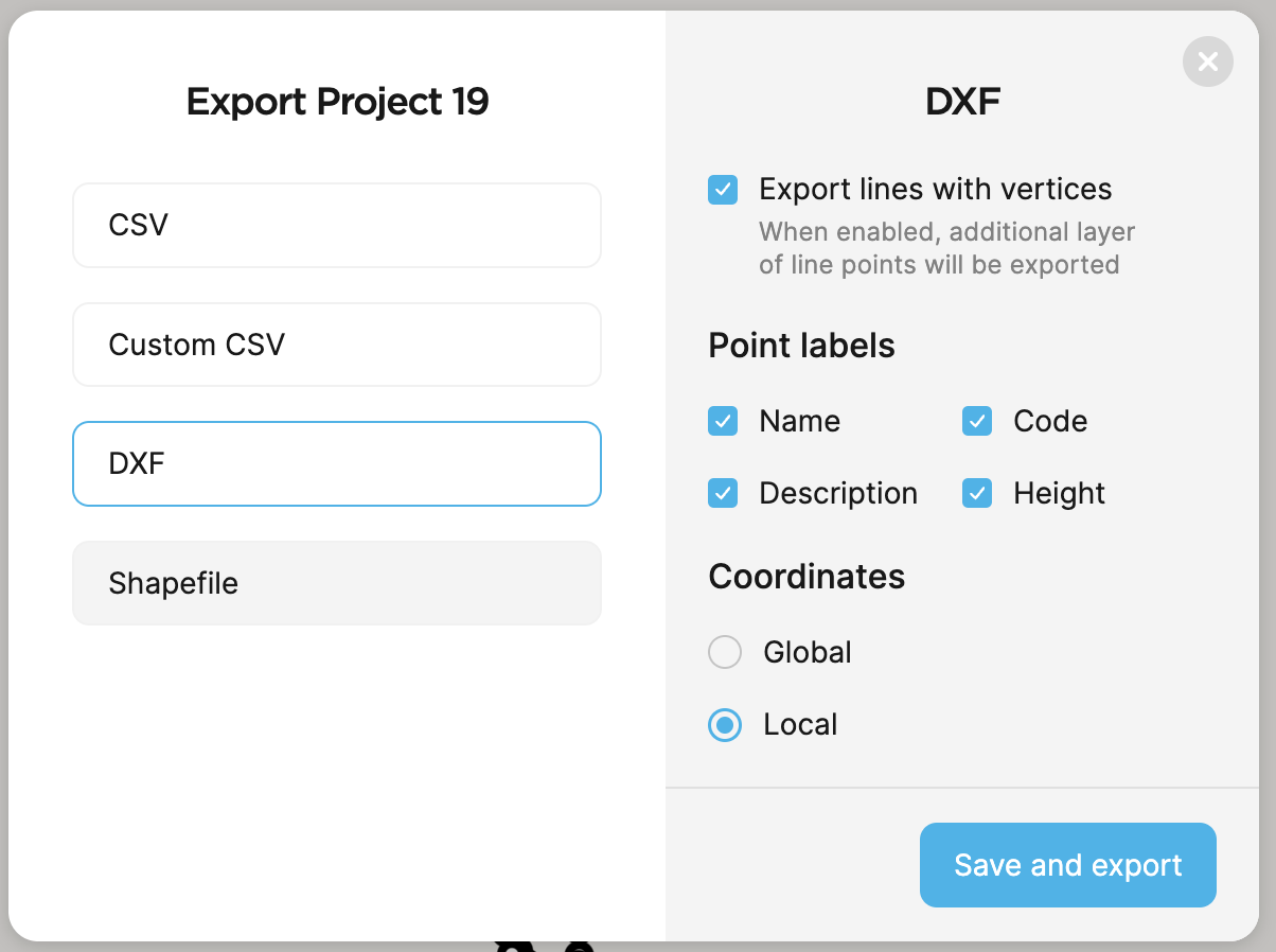
We have in RV3 app two options of dxf export:
DXF
DXF with labels
After export by using DXF way we get drawing with 2 layers:
points
numbers of points
points heights are missig
descitrions are misiing
After export by using DXF with labels way we get drawing with 3 layers:
points
numbers of points
points heights
descitrions are misiing
So the is no way to get all 4 layers eyt.
For surveyors is very important to have at least this mentioned 4 leayrs in exported DXF.
Than is easy to use this drawings for people who are using Bentley Microstation or Autodesk AutoCAD.
DXF with point labels option indeed doesn’t export description, but it exports point names. I see you use auto-generated numbers as points names. But the Name field can also be used as a description. Would it work for you?
Of course, we’re trying to make ReachView 3 as convenient as possible. That’s just a workaround, which can probably help while we’re working on the best solution for this.
Hi Svetlana,
Even though requested by only 1 person, there are many here that would like to see this as a feature of Reachview as well.
If more features such as this are included it would reduce the need for users to purchase expensive 3rd party software such as MicroSurvey FieldGenius
This may not be a large consideration in developed nations, however, it can be a deal-breaker for persons in developing nations or schools on a limited budget.
ReachView is already a great product but all of us are aware it has the potential to be better as the Emlid crew works so hard to respond to the needs of the consumer.
Thank you.
We always understand that behind one person requesting the feature, there are usually more who didn’t reach out to us Also, we understand how things work on the market, in general. And we want to provide you with more advanced features. But still want to do it the best way possible. You can be sure no one request goes unnoticed. Thank you for that!