Hello all.
I recently completed a flight with a DJI M350 RTK with a L2 Lidar scanner. The flight was in RTK, but I am trying to PPK the data as to improve the precision.
Additional info:
I established a base station over an unknown point, but have PPK’d the data using EMLID Studio and have the .pos file.
I have attached the drone data, the base logs, along with the NTRIP corrections and the corrected .pos file.
Here is the link to the data: WeTransfer - Send Large Files & Share Photos Online - Up to 2GB Free
Would someone be able to give me a hand working the this PPK process?
Thanks in advance!!!
Hi Andrew,
We have this guide explaining more about post-processing using Emlid Caster.
I checked the files you sent here, and we advise following the workflow below to post-process your data in Emlid Studio.
Static processing to obtain the precise position of the Reach receiver
Drone processing using the reach receiver as the base
For the first part of the processing:
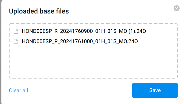
You will need to attach these two RNX observation files. It should look like this:
HOND00ESP_R_20241761000_01H_01S_MO.rnx
The two RNX files for the base weren’t visible, so convert them to RINEX before dragging them into the base section on Emlid Studio.
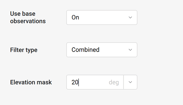
On Emlid Studio, in the configurations part, set the elevation mask to 20 and the Combined filter type option.
You can use the navigation file from Reach the one with the end _MN.rnx is the navigation file.
For the second part:
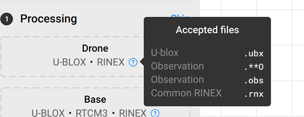
We found this thread on the DJI forum that you can rename the .RTK file to .RTCM3 since it contains the raw data.
The reason to rename the files is because the Emlid Studio only supports these extensions of files:
To the drone processing on the Emlid Flow app follow these steps:
To rename the files, right-click on the .RTK file > get info > change file extension to RTCM3.
Then, convert the RTCM3 file to RINEX.
Proceed with the drone processing on Emlid Studio.
1 Like
Thats a big help Victor. Thank you very much.
Ill try it out and let you know how it goes.
1 Like
jdouglas
July 17, 2024, 7:20pm
5
Hi Andrew, I am not sure where you are located, but if in the US, you could use OPUS for establishing your base point. OPUS Processing with Emlid Reach – E38 Survey Solutions
And here is a workflow on PPK with the L2 LiDAR. DJI Zenmuse L2 PPK Workflow – E38 Survey Solutions
You’ll end up having to go through DJI Terra and use the base file there in order to process your LiDAR data.
2 Likes
Thanks for that!
system
October 27, 2024, 8:25am
8
This topic was automatically closed 100 days after the last reply. New replies are no longer allowed.


