I have normally been working with a UK VRS service VRSNOW.co.uk and have been very happy using the RS2 with this service to gather observations in WGS84.
Over the last few days, I have been completing some R&D on the use of AUSPOS and CSRS as a backup to this VRS.
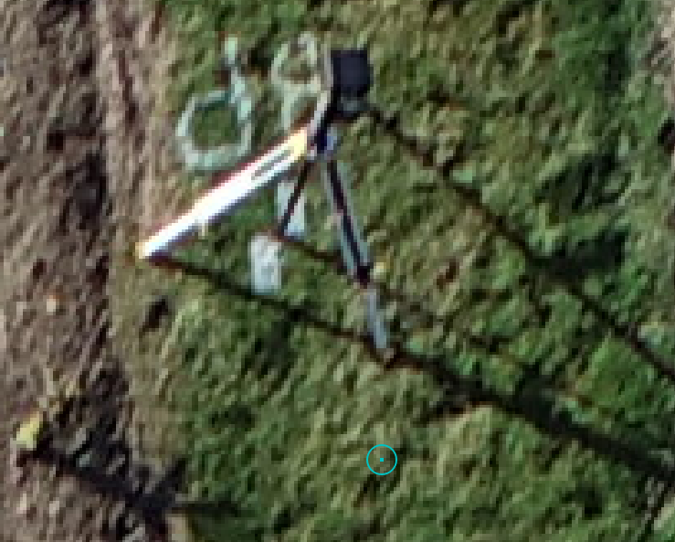
The result is a VRS position which is about 1.5m from both AUSPOS and CSRS outputs (Which give the same point). It’s a real headache as CSRS and AUSPOS are coming up with pretty much the same point. In this image the base position has been verified by vrsnow and the green point represents the AUSPOS and CSRS Points.
I am not certain, but I would be suspecting it would be a transformation/datum issue.
I can’t speak for VRS Now or CSRS, but AUSPOS (outside of Australia at least), I think you only get IRTF2014 co-ordinates? Is that correct? Maybe just check all things are on the same co-ordinate system.
The only other thing is using WGS84 as your “datum” means it is always shifting. So converting back to IRTF2014 co-ordinates means 10 years (of there abouts) of drift has occurred. This possibly explains the discrepancy? (maybe someone who knows more about geodesy can confirm). In Australia, between 1994 (when GDA94 matched WGS84) and 2020 (when GDA2020 matched WGS84) there was about 1.7m of shift NNE. 4 years on, WGS84 no longer matches GDA2020, which is why we use systems like CORS.
It looks like a datum issue. Classic world-wide datum versus local datum type of shift.
Are you sure your service provider is giving you WGS84 corrections and not a correction stream that shifts you to a local/national datum?
It’s not too difficult to check.
First AUSPOS and CSRS-PPP are relatively straightforward. Outside the host country you get a ITRF solution from both. ITRF14 from AUSPOS and ITRF20 from CSRS PPP. For your purposes you can consider them the same and the same as WGS84.
Just collect a multiple hour log on a point and get AUSPOS and CSRS-PPP generated coordinates for the point. They should be cm-level close. Then put your RS2 over the point using your correction service and see if you have the same coordinates. If they aren’t within several cm then either your service provider isn’t giving you WGS84 (ITRF) corrections and/or some setting in your receiver/software is changing things.
Sorry for joining the conversation so late. You seem to be heading in the right direction towards finding the cause of the issue. When you have finished the investigation, please share the solution with us. It might be useful for others.