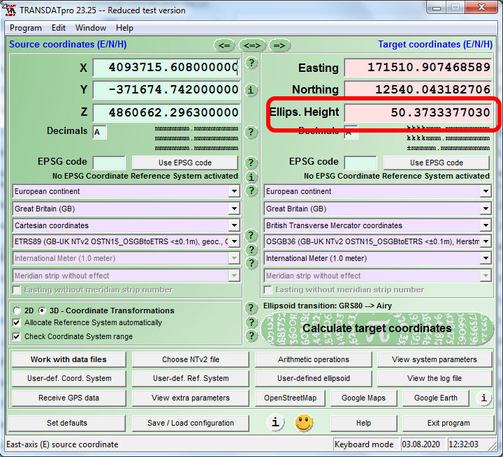
I’ve been testing out datums and accuracy, what I’ve found is Transdat is off by a few meters in height - at least it seems that way ?
I’ve been using a local reference station coordinates location for the tests.
Stn ID, ETRS89_X, ETRS89_Y, ETRS89_Z, ETRS89_Lat (N DD MM SS.SSSSSS), ETRS89_Long (E/W DDD MM SS.SSSSSS), ETRS89_H, OSGB36_E, OSGB36_N, Ortho_h, Ortho_Datum, TranModel, Km square, Hi, Current antenna/radome type code, Current receiver type code
Thanks @artem.fomenko But this is regarding pure coordinate conversion and no Emlid devices used.
I still believe Transdat maybe ‘incorrect’ but I not sure why. I would expect to get 47.426 or maybe 100.424 for height I can’t explain where 50.3733 comes from ?
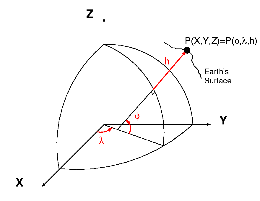
Although I’m not familiar with your software, Cartesian Coordinates (XYZ) give true Geodetic coordinates on the Earth’s ellipsoid. For the USA and using the NGS NSRS, the ellipsoid would be the GRS80 Ellipsoid. Your software is computing the ellipsoid height, which one is unknown. This is not orthometric height (approximate ground height). To determine orthometric heights, you would need a geoid model for your area. The software doesn’t specify which ellipsoid per the pic. The National Geodetic Survey here in the USA has many conversion tools freely available.