However, I encountered even more severe issues than those presented in the above-mentioned thread. I wonder if someone can point me in the right direction because I am not sure what I am doing incorrectly with these units.
First off, I am new to most things survey-related, and RS3 units are new. Thus, please comment in short and simple sentences as to speak.
Setup is basic. One RS3 as base and another RS3 as rover.
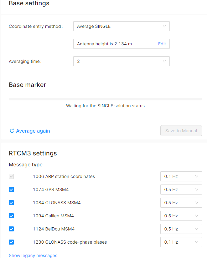
The base setup I tried as average fix or single fix, even tried to set up base with ntrip corrections.
Rover gets corrections via lora w/ tilt compensation on.
I collected points 7x times, base is always set on the exact same point at the exact same height. The results are baffling and confusing.
Every single time points are from 3 to 15 feet away from previously collected points. No pattern, no consistency. Every single time it is different. Seems that if I would be collecting points with my phone GPS it would be much more consistent. I am staking already poured building slab as a test.
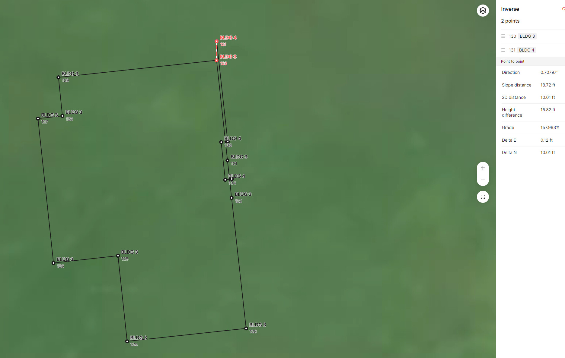
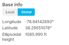
I’ve attached an example of points collected this past Friday compared to today. Even the difference in height… How could these units produce such results?
Hi Dan, it seems like your base is using a different base marker each time you collect. If you’re averaging a single solution that would explain the 15 ft difference. If you set your base location manually using the same point each time, you’ll likely see much better results with your rover.
Am I misunderstanding the way this system works? I am setting base each time in the same location, however, I do not have monument with known coordiantes.
Also, if I will save base location data arbitrarily, will I not be using faulty position? Overall, GNSS unit without correction should have 1m of accuracy. 15-20 ft is way outside even most simple GPS receiver.
If I understand correctly, EMLID units should repeat points with acceptable precision even if the base is set up in a different location each time. Am I correct?
You’re correct that your position would be faulty in terms of absolute accuracy if you’re using an arbitrary point. If you use that same point though, your relative accuracy should still be good. With a single solution your accuracy is roughly 3 - 5m, a float is closer to 1m, with a fix your in that cm level.
It will depend on the accuracy of your base marker in this case. If you repeat the exact position of the base and are using the same coordinate your relative accuracy should be high.
The main issue with your set up seems to be the marker that is being used by your base. If you use the same point each time, you should see repeatable relative data.
1st off, if you don’t have that many points to stake or collect, I’d turn OFF TILT for even better accuracy.
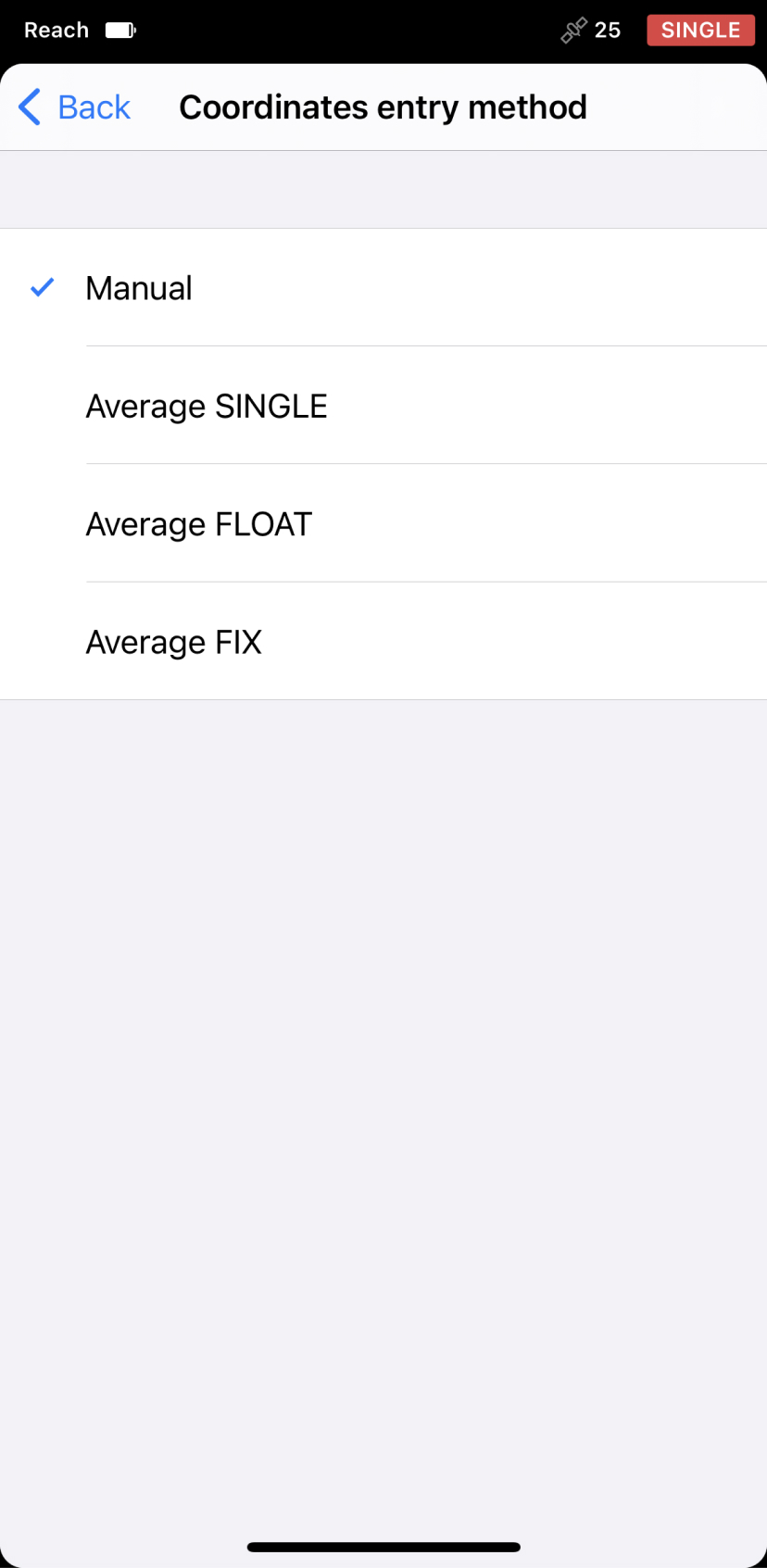
When you set up our BASE (say no NTRIP for now), and use AVERAGE SINGLE… the accuracy is RELATIVE… it is going to be very ESTIMATED as 3-5m accuracy, like the GPS in your phone. After it averages SINGLE, WRITE down, screen shot etc the AVERAGED SINGLE point the based derived and markl the point on the ground and take photo (preferably before of course). Then everytime you come back to that same MARK say next day, go into BASE settings and SELECT MANUAL instead of average single, enter the same POINT data you got the day you recorded. You will get cm accuracy repeatability each time via LoRA between BASE and ROVER.
Yes, I did set up the base precisely at the same location every single time, and every single time, I got wild results. If it was a couple of inches offset every time, it would be understandable, but up to 20ft offset, I cannot wrap my head around.
Could it be that one of the units simply has a hardware fault of some sort?
I think the physical location is fine, the coordinate applied to it is the issue. Since you’re just averaging a single solution each time that is what is wildly varying your coordinate the base is using.
I tried this option as well. 3x times - the same wild results. Base occupying exact same spot. This was my first attempt. So, I chalked it to possible differences in NTRIP datum. But nope, NTRIP or average fix or single fix it does not matter what settings and method I use the same strange results.
The reason I started testing was to get an accurate location of the already poured slab so I can overlay site plan and import as DXF. But because my collected points are trash every single time I cannot even get a single set of collected points that will correlate with reality in any meaningful way.
What you are saying is that I can get some repeatability if I save base coordinates from my first attempt. Does it matter that technically speaking points will be 15ft off on software side? It is hard to trust my work with this type of wild card in my hand.
Is it an inherent issue with this cheaper device? I have never heard of such an issue from others who use Topcon products, for example.
I was under the impression that you set the base with w/an average fix in any spot, and as a combo base/rover, one can have a 1cm precision in any location (as long as there is no physical interference). Or did I completely misunderstand the capabilities of these devices?
You can get an absolutely accurate point for your base in several ways. Whether that is using a known monument, averaging out a fixed point using a CORS station(NTRIP), or post processing using something like OPUS. Having an absolutely accurate point for your base will make your rover points absolutely accurate as well.
Your repeatability issue lies in your base marker. If you use the same mark in the base configuration settings, as well as on the job site, you will be able to repeat those points reliably with your rover.
Yes. Correct. RELATIVE to that AVERAGE SINGLE point the BASE is on. Which is the IMPORTANCE of recording that AVERAGE SINGLE point for later use or in your case to test measured points.
Once you RESTART the AVERAGE SINGLE again, it will derivee a NEW point it “thinks” it is at within 3-5m accuracy in AUTONOMOUS mode like your phone.
I think you are getting frustrated and doubting yhe equipment… rest assured, you will get cm accuracy you are looking for once you get your head around it.
As an example. Lets say you hire this wonderful registered professional surveyor from SC, @EBE111057 to come set you a KNOWN CONTROL POINT(S) you can reference or check from. You set your base on one of the KNOWN POINTS. You enter the exact same coordinates and elevation into your BASE as MANUAL… not averaged at all. As long as you are in the same coordinate system he used to set the control points, those points will be within cm accuracy.
Don’t worry, you’ll get it… the Emlid products are accurate as long as you know what you are doing etc.
Fyi, since foundations etc, your workflow should probably be using Total Stations for mm accuracy, but that’s up to you and who you are working with and the acceptable tolerances.
For foundations, plumbing etc we do use Topcon LN150s. I am trying to expand our toolset for site work because total station do have their limits as well plus site work does not require mm accuracy. I suppose I slightly misunderstood how cm accuracy can be achieved with these units and people in tutorials typically do not mention that for a repeated use one must record the position the base.
Do you think I will be better off using NTRIP service instead of relying on my own base?
Thank you for your advice. Helpful!
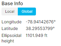
Attached base station data from Friday’s setup and today’s. Is it normal for these units to read its own location with 16ft difference in elevation? It looks strange to me because the phone GPS module will give only a few feet difference on various days. Thus, it is quite unexpected to see such behavior on a dedicated GNSS device.
Once u get the hang of it, try both methods and go from there. There are pros and cons. BASE / ROVER via LoRa will give you the best accuracy possible. NTRIP is more of convenience, absolute accuracy, interent connection, only have 1 rover, but may lose accuracy if distance to NTRIP CORS site is too far.
That is not normal. Should be very close if base set on same exact point as Friday and entered that AVERAGE SINGLE result from Friday as MANUAL today. Something is off.
Your equipment if set up properly is capable of giving you repeatable, reliable measurements. Reading through this thread, it sounds like you are a little in over your head regarding the technology.
I recommend getting someone familiar with using the Emlid products to get you set up and train you in equipment handling/use. This will prevent expensive construction mistakes being made on your account.
If such a person is not available nearby, watch videos on YouTube and continue getting help from this forum.
In the end - practice, practice, practice with your equipment until you have an elementary understanding of its uses and limitations before going in the field at a real work site.
I highly suspect you are not experiencing equipment error. but rather user error.
Land surveyors are trained in detecting, minimizing, reducing and avoiding error. Rely on that training…
May the Force be with You
As mentioned multiple times already, using anything other than manual for your base location is going to get you inaccurate results.
What sort of base control point do you have that you are setting up on and have you shot this from a known benchmark or occupied it for a long duration and post processed it’s location
I do use equipment that is many times more sophisticated than these simple devices.
Reason why I got frustrated is the fact that straight forward application should produce repeatable results.
Rover unit setup in base mode does work properly, thus there is some sort of hardware issue with the device. It is being replaced thus we can close the subject.